Delaware Township near Turbotville in Northumberland County, Pennsylvania — The American Northeast (Mid-Atlantic)
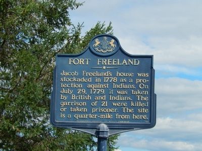
Fort Freeland
Erected 1947 by Pennsylvania Historical and Museum Commission.
Topics and series. This historical marker is listed in these topic lists: Forts and Castles • War, US Revolutionary. In addition, it is included in the Pennsylvania Historical and Museum Commission series list. A significant historical date for this entry is July 29, 1779.
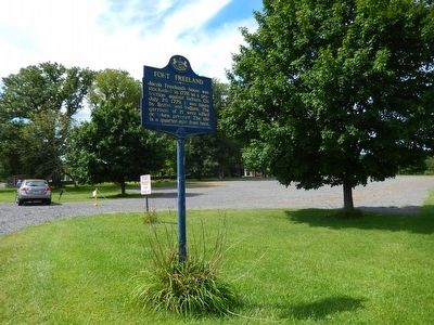
Location. 41° 5.975′ N, 76° 48.359′ W. Marker is near Turbotville, Pennsylvania, in Northumberland County. It is in Delaware Township. Marker is on Susquehanna Trail (Pennsylvania Route 1007). Marker is adjacent to the Warrior Run Cemetery. Touch for map. Marker is at or near this postal address: 4505 Susquehanna Trail, Turbotville PA 17772, United States of America. Touch for directions.
Other nearby markers. At least 8 other markers are within 6 miles of this marker, measured as the crow flies. A different marker also named Fort Freeland (within shouting distance of this marker); Col. Matthew Smith (within shouting distance of this marker); Warrior Run Church (about 700 feet away, measured in a direct line); Widow Catherine Smith (approx. 3.8 miles away); Clinger Lumber Company / Kepler Brothers Trucking Company (approx. 6 miles away); The Hastings Printing Company (approx. 6 miles away); Milton's Railroads (approx. 6 miles away); The L.M. & W. Trolley Company (approx. 6 miles away). Touch for a list and map of all markers in Turbotville.
Credits. This page was last revised on February 7, 2023. It was originally submitted on August 23, 2015, by Bill Pfingsten of Bel Air, Maryland. This page has been viewed 473 times since then and 26 times this year. Photos: 1, 2. submitted on August 23, 2015, by Bill Pfingsten of Bel Air, Maryland.

