Ray Township in Macomb County, Michigan — The American Midwest (Great Lakes)
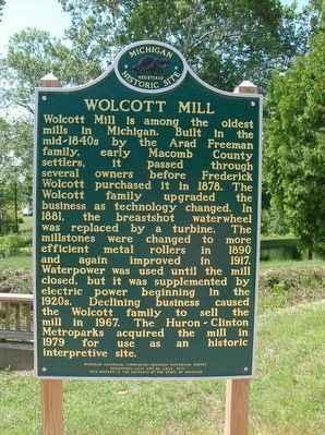
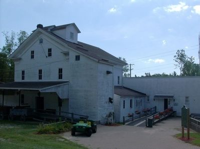
Wolcott Mill
Erected 2012 by Michigan Historical Commission-Michigan Historical Center. (Marker Number L2234.)
Topics and series. This historical marker is listed in this topic list: Industry & Commerce. In addition, it is included in the Michigan Historical Commission series list.
Location. 42° 46.006′ N, 82° 55.634′ W. Marker is near Ray, Michigan, in Macomb County. It is in Ray Township. Marker can be reached from Kunstman Road, 0.6 miles north of 29 Mile Road. The marker is in Wolcott Mill Metropark. From the entrance on Kunstman Road, it is about 0.9 miles from the park entrance to the parking lot. From the parking lot, it is about a 0.2 mile walk to the marker next to the mill. Touch for map. Marker is at or near this postal address: 64162 Kunstman Road, Ray MI 48096, United States of America. Touch for directions.
Other nearby markers. At least 8 other markers are within 5 miles of this marker, measured as the crow flies. Millstones (a few steps from this marker); Religious Society Church (approx. ¼ mile away); Ray Township District No. 1 School (approx. ¼ mile away); First Methodist Episcopal Church (approx. 3 miles away); Crawford Settlement Burying Ground (approx. 4.6 miles away); Walter C. Wetzel State Recreation Area (approx. 4.8 miles away); Helen Starkweather (approx. 5.1 miles away); From the Foundry Fires (approx. 5.1 miles away). Touch for a list and map of all markers in Ray.
Also see . . . Wolcott Mill Metropark. (Submitted on August 24, 2015, by Joel Seewald of Madison Heights, Michigan.)
Credits. This page was last revised on February 7, 2023. It was originally submitted on August 24, 2015, by Joel Seewald of Madison Heights, Michigan. This page has been viewed 483 times since then and 16 times this year. Photos: 1, 2. submitted on August 24, 2015, by Joel Seewald of Madison Heights, Michigan.

