Near Worden in Klamath County, Oregon — The American West (Northwest)
The 42nd Parallel
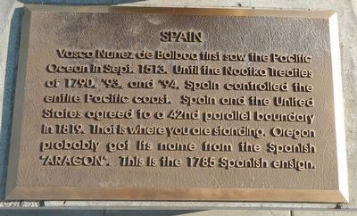
Vasco Nunez de Balboa first saw the Pacific Ocean in Sept. 1513. Until the Nootka Treaties of 1790, '93, and '94, Spain controlled the entire Pacific coast. Spain and the United States agreed to a 42nd parallel boundary in 1819. That is where you are standing. Oregon probably got its name from the Spanish "ARAGON". This is the 1785 Spanish ensign.
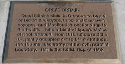
Great Britain's claim to Oregon was based on Drake's 1578 voyage, Cook's and Vancouver's voyages, and MacKenzie's overland trip to the Pacific. Britain blunted Spain's claims at Nootka Sound. From 1818, Britain and the U.S. jointly occupied 42º to 54º 40' latitude. The 15 June 1846 treaty set the 49th parallel boundary. This is the British flag of 1802.
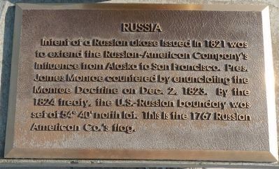
Intent of a Russian ukase issued in 1821 was to extend the Russian-American Company's influence from Alaska to San Francisco. Pres. James Monroe countered by enunciating the Monroe Doctrine on Dec. 2, 1823. By the 1824 treaty, the U.S.-Russian boundary was set of 54º 40' north lat. This is the 1767 Russian American Co.'s flag.
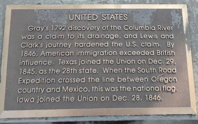
Gray's 1792 discovery of the Columbia River was a claim to its drainage, and Lewis and Clark's journey hardened the U.S. claim. By 1846, American immigration exceeded British influence. Texas joined the Union on Dec. 29, 1845, as the 28th state. When the South Road Expedition crossed the lines between Oregon country and Mexico, this was the national flag. Iowa joined the Union on Dec. 28, 1846.
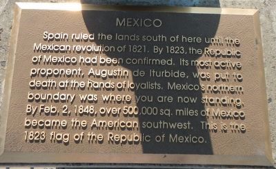
Spain ruled the lands south of here until the Mexican revolution of 1821. By 1823, the Republic of Mexico had been confirmed. Its most active proponent, Augustin de Iturbide, was put to death at the hands of loyalists. Mexico's northern boundary was where you are now standing. By Feb. 2, 1848, over 500,000 sq. miles of Mexico became the American southwest. This is the 1823 flag of the Republic of a Mexico.
Topics and series. This historical marker is listed in this topic list: Political Subdivisions. In addition, it is included in the Former U.S. Presidents: #05 James Monroe series list. A significant historical date for this entry is June 15, 1846.
Location. 42° 0.202′ N, 121° 53.399′ W. Marker is near Worden, Oregon, in Klamath County. Marker can be reached from U.S. 97, on the left when traveling south. Touch for map. Marker is at or near this postal address: 24800 US Highway 97, Klamath Falls OR 97601, United States of America. Touch for directions.
Other nearby markers. At least 8 other markers are within 9 miles of this marker, measured as the crow flies. Resolving the Oregon Question (a few steps from this marker); Western International History (a few steps from this marker); Applegate Trail (within shouting distance of this marker); a different marker also named Applegate Trail (about 400 feet away, measured in a direct line); Dorris Veterans Memorial (approx. 3.1 miles away in California); Picard California (approx. 5.1 miles away in California); South Road - Hot Creek (approx. 5.1 miles away in California); Bear Valley (approx. 8.6 miles away). Touch for a list and map of all markers in Worden.
More about this marker. This marker is located at the Francis C. Landrum Historic Wayside.
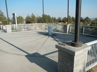
This monument is centered around a white pylon located on the 42nd Parallel. Surrounding the pylon are five flagpoles, one for Spain, Great Britain, Russia, the Unites States, and Mexico. Affixed to the base of each flagpole is a plaque, outlining the basis for that county's claim to the Oregon territory. Unfortunately, the historic flags of each country were not being flown on the day of this correspondent's visit.
Also see . . . Oregon Boundary Dispute - Wikipedia. The Oregon Question originated in the 18th century during the early European or American exploration of the Pacific Northwest. Various Empires began to consider the area suitable for colonial expansion, including the Americans, Russians, Spanish and British. Naval captains such as the Spanish Juan José Pérez Hernández, British George Vancouver and American Robert Gray gave defining regional water formations like the Columbia River and the Puget Sound their modern names and charted in the 1790s. Overland explorations were commenced by the British Alexander Mackenzie in 1792 and later followed by the American Lewis and Clark expedition, which reached the mouth of the Columbia River in 1805. These explorers often claimed in the name of their respective governments sovereignty over the Northwest Coast. (Submitted on August 31, 2015, by Barry Swackhamer of Brentwood, California.)
Credits. This page was last revised on June 16, 2016. It was originally submitted on August 31, 2015, by Barry Swackhamer of Brentwood, California. This page has been viewed 879 times since then and 81 times this year. Photos: 1, 2, 3, 4, 5, 6, 7. submitted on August 31, 2015, by Barry Swackhamer of Brentwood, California.
