Saint-Laurent-sur-Mer in Calvados, Normandy, France — Western Europe
Omaha Beach, haut lieu du Débarquement du 6 juin 1944
Omaha Beach, landmark of the landings of 6 June 1944
Inscription.
En Française:
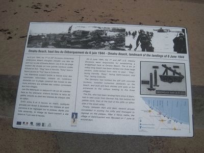
Le 6 juin 1944, les 1re et 29e Divisions d’Infanterie américaine étaient chargées d’établir une tête de pont sur ce site d’Omaha Beach. Les 6 km de plage avaient été divises en trois grands secteurs codes d’Ouest en Est: "Dog" face à Vierville, "Easy" face à Saint-Laurent et "Fox" face à Colleville.
Les Allemands avaient fortifié la falaise avec des casemates bétonnées, installé de nombreux obstacles sur la plage, construit des fossés et des murs antichars aux entrées des vallées conduisant aux trois villages.
Les GIs débarques ici depuis 6 h 30 ont dû s’abriter face au feu allemand, d’abord derrière le talus de galets, ensuite au pied des falaises de chaque côté du vallon.
Enfin entre 8 et 9 heures du matin, quelques groupes ont réussi à escalader les falaises et sont parvenus à se regrouper sur le plateau. Après une lutte acharnée, le village de Saint-Laurent a été libéré le 7 juin vers 9 heures.
English:
On 6 June 1944, the 1st and 29th U.S. Infantry Divisions were responsible for establishing a bridgehead here at Omaha Beach. The 6 km (4 miles) long beach had been divided into three large sectors, code-named from west to east: "Dog", facing Vierville, "Easy", facing Saint-Laurent, and "Fox, facing Colleville.
The Germans had fortified the cliff with concrete bunkers, installed numerous obstacles on the beach, and built anti-tank ditches and walls at the entrances to the valleys leading to the three villages.
The GIs, who had been landing here since 6:30am, had to take cover from German fire, first behind the pebble bank, then at the foot of the cliffs on either side of the small valley.
Finally, between 8am and 9am, several groups succeeded in scaling the cliffs and managed to regroup on the plateau. After a fierce battle, the village of Saint-Laurent was liberated on 7 June at around 9am.
Erected by Normandie Terre de Liberté.
Topics. This historical marker is listed in this topic list: War, World II. A significant historical date for this entry is June 6, 1944.
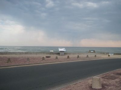
Location. 49° 22.23′ N, 0° 52.736′ W. Marker is in Saint-Laurent-sur-Mer, Normandie (Normandy), in Calvados. Marker can be reached from Rue Bernard Anquetil just east of Avenue de la Libération (Route D517). Marker is on the beach, near the Omaha Beach Memorial. Touch for map. Marker is in this post office area: Saint-Laurent-sur-Mer, Normandie 14710, France. Touch for directions.
Other nearby markers. At least 8 other markers are within 3 kilometers of this marker, measured as the crow flies. A different marker also named Omaha Beach (within shouting distance of this marker); Les Braves - To Those Brave Men (within shouting distance of this marker); Remember Omaha (within shouting
distance of this marker); Operation Aquatint (about 150 meters away, measured in a direct line);
Credits. This page was last revised on September 10, 2018. It was originally submitted on September 20, 2015, by Kevin W. of Stafford, Virginia. This page has been viewed 389 times since then and 13 times this year. Photos: 1, 2. submitted on September 20, 2015, by Kevin W. of Stafford, Virginia.

