Masterson in Moore County, Texas — The American South (West South Central)
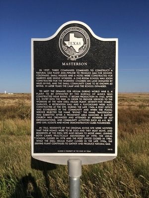
Masterson
To meet the demand for helium during World War II, a plant to be operated by the Bureau of Mines was constructed near Bivins; it began production in 1943, after U.S. entry into the war. In order to provide services to the workers at the new Exell Helium Plant, seventy-five homes, garages, a recreation hall and a playground were also constructed at the site. During the late 1940s a post office was established in the community and when the postal service rejected the name “Bivins,” the name “Masterson” was submitted after a prominent area rancher. A Baptist church was organized and attended by members of all denominations, and community activities such as 4-H, boy and girl scouts and home demonstration clubs flourished.
In 1963, residents of the original Bivins site were notified that their homes were to be sold and they must move, and residents at the Exell site also began to move away, leaving both camps practically abandoned by 1970. The local school closed in 1978 and the post office closed in 1984. While the Exell Helium Plant closed in the late 1990s, the Bivins plant continues to gather and produce natural gas.
Erected 2010 by Texas Historical Commission and the State of Texas. (Marker Number 16490.)
Topics. This historical marker is listed in these topic lists: Industry & Commerce • Settlements & Settlers • War, World II. A significant historical year for this entry is 1927.
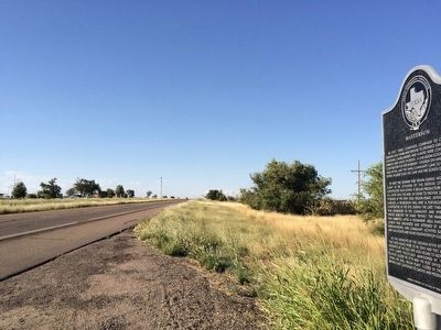
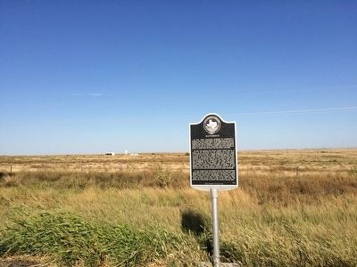
Location. 35° 37.983′ N, 101° 57.571′ W. Marker is in Masterson, Texas, in Moore County. Marker is on U.S. 287, 0.2 miles north of Helium Plant Road, on the right when traveling north. Touch for map. Marker is in this post office area: Masterson TX 79058, United States of America. Touch for directions.
Other nearby markers. At least 8 other markers are within 14 miles of this marker, measured as the crow flies. First Gas Well in the Panhandle of Texas (approx. 4.2 miles away); Route of the Old Tascosa-Dodge City Trail (approx. 8.8 miles away); Moore County (approx. 8.8 miles away); First Cemetery in Potter County (approx. 11.6 miles away); Great Spanish Road / First Ranch in Potter County / First Store in Potter County (approx. 11.7 miles away); The Canadian River (approx. 11.7 miles away);
The _X (LX) First Ranch in Potter County (approx. 13.3 miles away); The United States Topographical Engineers in the High Plains of Texas (approx. 13.3 miles away).
Also see . . .
1. Wikipedia article on Masterson. (Submitted on September 20, 2015, by Mark Hilton of Montgomery, Alabama.)
2. Texas Escapes Online Magazine story on Masterson. (Submitted on September 20, 2015, by Mark Hilton of Montgomery, Alabama.)
3. Story on Exell Helium Plant. (Submitted on September 20, 2015, by Mark Hilton of Montgomery, Alabama.)
Credits. This page was last revised on June 16, 2016. It was originally submitted on September 20, 2015, by Mark Hilton of Montgomery, Alabama. This page has been viewed 3,471 times since then and 248 times this year. Photos: 1, 2, 3. submitted on September 20, 2015, by Mark Hilton of Montgomery, Alabama.


