Reliance in Sweetwater County, Wyoming — The American West (Mountains)
Tipples and the Reliance Coal Mines
Inscription.
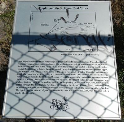
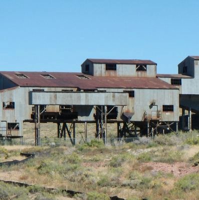
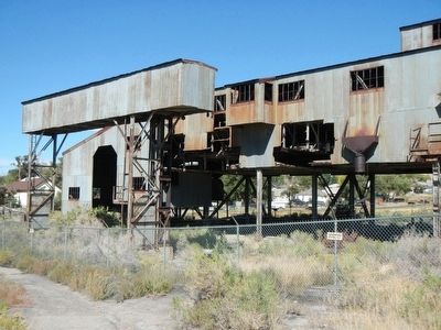
The tipples constructed here were designed to serve all the Reliance coal mines. Union Pacific Coal Company opened their mines in phases. The coal mines were all located east of here with portals located along the sides of the valley. Coal from there mines was hauled to the surface by either electric locomotives or hoists. From the portal, the coal was shipped over a tramway to the tipple. The distance from the No. 7 mine portal to the tipple was about 1.2 miles. Once the coal cars were inside the tipple you see today, they were set on a rotary dump. The coal car was fastened down, rolled over, and emptied into the coal hopper. From the hopper, the coal was moved over conveyors to the shaker screen. The screen sorted the coal by size. The coal then fell through the screens into a chute that carried it to the picking tables. At the picking tables, men, boys, and later women sorted through the coal looking for stones or checking the size of the coal. Good coal was loaded into waiting rail cars while stone and refuse were conveyed outside the tipple into a refuse bin. The tipple you see in front of you, constructed in 1936 at a cost of $232,700, was designed to be a model of efficiency.
Erected by Wyoming State Archives and Historical Department.
Topics. This historical marker is listed in these topic lists: Industry & Commerce • Railroads & Streetcars.
Location. 41° 40.083′ N, 109° 11.826′ W. Marker is in Reliance, Wyoming, in Sweetwater County. Marker is on South Street near 2nd Street, on the right when traveling east. Touch for map. Marker is at or near this postal address: 1201 South Street, Reliance WY 82943, United States of America. Touch for directions.
Other nearby markers. At least 8 other markers are within 6 miles of this marker, measured as the crow flies. The Reliance Tipple (within shouting distance of this marker); Women and the Reliance Mines (within shouting distance of this marker); Rock Spring Stage Station Site (approx. 4.8 miles away); Rock Springs Coal (approx. 5.8 miles away); "Charlie Smith" (approx. 5.8 miles away); A Tragedy Remembered (approx. 5.8 miles away); Beneath This Monument (approx. 5.8 miles away); Rock Springs Coal Welcome Sign (approx. 5.8 miles away). Touch for a list and map of all markers in Reliance.
Credits. This page was last revised on June 16, 2016. It was originally submitted on October 20, 2015, by Barry Swackhamer of Brentwood, California. This page has been viewed 311 times since then and 17 times this year. Photos: 1, 2, 3. submitted on October 20, 2015, by Barry Swackhamer of Brentwood, California.


