
Near Sinclair in Carbon County, Wyoming — The American West (Mountains)
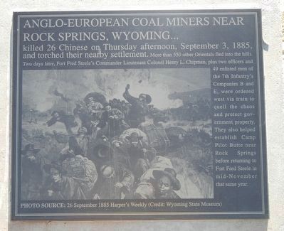
Rock Springs Massacre
Photographed by Barry Swackhamer, September 9, 2015
1. Rock Springs Massacre Marker
Photo Source: 26 September 1885 Harper's Weekly
Erected by Wyoming Recreation Commission.
Topics. This historical marker is listed in this topic list: Asian Americans. A significant historical date for this entry is September 3, 1885.
Location. 41° 46.669′ N, 106° 56.765′ W. Marker is near Sinclair, Wyoming, in Carbon County. It is on County Route 347 near Interstate 80, on the right when traveling north. Touch for map. Marker is in this post office area: Sinclair WY 82334, United States of America. Touch for directions.

Regionally, this marker is in Wyoming’s Westward Expansion Trails Region. It is
this page online
Other nearby markers. At least 8 other markers are within walking distance of this marker: Image of Fort Fred Steele (here, next to this marker); Major Thomas Tipton Thornburgh (here, next to this marker); Major General Philippe Regis de Trobriand (here, next to this marker); Major General Frederick Steele (here, next to this marker); Thornburgh's Command (here, next to this marker); Viewing the Fort Grounds (within shouting distance of this marker); Fort Fred Steele after 1886 (within shouting distance of this marker); Enlisted Men's Barracks (about 300 feet away, measured in a direct line). Touch for a list and map of all markers in Sinclair.
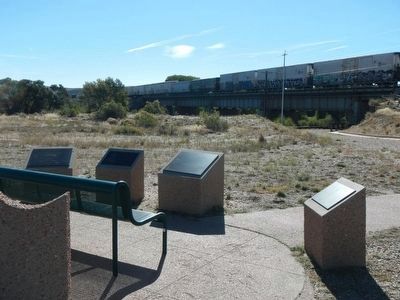
More about this marker. This marker, among a grouping of a half-dozen other markers, is located at Fort Fred Steele State Park on County Road 347, north of the Interstate 80 Exit 228 and on the north side of the railroad tracks near where County Road 347 passes
Photographed by Barry Swackhamer, September 9, 2015
2. Rock Springs Massacre Marker
This marker is second from the right.
Also see . . .
1. The Rock Springs Massacre - Wyoming Historical Society. On the morning of Sept. 2, 1885, a fight broke out between white and Chinese miners in the No. 6 mine in Rock Springs. Whites fatally wounded a Chinese miner with blows of a pick to the skull. A second Chinese was badly beaten. Finally a foreman arrived and ended the violence. But instead of going back to work, the white miners went home and fetched guns, hatchets, knives and clubs. (Submitted on October 21, 2015, by Barry Swackhamer of Brentwood, California.)
2. Chinese and the Anti-Chinese Movement - Center for the Study of the Pacific Northwest. Chinese immigrants worked primarily as laborers and lived largely in the states and territories of the American West. Most toiled at mining and constructing railroad lines across the region, and they also worked in agriculture. Some worked at providing services to other Chinese people, particularly those concentrated in Chinatown districts in western cities. (Submitted on October 21, 2015, by Barry Swackhamer of Brentwood, California.)
Additional keywords. Anti-Chinese
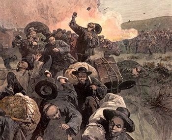
Photographed by Harper's Illustrated, circa 1885
3. The Rock Springs Massacre
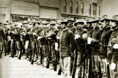
National Archives, circa 1885
4. Federal Troops on South Front Street, Rock Springs, 1885
Credits. This page was last revised on June 16, 2016. It was originally submitted on October 21, 2015, by Barry Swackhamer of Brentwood, California. This page has been viewed 1,410 times since then and 31 times this year. Photos: 1, 2, 3. submitted on October 21, 2015, by Barry Swackhamer of Brentwood, California. 4. submitted on October 22, 2015, by Barry Swackhamer of Brentwood, California.
