Near Sinclair in Carbon County, Wyoming — The American West (Mountains)
Fort Steele Schoolhouse
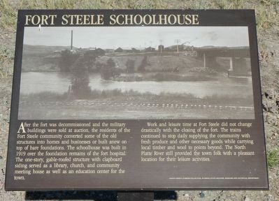
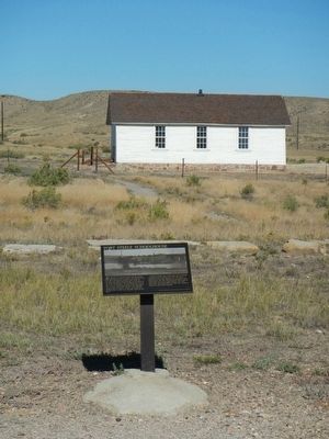
Work and leisure time at Fort Steele did not change drastically with the closing of the fort. The trains continued to stop daily supplying the community with fresh produce and other necessary goods while carrying local timber and will to points beyond. The North Platte River still provided the town folk with a pleasant location for their leisure activities.
Erected by Wyoming Recreation Commission.
Topics. This historical marker is listed in these topic lists: Education • Entertainment.
Location. 41° 46.736′ N, 106° 56.877′ W. Marker is near Sinclair, Wyoming, in Carbon County. Marker can be reached from County Route 347 near Interstate 80, on the right when traveling west. Touch for map. Marker is in this post office area: Sinclair WY 82334, United States of America. Touch for directions.
Other nearby markers. At least 8 other markers are within walking distance of this marker. Officers Who Commanded Fort Fred Steele (a few steps from this marker); Officer's Quarters (a few steps from this marker); Wild Times In Benton! (within shouting distance of this marker); This January 1880 plan of Fort Fred Steele... (within shouting distance of this marker); The Great Lincoln Highway... (within shouting distance of this marker); The Passenger's Railroad (within shouting distance of this marker); Enlisted Men's Barracks (about 400 feet away, measured in a direct line); Fort Fred Steele (about 400 feet away). Touch for a list and map of all markers in Sinclair.
Regarding Fort Steele Schoolhouse. This marker is located at Fort Fred Steele State Historic Site. The site is on County Road 347, north of the Interstate 80 Exit 228 and north of the railroad tracks.
Credits. This page was last revised on June 16, 2016. It was originally submitted on October 25, 2015, by Barry Swackhamer of Brentwood, California. This page has been viewed 348 times since then and 7 times this year. Photos: 1, 2, 3, 4. submitted on October 25, 2015, by Barry Swackhamer of Brentwood, California.


