Perkinsville in Windsor County, Vermont — The American Northeast (New England)
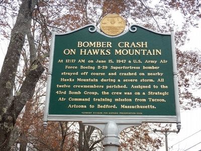
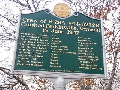
Bomber Crash on Hawks Mountain / Crew of B-29A #44-62228 Crashed Perkinsville, Vermont 15 June 1947
At 12:17 AM on June 15, 1947 a U.S. Army Air Force Boeing B–29 Superfortress bomber strayed off course and crashed on nearby Hawks Mountain during a severe storm. All twelve crewmembers perished. Assigned to the 43rd Bomb Group, the crew was on a Strategic Air Command training mission from Tucson, Arizona to Bedford, Massachusetts.
1st Lt Robert G Fessler Pilot Madison, WI
2nd Lt Wilfred E Gassett Copilot Brockton, MA
2nd Lt Cesare P Fontana Navigator W. Springfield, MA
S/Sgt Oliver W Hartwell Jr Engineer Wells, ME
S/Sgt Sylvester S Michalac Radar Operator Summithill, PA
T/Sgt Clayton K Knight Radio Operator Knoxville, TN
T/Sgt Paul H Fetterhoff Central Fire Controller Shreveport, LA
Cpl Robert H Clark Gunner Jamaica Plain, MA
S/Sgt John J O'Toole Gunner Queens Village, NY
M/Sgt D D Jack Gunner The Dalles, OR
Cpl Harry Humphrey Gunner Albuquerque, NM
Pfc Robert M Stewart Passenger Wisconsin Rapids, WI
Erected 2008 by Vermont Division for Historic Preservation.
Topics. This historical marker is listed in this topic list: Air & Space . A significant historical date for this entry is June 15, 1947.
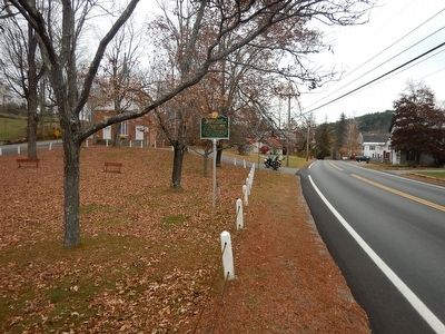
Location. 43° 22.323′ N, 72° 30.96′ W. Marker is in Perkinsville, Vermont, in Windsor County. Marker is at the intersection of Vermont Route 106 and Church Street, on the right when traveling south on State Route 106. Touch for map. Marker is in this post office area: Perkinsville VT 05151, United States of America. Touch for directions.
Other nearby markers. At least 8 other markers are within 7 miles of this marker, measured as the crow flies. Salmond Bridge (approx. 4.1 miles away); The Gage Accident (approx. 4.7 miles away); Indian Stones (approx. 5.2 miles away); James Hartness & Precision Valley Inventors (approx. 5.2 miles away); Helen Hartness Flanders (approx. 5.3 miles away); William Jarvis (approx. 5.6 miles away); Union Church (approx. 6½ miles away in New Hampshire); Stellafane Observatory (approx. 6½ miles away).
Also see . . . New England Aviation History - Bomber Crash on Hawks Mountain. (Submitted on October 30, 2015, by Kevin Craft of Bedford, Quebec.)
Credits. This page was last revised on February 16, 2023. It was originally submitted on October 30, 2015, by Kevin Craft of Bedford, Quebec. This page has been viewed 1,016 times since then and 128 times this year. Photos: 1, 2, 3. submitted on October 30, 2015, by Kevin Craft of Bedford, Quebec.


