Bluefield in Mercer County, West Virginia — The American South (Appalachia)
Bluefield
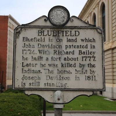
Photographed by J. J. Prats, October 16, 2015
1. Bluefield Marker
Topics and series. This historical marker is listed in these topic lists: Political Subdivisions • Settlements & Settlers. In addition, it is included in the West Virginia Archives and History series list. A significant historical year for this entry is 1774.
Location. 37° 16.017′ N, 81° 13.3′ W. Marker is in Bluefield, West Virginia, in Mercer County. It is at the intersection of Bland Street (U.S. 52) and High Street and Federal Street, on the right on Bland Street. It is in front of the Elizabeth Kee Federal Building, where the main post office is located. Touch for map. Marker is at or near this postal address: 601 Federal St, Bluefield WV 24701, United States of America. Touch for directions.

Regionally, this marker
this page online
Other nearby markers. At least 8 other markers are within walking distance of this marker: Elizabeth Kee (a few steps from this marker); Bailey Building (within shouting distance of this marker); Kee Federal Building (within shouting distance of this marker); Old City Hall (about 300 feet away, measured in a direct line); Peery Building (about 400 feet away); Bluefield Daily Telegraph Building (about 500 feet away); The West Virginian Hotel (about 600 feet away); Law and Commerce Building (about 700 feet away). Touch for a list and map of all markers in Bluefield.
Also see . . . Wikipedia entry for Bluefield, West Virginia.
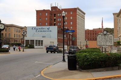
Photographed by J. J. Prats, October 16, 2015
2. Bluefield Marker
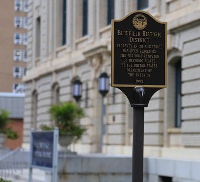
Photographed by J. J. Prats, October 16, 2015
3. Bluefield Historic District Marker
“Property in this District has been placed on the National Register of Historic Places by the United States Department of the Interior. 1992.”
Credits. This page was last revised on June 16, 2016. It was originally submitted on November 10, 2015, by J. J. Prats of Powell, Ohio. This page has been viewed 1,759 times since then and 193 times this year. Photos: 1, 2, 3. submitted on November 10, 2015, by J. J. Prats of Powell, Ohio.
