Near Meade in Dickenson County, Virginia — The American South (Mid-Atlantic)
Dickenson County
— The Crooked Road — Virginia’s Heritage Music Trail —
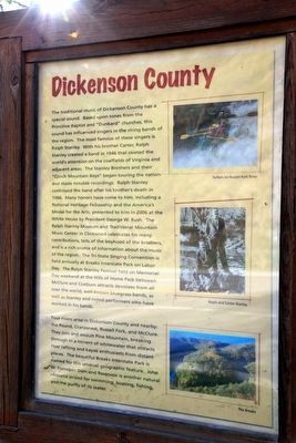
Dickenson County.The traditional music of Dickenson County has a special sound. Based upon tones from the Primitive Baptist and “Dunkard“ churches, this sound has influenced singers in the string bands of the region. The most famous of these singers is Ralph Stanley. With his brother Carter, Ralph Stanley created a band in 1946 that riveted the world’s attention on the coalfields of Virginia and adjacent areas. The Stanley Brothers and their “Clinch Mountain Boys” began touring the nation and made notable recordings. Ralph Stanley continued the band after his brother's death in 1966. Many honors have come to him, including a National Heritage Fellowship and the America's Medal for the Arts, presented to him in 2006 at the White House by President George W. Bush. The Ralph Stanley Museum and Traditional Mountain Music Center in Clintwood celebrates his many contributions, tells of the boyhood of the brothers and is a rich source of information about the music of the region. The Tri-State Singing Convention is held annually at Breaks Interstate Park on Labor Day. The Ralph Stanley Festival held on Memorial Day weekend at the Hills of Home Park between McClure and Coeburn attracts devotees from all over the world, well-known bluegrass bands, as well as Stanley and noted performers who have worked in his bands.
Four rivers arise in Dickenson County and nearby: the Pound, Cranesnest, Russell Fork, and McClure. They join and assault Pine Mountain, breaking through in a torrent of whitewater that attracts river rafting and kayak enthusiasts from distant places. The beautiful Breaks Interstate Park is named for this unusual geographic feature. John W. Flanagan Dam and Reservoir is another natural resource prized for swimming, boating, fishing the purity of its water.
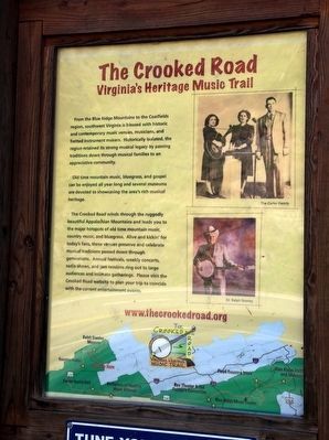
The Crooked Road, Virginia’s Heritage Music Trail. From the Blue Ridge Mountains to the Coalfields region, southwest Virginia is blessed with historic and contemporary music venues, musicians, and fretted instrument makers. Historically isolated, the region retained its strong musical legacy by passing traditions down through musical families to an appreciative community.
Old time mountain music, bluegrass, and gospel can be enjoyed all year long and several museums are devoted to showcasing the area’s rich musical heritage.
The Crooked Road winds through the ruggedly beautiful Appalachian Mountains and leads you to the major hotspots of old time mountain music, country music, and bluegrass. Alive and kickin’ for today’s fans, these venues preserve and celebrate musical traditions passed down through generations. Annual festivals, weekly concerts, radio shows, and jam sessions ring out to large audiences and intimate gatherings. Please visit the Crooked Road website to plan your trip to coincide with the current entertainment events.
Erected by The Crooked Road.
Topics and series. This historical marker is listed in these topic lists: Arts, Letters, Music • Churches & Religion • Entertainment. In addition, it is included in the The Crooked Road: Virginia’s Heritage Music Trail series list.
Location. 37° 7.882′ N, 82° 32.457′ W. Marker is near Meade, Virginia, in Dickenson County. Marker is on Dickenson Highway (Virginia Route 83) east of Red Onion Prison Road (Virginia Route 361), on the right. It is just inside the county line. Touch for map. Marker is in this post office area: Clintwood VA 24228, United States of America. Touch for directions.
Other nearby markers. At least 8 other markers are within 4 miles of this marker, measured as the crow flies. Daniel Webster Dotson (about 800 feet away, measured in a direct line); Wise County / Dickenson County (approx. 0.3 miles away); Sunnydale Farm (approx. 1.8 miles away); Pound, Virginia (approx. 3.3 miles away); Pound War Memorial (approx. 3.4 miles away); These Men Gave the Supreme Sacrifice for Our Freedom (approx. 3˝ miles away); Dotson-Mullins Field (approx. 3˝ miles away); Pound High School (approx. 3˝ miles away).
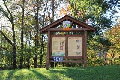
More about this marker. The Dickenson County panel has three photographs, the first of rafters on the Russell Fork River, the second of Ralph and Carter Stanley, and the third showing a view of the Breaks. The Crooked Road panel shows The Carter Family on the upper right, Dr. Ralph Stanley in the center right and a map of western Virginia showing stops on The Crooked Road and “You are Here.”
Also see . . . Stanley Brothers - How Mountain Gals Can Love.
Credits. This page was last revised on December 25, 2019. It was originally submitted on November 20, 2015, by J. J. Prats of Powell, Ohio. This page has been viewed 437 times since then and 25 times this year. Photos: 1, 2, 3. submitted on November 20, 2015, by J. J. Prats of Powell, Ohio.


