Near Pound in Wise County, Virginia — The American South (Mid-Atlantic)
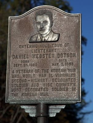
Daniel Webster Dotson
Topics. This memorial is listed in these topic lists: War, Korean • War, World II. A significant historical year for this entry is 1920.
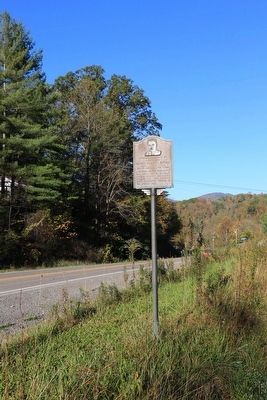
Location. 37° 7.829′ N, 82° 32.602′ W. Marker is near Pound, Virginia, in Wise County. Memorial is on Clintwood Highway (Virginia Route 82) just west of Red Onion Road (County Route 853), on the right when traveling west. Touch for map. Marker is in this post office area: Pound VA 24279, United States of America. Touch for directions.
Other nearby markers. At least 8 other markers are within 4 miles of this marker, measured as the crow flies. Dickenson County (about 800 feet away, measured in a direct line); Wise County / Dickenson County (approx. 0.2 miles away); Sunnydale Farm (approx. 1.8 miles away); Pound, Virginia (approx. 3.1 miles away); Pound War Memorial (approx. 3.2 miles away); These Men Gave the Supreme Sacrifice for Our Freedom (approx. 3.3 miles away); Dotson-Mullins Field (approx. 3.3 miles away); Pound High School (approx. 3.3 miles away). Touch for a list and map of all markers in Pound.
Credits. This page was last revised on June 16, 2016. It was originally submitted on November 20, 2015, by J. J. Prats of Powell, Ohio. This page has been viewed 314 times since then and 28 times this year. Photos: 1, 2. submitted on November 20, 2015, by J. J. Prats of Powell, Ohio.

