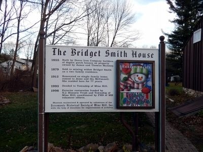
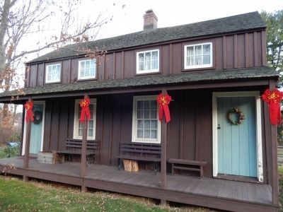
The Bridget Smith House
1855 Built by Dover Iron Company builders of duplex patch houses on property owned by James and Thomas Maloney.
1879 Sold to mining widow Bridget Smith as a two-family residence.
1912 Renovated as single-family home; rented to Jesse and Ida McConnell. She resided here for 77 years.
1993 Deeded to Township of Mine Hill.
1998 Exterior restoration funded by N. J. Historic Trust and Township of Mine Hill; coordinated by FHS of MH volunteer efforts.
Museum maintained and operated by volunteers of the Ferromonte Historical Society of Mine Hill, Inc. with the help of donations from improvements and archives.
Topics. This historical marker is listed in this topic list: Industry & Commerce. A significant historical year for this entry is 1855.
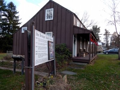
Location. 40° 52.434′ N, 74° 35.796′ W. Marker is in Mine Hill, New Jersey, in Morris County. Marker is on Randolph Ave.. The marker is located on the lawn by the side of the house. Touch for map. Marker is at or near this postal address: 124 Randolph Ave, Mine Hill NJ 07803, United States of America. Touch for directions.
Other nearby markers. At least 8 other markers are within 2 miles of this marker, measured as the crow flies. A different marker also named Bridget Smith House (here, next to this marker); Bridget Lockman Smith (a few steps from this marker); Dickerson Mine (approx. half a mile away); Site of Ferromonte
Credits. This page was last revised on June 16, 2016. It was originally submitted on December 12, 2015, by Don Morfe of Baltimore, Maryland. This page has been viewed 473 times since then and 16 times this year. Photos: 1, 2, 3. submitted on December 12, 2015, by Don Morfe of Baltimore, Maryland. • Bill Pfingsten was the editor who published this page.


