Casper in Natrona County, Wyoming — The American West (Mountains)
Guinard Bridge
Inscription.
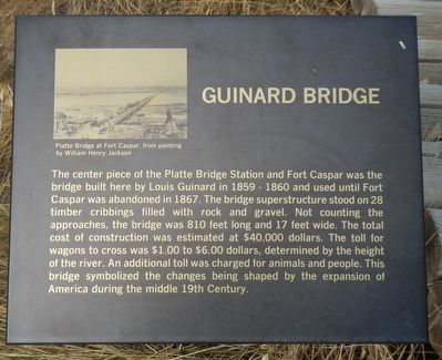
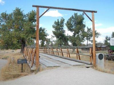
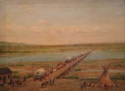
The center piece of the Platte Bridge Station and Fort Caspar was the bridge built here by Louis Guinard in 1859-1860 and used until Fort Caspar was abandoned in 1867. The bridge superstructure stood on 28 timber cribbings filled with rock and gravel. Not counting the approaches, the bridge was 810 feet long and 17 feet wide. The total cost of construction was estimated at $40,000 dollars. The toll for wagons to cross was $1.00 to $6.00, determined by the height of the river. An additional toll was charged for animals and people. This bridge symbolized the changes being shaped by the expansion of America during the middle 19th Century.
Erected 1988 by Natrona County Historical Society.
Topics and series. This historical marker is listed in this topic list: Bridges & Viaducts. In addition, it is included in the Oregon Trail series list.
Location. 42° 50.258′ N, 106° 22.301′ W. Marker is in Casper, Wyoming, in Natrona County. Marker can be reached from Fort Caspar Road near Southwest Wyoming Boulevard (Wyoming Highway 258), on the right when traveling west. Touch for map. Marker is at or near this postal address: 4001 Fort Caspar Road, Casper WY 82604, United States of America. Touch for directions.
Other nearby markers. At least 8 other markers are within walking distance of this marker. Site of Old Platte Bridge (here, next to this marker); The Upper Crossing (a few steps from this marker); The Road to Zion (a few steps from this marker); The Mormon Ferry (a few steps from this marker); Reconstructed Fort Caspar (about 300 feet away, measured in a direct line); The Battle at Platte Bridge (about 300 feet away); The Battle of Red Buttes (about 400 feet away); Robert Stuart Cabin Site (about 500 feet away). Touch for a list and map of all markers in Casper.
More about this marker. This marker is located next to the reconstruction of Platte Bridge.
Credits. This page was last revised on June 16, 2016. It was originally submitted on December 19, 2015, by Barry Swackhamer of Brentwood, California. This page has been viewed 620 times since then and 43 times this year. Photos: 1, 2, 3. submitted on December 19, 2015, by Barry Swackhamer of Brentwood, California.


