Vega in Oldham County, Texas — The American South (West South Central)
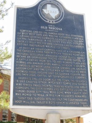
Site of Old Tascosa
(23 miles N.E.)
At first an Indian camping place at a crossing on the Canadian River, then Mexican trading point and pastoral settlement, Atascosa (Boggy Place) rapidly became an open-range trading center and capital of a cattle empire from 1876 to 1887. Romero Plaza and Howard and Rinehart store marked the boom in growth. Struggles between large ranch owners like Charles Goodnight and the "Little Men" of the plains were focused there. Became seat of Oldham County, 1880, and the legal capital of ten unorganized counties.
Progress spelled doom for the town. The railroad in 1887 created other important towns and barbed wire fences ended the vital trading routes and great roundups. The open ranges and cattle trails like the famous Dodge City Trail were gone. When county seat was moved to Vega in 1915, few residents remained.
Today "Old Tascosa" retains only the courthouse and Boot Hill. Cal Farley's Boys Ranch is located there.
Erected 1967 by State Historical Survey Committee. (Marker Number 4861.)
Topics. This historical marker is listed in this topic list: Settlements & Settlers. A significant historical year for this entry is 1876.
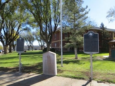
Location. 35° 14.818′ N, 102° 25.688′ W. Marker is in Vega, Texas, in Oldham County. Marker is at the intersection of South Main Street and Route 66, on the right when traveling north on South Main Street. Marker is on the southeast corner. Touch for map. Marker is in this post office area: Vega TX 79092, United States of America. Touch for directions.
Other nearby markers. At least 7 other markers are within 4 miles of this marker, measured as the crow flies. Senator W. S. Oldham (here, next to this marker); Doctor Oscar H. Loyd (here, next to this marker); Oldham County Courthouse, Vega, Texas (within shouting distance of this marker); Quanah Parker Trail (about 300 feet away, measured in a direct line); The Mother Road of Historic Route 66 (approx. 0.2 miles away); Dot's Mini Museum, Vega, Texas (approx. 0.2 miles away); Fort Smith-Santa Fe Trail (approx. 3˝ miles away).
Credits. This page was last revised on June 16, 2016. It was originally submitted on December 21, 2015, by Bill Kirchner of Tucson, Arizona. This page has been viewed 510 times since then and 42 times this year. Photos: 1, 2. submitted on December 21, 2015, by Bill Kirchner of Tucson, Arizona.

