Tara in County Meath, Leinster, Ireland — Mid-East (and Dublin)
Welcome to Tara of the Kings
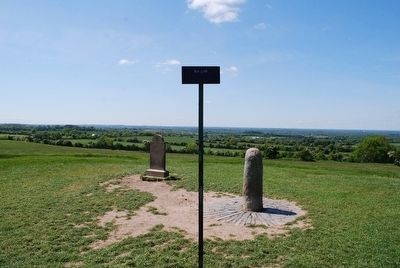
Hill of Tara
Inscription.
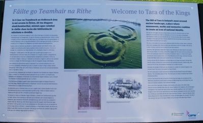
The Hill of Tara is Ireland's most revered ancient landscape, a place where monuments, myths and memories combine to create an icon of national identity.
Tara was the chief pagan sanctuary of early Ireland, an arena for ceremony, burial and ritual. Twenty-five monuments are visible as earthworks on the Hill of Tara today; archaeologists have detected a further 50 buried beneath the soil. The five principal roads of ancient Ireland converged on this place and Tara's influence radiated into the surrounding countryside, where many related monuments are to be found.
The story of Tara starts in the late fourth millennium before the birth of Christ, when a communal burial place (passage tomb0, Duma na nGiall, was constructed on the hill. so began Tara's role as a place of burial, a role that was to endure for over three millennia.
Generation after generation added their imprint, each reflecting and referencing the monuments that had gone before. In so doing, communities engaged with the sacred world by erecting some of the most spectacular ceremonial monuments of prehistoric Ireland. It is likely that the great processional avenue (cursus) known as the Tech Midchuarta and the large ceremonial enclosure (henge) Rath Maeve were constructed toward the end of the Stone Age.
Funerary barrows like the Cloenfherta are Bronze Age and Iron Age burial places. Perhaps they hold the remains of those who constructed the vast ceremonial sanctuary of Raith na Rig, which crowns the Hill of Tara, and prestigious dwellings such as Raith na Senad.
Eventually the prestige of Tara's past was harnessed as a symbol of a national kingship; to be crowned king of Tara was to be accepted as king of Ireland.
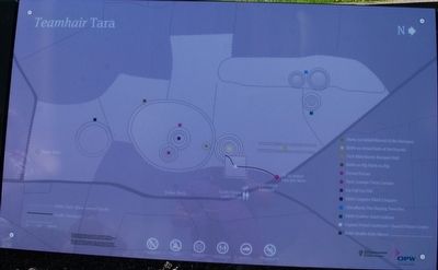
The Irish names given to each monument are derived from eleventh-century AD Dindgnai Temrach, 'The remarkable places of Tara'. This forms part of a series of medieval texts entitled Dindshenchas Erenn.
A visit to Tara around the time of the birth of Christ may have begun by journeying up Tech Midchuarta towards the sacred summit sanctuary at Raith na Rig. We can still follow this route today and immerse ourselves in this hallowed landscape.
Tara is one of the 'royal sites' of Ireland, which served as the seats of the Gaelic kings. Historical sources associate these sites with various medieval Irish kingdoms, and archaeological investigations have shown that many of them were culturally significant. Each Irish kingdom is thought to have had its own royal site but six such sites are considered to be the most important. four of these are associated with the four major provinces of Ireland - Cashel for Munster, Emain Macha (Navan Fort) for Ulster, Dun Ailinne for Leinster and Rathcroghan for Connacht. The Hill of Tara served as the seat of the kings of Meath and as the seat of the high king of Ireland.
other text on the marker are in Gaelic
Erected by OPW (The Office of Public Works).
Topics. This historical marker is listed in this topic list: Forts and Castles.
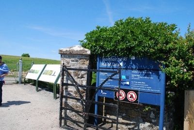
Location. 53° 34.903′ N, 6° 36.606′ W. Marker is in Tara, Leinster, in County Meath. This marker is located at the gated entrance of the trail that leads up to the Hill of Tara. Touch for map. Touch for directions.
Other nearby markers. At least 8 other markers are within 16 kilometers of this marker, measured as the crow flies. Bective Abbey / Mainistir Bheigtí (approx. 6.1 kilometers away); Culmullen & 1798 (approx. 10.1 kilometers away); Donaghmore Church and Round Tower (approx. 10.5 kilometers away); Newtowntrim Cathedral / Ardeaglais an Bhaile Nua (approx. 11.1 kilometers away); St Mary's Abbey (approx. 15.1 kilometers away); Connell's House (approx. 15.1 kilometers away); Duleek Courthouse (approx. 15.2 kilometers away); The Lime Tree (approx. 15.2 kilometers away).
Credits. This page was last revised on April 30, 2017. It was originally submitted on January 6, 2016, by Brandon Fletcher of Chattanooga, Tennessee. This page has been viewed 433 times since then and 12 times this year. Photos: 1, 2, 3, 4, 5, 6. submitted on January 6, 2016, by Brandon Fletcher of Chattanooga, Tennessee. • Bill Pfingsten was the editor who published this page.
