West Simsbury in Hartford County, Connecticut — The American Northeast (New England)
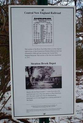
Central New England Railroad
Stratton Brook Depot
Inscription.
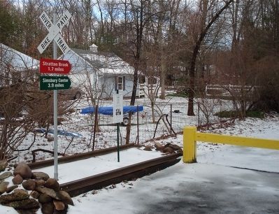
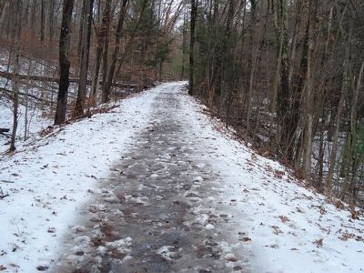
This section of the River Trail Bike Path is on the original right of way of the Connecticut Western Railroad that was chartered in 1868 and later became the Central New England Railroad. This section of the line was abandoned in 1937.
Stratton Brook Depot located 1.7 miles down the trail from here was a flag stop station in West Simsbury, CT. The train would only stop for disembarking passengers or if it was flagged by a waiting passenger at the Depot.
Erected by An Eagle Scout Project by Jack Mundt of Troop 76, Simsbury, CT.
Topics. This historical marker is listed in this topic list: Railroads & Streetcars.
Location. 41° 50.982′ N, 72° 52.033′ W. Marker is in Simsbury, Connecticut, in Hartford County. It is in West Simsbury. Marker is on West Mountain Road, on the right when traveling north. Touch for map. Marker is at or near this postal address: 196 West Mountain Road, West Simsbury CT 06092, United States of America. Touch for directions.
Other nearby markers. At least 8 other markers are within 3 miles of this marker, measured as the crow flies. Collinsville, Town of Canton (approx. 2.1 miles away); Canton (approx. 2.2 miles away); In Memory of Phoebe Humphrey (approx. 2.3 miles away); a different marker also named Collinsville, Town of Canton (approx. 2.4 miles away); Nike Missile Site (approx. 2.7 miles away); Pettibone Tavern (approx. 2.8 miles away); Weatogue Soldiers’ Memorial (approx. 2.8 miles away); Roderick A. White M.D. (approx. 2.9 miles away). Touch for a list and map of all markers in Simsbury.
Regarding Central New England Railroad. The Connecticut Western Railroad ran from Hartford west to the New York state line. It was completed in 1871. It had one short branch completed in 1874 that went south into Collinsville. In 1899 it became part of the Central New England Railroad.
Also see . . .
1. Central New England Railroad, history. (Submitted on January 10, 2016, by Alan M. Perrie of Unionville, Connecticut.)
2. Central New England Railroad of today. (Submitted on January 10, 2016, by Alan M. Perrie of Unionville, Connecticut.)
Credits. This page was last revised on July 30, 2023. It was originally submitted on January 10, 2016, by Alan M. Perrie of Unionville, Connecticut. This page has been viewed 537 times since then and 74 times this year. Photos: 1, 2, 3. submitted on January 10, 2016, by Alan M. Perrie of Unionville, Connecticut. • Bill Pfingsten was the editor who published this page.


