Near Cheyenne in Laramie County, Wyoming — The American West (Mountains)
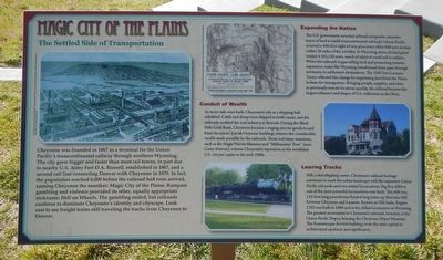
Magic City of the Plains
The Settled Side of Transportation
Inscription.
Cheyenne was founded in 1867 as a terminal for the Union Pacific's transcontinental railway through southern Wyoming. The city grew bigger and faster than most rail towns, in part due to nearby U.S. Army Fort D.A. Russell, established in 1867, and a second rail line connecting Denver with Cheyenne in 1870. In fact, the population reached 6,000 before the railroad had even arrived, earning Cheyenne the moniker: Magic City of the Plains. Rampant gambling and violence provided its other, equally appropriate nickname: Hell on Wheels. The gambling ended, but railroads continue to dominate Cheyenne's identity and cityscape. Look east to see freight trains still traveling the tracks from Cheyenne to Denver.
Expanding the Nation
The U.S. government awarded railroad companies extensive tracts of land to build transcontinental railroads. Union Pacific received a 400-foot right-of-way plus every other 640-acre section within 20 miles of the corridor. In Wyoming alone, its land grant totaled 4,582,520 acres, much of which it could sell to settlers. When the railroad began selling land and promoting western expansion, states like Wyoming transformed from pass-through territories to settlement destinations. The 1868 Fort Laramie Treaty reflected this change by negotiating land from the Plains Indians for immigration. Bringing people, supplies, and ideas to previously remote locations quickly, the railroads became the largest influence and shaper of U.S. settlement in the West.
Conduit of Wealth
As more rails were built, Cheyenne's role as a shipping hub solidified. Cattle and sheep were shipped to both coasts, and the railroad enabled the coal industry to flourish. During the Black Hills Gold Rush, Cheyenne became a staging area for goods to and from the mines. Lavish Victorian buildings witness the considerable wealth made possible by the railroads. These and many mansions, such as the Nagle Warren Mansion and "Millionaires' Row" (now Carey Avenue), witness Cheyenne's reputation as the wealthiest U.S. city per capita in the mid-1880s.
Leaving Tracks
Still a vital shipping center, Cheyenne's railroad heritage continues to mark the urban landscape with the expansive Union Pacific rail yards and two retired locomotives. Big Boy 4004 is one of the most powerful locomotives ever built. This 600-ton, 132-foot long powerhouse hauled long trains up Sherman Hill between Cheyenne and Laramie. Known as Old Sadie, Engine 1242 was built in 1890 and is the oldest locomotive in Wyoming. The greatest monument to Cheyenne's railroad, however, is the Union Pacific Depot, housing the Cheyenne Depot Museum. The Romanesque Revival building rivals the state capital in architectural opulence and significance.
Topics. This historical marker is listed in these topic lists: Industry & Commerce • Railroads & Streetcars.
Location. 41° 3.505′ N, 104° 52.739′ W. Marker is near Cheyenne, Wyoming, in Laramie County. Marker can be reached from High Plains Road near Interstate 25, on the left when traveling east. Touch for map. Marker is at or near this postal address: 5611 High Plains Road, Cheyenne WY 82007, United States of America. Touch for directions.
Other nearby markers. At least 8 other markers are within 6 miles of this marker, measured as the crow flies. Wyoming’s Wildlife Heritage (a few steps from this marker); Yellowstone Highway (within shouting distance of this marker); Outlaws! (within shouting distance of this marker); Trails & Tales of I-25 (about 300 feet away, measured in a direct line); The Greeting and The Gift (about 500 feet away); Cheyenne Corner Stone (approx. 4.8 miles away); Camp Carlin (approx. 5.7 miles away); Cheyenne's Early Fire Companies (approx. 5.9 miles away). Touch for a list and map of all markers in Cheyenne.
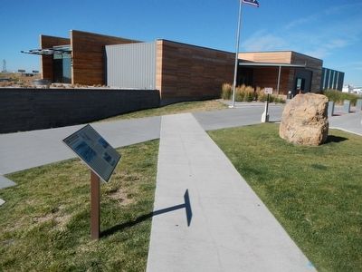
More about this marker. This marker is at the Wyoming Travel and Tourism Center located east of Interstate 25 at Exit 4.
Credits. This page was last revised on June 16, 2016. It was originally submitted on January 13, 2016, by Barry Swackhamer of Brentwood, California. This page has been viewed 423 times since then and 17 times this year. Photos: 1, 2. submitted on January 13, 2016, by Barry Swackhamer of Brentwood, California.

