Pike Creek near Newark in New Castle County, Delaware — The American Northeast (Mid-Atlantic)
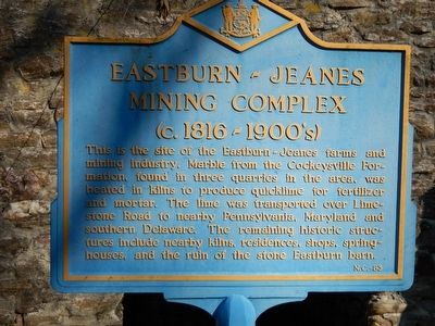
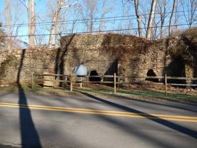
Eastburn-Jeanes Mining Complex
(c. 1816 - 1900's)
Erected by Delaware Public Archives. (Marker Number NC-83.)
Topics and series. This historical marker is listed in this topic list: Industry & Commerce. In addition, it is included in the Delaware Public Archives series list. A significant historical year for this entry is 1816.
Location. 39° 44.468′ N, 75° 42.862′ W. Marker is near Newark, Delaware, in New Castle County. It is in Pike Creek. Marker is on Upper Pipe Creek Road, on the left when traveling east. Touch for map. Marker is in this post office area: Newark DE 19711, United States of America. Touch for directions.
Other nearby markers. At least 8 other markers are within 3 miles of this marker, measured as the crow flies. Ebenezer United Methodist Church (approx. half a mile away); Pioneer of Preservation (approx. 1.3 miles away); The Post Mark'd West (approx. 1.6 miles away); Site of Post Mark'd West (approx. 1.6 miles away); Site of General Weedon's Foray at Spring Grove (approx. 1.9 miles away); The Daniel Nichols House (approx. 2 miles away); Original Site of the White Clay Creek Presbyterian Church (approx. 2 miles away); The Judge Morris Estate (approx. 2.4 miles away). Touch for a list and map of all markers in Newark.
Credits. This page was last revised on September 18, 2023. It was originally submitted on January 19, 2016, by Bill Pfingsten of Bel Air, Maryland. This page has been viewed 534 times since then and 43 times this year. Photos: 1, 2, 3. submitted on January 19, 2016, by Bill Pfingsten of Bel Air, Maryland.


