Collinsville in Canton in Capitol Region, Connecticut — The American Northeast (New England)
Collinsville, Town of Canton
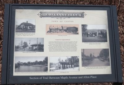
Central New England Railroad
Photographed by Alan M. Perrie, February 1, 2016
1. Collinsville, Town of Canton Marker
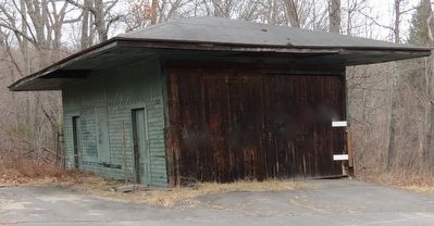
Central New England Railroad had several names but started in 1871 and ended in 1927. It ran from Hartford, Connecticut to Millerton, New York. The train came into this High Street Junction (on Dyer Avenue) from Simsbury. The passenger station was on River Road and originally a horse car on tracks brought passengers to and from the Dyer Avenue Station. Eventually, a plan was devised for a WYE and the train BACKED down to River Road to pick up passengers. It then continued west toward New Hartford. The building standing today on Dyer Avenue was the freight station and has been moved a slight distance from its original location.
Topics. This historical marker is listed in this topic list: Railroads & Streetcars. A significant historical year for this entry is 1900.
Location. 41° 49.167′ N, 72° 54.983′ W. Marker is in Canton in Capitol Region, Connecticut. It is in Collinsville. It can be reached from Dyer Avenue. The marker is located on the Farmington River Trail, 0.4 miles west of the parking lot on route 179 (River Road). Touch for map. Marker is at or near this postal address: 3 Allen Pl, Canton CT 06019, United States
this page online

Regionally, this marker is in the Connecticut River Valley, in Greater Hartford, and in the Knowledge Corridor. It is also in the American Northeast and in New England. Globally, it is in North America, the Western Hemisphere, the Western World, and the Anglosphere. Historically, it finds itself in what was once Hartford County and also one of the original Thirteen Colonies.
Other nearby markers. At least 8 other markers are within walking distance of this marker: Constitution Oak (approx. 0.3 miles away); a different marker also named Collinsville, Town of Canton (approx. 0.3 miles away); Canton Veterans Memorial (approx. 0.6 miles away); Charter Oak Offspring (approx. 0.7 miles away); a different marker also named Collinsville (approx. 0.7 miles away); Canton Soldiers Memorial (approx. 0.7 miles away); The Collins Company Plow Building (approx. ¾ mile away); Collinsville’s Powerhouse Station No. 3 (approx. 0.8 miles away). Touch for a list and map of all markers in Canton.
Also see . . .
1. The history and map of the Railway. (Submitted on February 4, 2016, by Alan M. Perrie of Unionville, Connecticut.)
2. A wye description.
Photographed by Alan M. Perrie, February 1, 2016
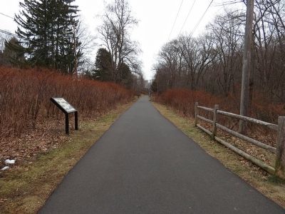
2. Farmington River Trail
After the railway stopped using their right of way, it was converted into a recreation path called the Farmington River Trail
Photographed by Alan M. Perrie, February 1, 2016
3. The freight station on Dyer Avenue.
Credits. This page was last revised on May 19, 2026. It was originally submitted on February 4, 2016, by Alan M. Perrie of Unionville, Connecticut. This page has been viewed 658 times since then and 30 times this year. Photos: 1, 2, 3. submitted on February 4, 2016, by Alan M. Perrie of Unionville, Connecticut. • Bill Pfingsten was the editor who published this page.
