Loma Rica in Yuba County, California — The American West (Pacific Coastal)
Loma Rica Grange Hall #802
Inscription.
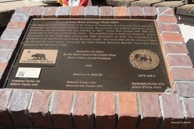
The National Grange of the Order of the Patrons of Husbandry is a fraternal organization that encourages families to band together to promote the economic and political well-being of the community and agriculture and was founded in 1867. Loma Rica Grange Hall #802 was constructed in 1923 as a community center. The recorded cost to build was $1660.14. It was incorporated as the Loma Rica Community Hall Association in 1948 and designated as a non-profit to be used by the community for local events. The Lions Club and the Calvary Chapel ran the hall for many years. Currently the Yuba County Women's Sheriff's Posse have been stewards of the hall since 2009.
Erected 2015 by Grand Parlor and District 13 Parlors of the Native Sons of the Golden West, Dean Zellers, Grand President. (Marker Number 139-5.)
Topics and series. This historical marker is listed in this topic list: Fraternal or Sororal Organizations. In addition, it is included in the Native Sons/Daughters of the Golden West series list. A significant historical year for this entry is 1923.
Location. 39° 18.757′ N, 121° 25.048′ W. Marker is in Loma Rica, California, in Yuba County. Marker is at the intersection of Loma Rica Road and Summit Avenue, on the left when traveling north on Loma Rica Road. Touch for map. Marker is at or near this postal address: 11420 Loma Rica Road, Marysville CA 95901, United States of America. Touch for directions.
Other nearby markers. At least 8 other markers are within 10 miles of this marker, measured as the crow flies. Donnebrouge Mine (approx. 4.9 miles away); Browns Valley: 1850 – 1860 (approx. 5 miles away); Brown's Valley: Beginnings (approx. 5 miles away); Hammon Grove (approx. 5.8 miles away); The Yuba River Bridge at Parks Bar (approx. 7.9 miles away); Sucker Flat (approx. 9.4 miles away); Church of the Immaculate Conception (approx. 9.7 miles away); Smartville / Smartsville (approx. 9.7 miles away).
More about this marker. The marker is to the right of the front steps.

Photographed By Deborah De Martini, Assistant Grand Historian, September 19, 2015
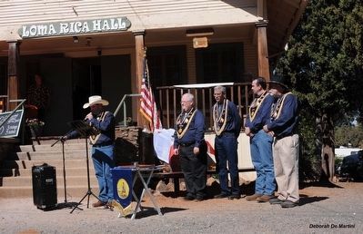
2. Marker Dedication Ceremony
The marker can be seen draped with the California Bear Flag.
Dedication Team(l-r):
Grand President Dean Zellers
Jr. Past Grand President Timothy Tullius
Grand 1st VP Paul Lapachet
Grand 2nd VP Erik Christeson
Past Grand President David Allen
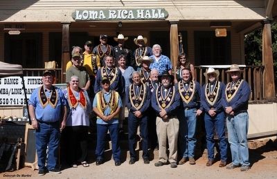
Dedication Team(l-r):
Grand President Dean Zellers
Jr. Past Grand President Timothy Tullius
Grand 1st VP Paul Lapachet
Grand 2nd VP Erik Christeson
Past Grand President David Allen
Credits. This page was last revised on June 16, 2016. It was originally submitted on April 15, 2016, by James King of San Miguel, California. This page has been viewed 462 times since then and 47 times this year. Photos: 1, 2, 3. submitted on April 15, 2016, by James King of San Miguel, California. • Syd Whittle was the editor who published this page.

