Cape Henlopen State Park near Lewes in Sussex County, Delaware — The American Northeast (Mid-Atlantic)
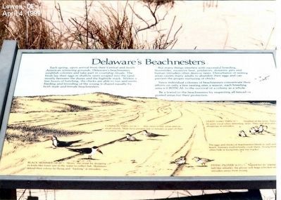
Delaware’s Beachnesters
Photographed by Don Morfe, April 4, 1999
1. Delaware’s Beachnesters Marker
Each spring, upon arrival from their Central and South American wintering grounds, Delaware beachnesters establish colonies and take part in courtship rituals. The birds lay their eggs in shallow nests scraped into the sand mostly between the dunes and the hightide mark. Within few hours of hatching, the chicks are able to run and swim. Feeding and brooding of the young is shared equally by both male and female beachnesters.
But many things interfere with successful breeding. Stormtides, excessive heat predators, domestic pets and human intruders often destroy nests. Disturbance of resting areas causes many adults to abandon their eggs and can prevent the proper nurturing of chicks.
Since individual colonies of beachnesters concentrate their efforts on only a few nesting sites a season, each breeding area is critical to the survival of a colony as a whole.
Be a friend to the beachnesters by respecting all fenced or posted areas for their protection.
Topics. This historical marker is listed in this topic list: Animals.
Location. 38° 47.721′ N, 75° 5.516′ W. Marker
this page online

Regionally, this marker is on Delaware’s Beaches. It is also in the American Mid-Atlantic, on the Delmarva Peninsula, and on the Eastern Seaboard. Globally, it is in the North Atlantic Region, North America, the Western Hemisphere, the Western World, and the Anglosphere. Historically, it finds itself in what was once New Netherland, one of the original Thirteen Colonies, and the Antebellum South.
Other nearby markers. At least 8 other markers are within walking distance of this marker: The Osprey (here, next to this marker); The Ever Changing Cape Henlopen (a few steps from this marker); Battery Hunter (approx. half a mile away); Senator David B. McBride (approx. 0.7 miles away); William J. Hopkins (approx. 0.8 miles away); Delaware Breakwater Quarantine Station (approx. 0.8 miles away); Quarantine Station (approx. 0.8 miles away); German Submarine at Cape Henlopen
Photographed by Don Morfe, April 4, 1999
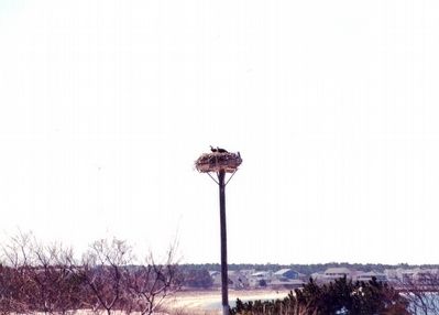
2. Osprey platform
Additional commentary.
1. About the sign
While nature signs that do not interpret human history are no longer included in the Database, this one was originally filed prior to that change.
— Submitted April 30, 2024, by Devry Becker Jones of Washington, District of Columbia.
Credits. This page was last revised on April 30, 2024. It was originally submitted on April 29, 2016, by Don Morfe of Baltimore, Maryland. This page has been viewed 429 times since then and 14 times this year. Photos: 1, 2. submitted on April 29, 2016, by Don Morfe of Baltimore, Maryland. • Bill Pfingsten was the editor who published this page.
