Casper in Natrona County, Wyoming — The American West (Mountains)
Cable Tool Drilling Rig
Inscription.
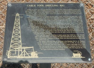
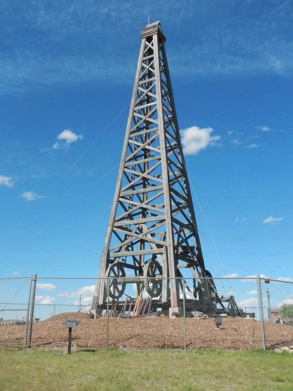
Drilling rigs of this type were used from about 1878 into the 1950's. With the drilling of deeper wells, starting in the 1920's, cable-tool drilling was gradually replaced by more modern rotary-drilling methods. This replica was built using plans adapted from Report No. III of the Second Geological Survey of Pennsylvania, 1880. It incorporates many original parts donated by individuals and companies from operating oil fields in Natrona County.
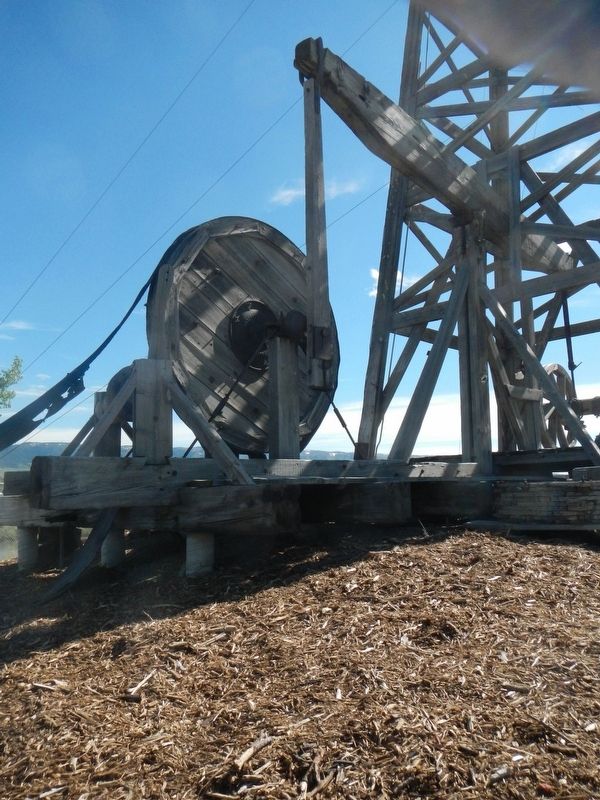
Drilling is accomplished by an engine driving a belt or "band" which turns the band wheel. As the band wheel rotates, a crank on the band-wheel shaft connected by a pitman to one end of the beam rocks the beam up and down. The temper screw hangs from the other end of the walking beam and is clamped around the drilling cable. Cable is stored on the bull wheel from which it leads up through the derrick to the sheave on the crown block and then back down to the temper screw. The actually weight of the drilling operation is carried by the walking beam and temper screw. As the walking beam rocks up and down, a chisel-shaped bit on the bottom end of the cable is raised and dropped, pulverizing the rock at the bottom of the drill hole. The rock cuttings are removed by hoisting the bit out of the hole and lowering a bailer down the hole. The bailer is a hollow tube with a simple valve on its lower end which opened when the bailer touches the bottom of the hole, and allows a slurry of cuttings to enter and fill the tube. When the bailer is hoisted, the weight of the cuttings close the valve, and when the bailer reaches the surface, it is swung away from the hole and dumped.
These rigs were capable of drilling to a depth greater than 9,000 feet. Over 300,000 wells in the United States were drilled with cable tools before the advent of rotary rigs. Many of Wyoming's important oil and gas fields were discovered and developed using rigs similar to this one.
The deepest cable-tool hole in Wyoming is the Resolute Oil Co. #1 Northern Pacific Railroad located in the SW NE Section 17, T. 57N., R. 101W., Park County. It took three years from 1928 to 1931 to reach a total depth of 8,723 feet. This well was the discovery for Badger Basin Field. It initially flowed 55 barrels per day of 50 degree API gravity oil and 250,000 cubic feet of gas per day from the Upper Cretaceous Frontier formation.
Erected 1993 by Petroleum Association of Wyoming.
Topics. This historical marker is listed in these topic lists: Industry & Commerce • Notable Buildings.
Location. 42° 50.853′ N, 106° 20.255′ W. Marker is in Casper, Wyoming, in Natrona County. Marker is at the intersection of West Yellowstone Highway (U.S. 26) and South Poplar Street (Wyoming Highway 220), on the left when traveling west on West Yellowstone Highway. Touch for map. Marker is at or near this postal address: 801 West Yellowstone Highway, Casper WY 82604, United States of America. Touch for directions.
Other nearby markers. At least 8 other markers are within 2 miles of this marker, measured as the crow flies. Wyoming's Oil & Gas (a few steps from this marker); Casper: "The Oil Capital of the Rockies" (approx. 0.6 miles away); Oregon-California Trail (approx. 0.7 miles away); Monument Corrections (approx. 0.7 miles away); Pioneer Monument / Fort Casper (approx. 0.7 miles away); City of Casper (approx. 0.9 miles away); The Armory (approx. 1.2 miles away); Giving Shape to History (approx. 1.4 miles away). Touch for a list and map of all markers in Casper.
More about this marker. This marker is in the Platte River Parkway. There is no nearby parking.
Also see . . . Oil Well - Wikipedia. The earliest oil wells in modern times were drilled percussively, by repeatedly raising and dropping a cable tool into the earth. In the 20th century, cable tools were largely replaced with rotary drilling, which could drill boreholes to much greater depths and in less time. (Submitted on July 2, 2016, by Barry Swackhamer of Brentwood, California.)
Credits. This page was last revised on July 2, 2016. It was originally submitted on July 2, 2016, by Barry Swackhamer of Brentwood, California. This page has been viewed 854 times since then and 57 times this year. Photos: 1, 2, 3. submitted on July 2, 2016, by Barry Swackhamer of Brentwood, California.


