Casper in Natrona County, Wyoming — The American West (Mountains)
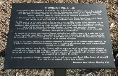
Wyoming's Oil & Gas
In 1851, mountain men found oil seeping along the Bridger Trail near Poison Spider Creek west of Casper and, mixing the oil with flour, sold it to westward-bound pioneers as axle grease.
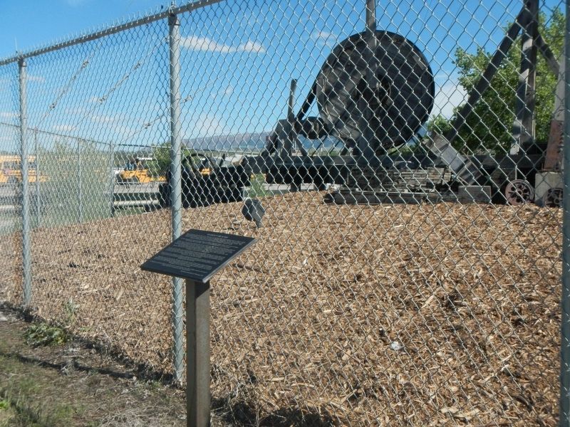
In 1884, using a rig even more primitive the one before you, Mike Murphy drilled Wyoming's first oil well to a depth of 300 feet, near the "great tar spring", launching Wyoming's most important industry. Subsequently early discoveries in the state's northeast and southwest corners caused speculation that a great river of oil lay diagonally underneath Wyoming - a theory which was quickly disproved.
Between 1889 and 1925, twelve giant oil fields were discovered. Today these fields remain active, still producing a large portion of Wyoming's oil.
By the end of the 1920's, Americans has become mechanized and mobile, assuring oil a major role in the country's and the state's future. Industrial growth, advanced science and new pipelines opened markets for natural gas which was produced with oil. Before that, the gas often hampered oil production and was burned of as an unusable by-product.
During the war years, Wyoming's oil industry responded by participating in numerous supply contracts. As a result of the war and continued economic growth, the state's oil production and proved reserves almost doubled between 1939 and 1945.
Throughout the next four decades, Wyoming achieved status as one of the nation's largest petroleum producing states becoming the 5th largest natural gas producer and the 6th largest producer of crude oil. By the end of the 1980's 14,000 wells, 10,000 miles of pipelines, 58 gas plants and 6 refineries were located throughout 22 of the state's 23 counties.
As Wyoming's petroleum industry proceeds into its second century, more than 6 billion barrels of oil and 17 trillion cubic feet of natural gas have been produced.
Erected 1993 by Petroleum Association of Wyoming.
Topics. This historical marker is listed in this topic list: Industry & Commerce.
Location. 42° 50.861′ N, 106° 20.25′ W. Marker is in Casper, Wyoming, in Natrona County. Marker is at the intersection of West Yellowstone Highway (U.S. 26) and South Poplar Street, on the left when traveling west on West Yellowstone Highway. Touch for map. Marker is at or near this postal address: 801 West Yellowstone Highway, Casper WY 82604, United States of America. Touch for directions.
Other nearby markers. At least 8 other markers are within 2 miles of this marker, measured as the crow flies. Cable Tool Drilling Rig (a few steps from this marker); Casper: "The Oil Capital of the Rockies" (approx. 0.6 miles away); Oregon-California Trail (approx. 0.7 miles away); Monument Corrections (approx. 0.7 miles away); Pioneer Monument / Fort Casper (approx. 0.7 miles away); City of Casper (approx. 0.9 miles away); The Armory (approx. 1.2 miles away); Giving Shape to History (approx. 1.4 miles away). Touch for a list and map of all markers in Casper.
More about this marker. This maker is located in the Platte River Parkway. There is no nearby parking.
Credits. This page was last revised on July 2, 2016. It was originally submitted on July 2, 2016, by Barry Swackhamer of Brentwood, California. This page has been viewed 309 times since then and 19 times this year. Photos: 1, 2. submitted on July 2, 2016, by Barry Swackhamer of Brentwood, California.

