Guatemala City in Guatemala Department, — Central America
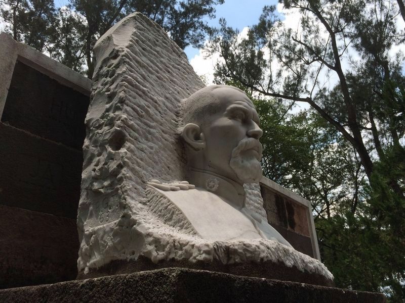
Lieutenant Colonel and Engineer Francisco Vela
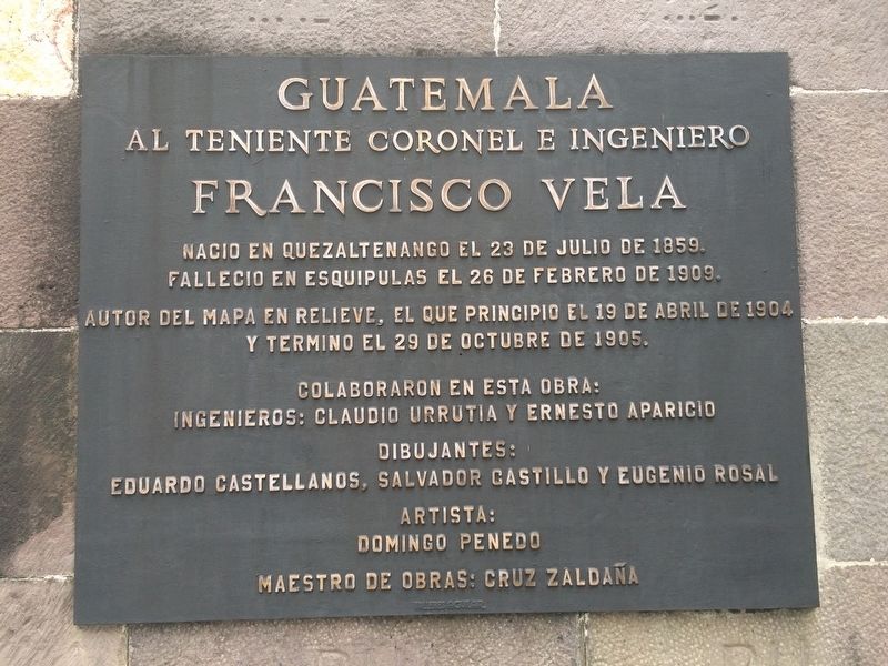
Inscription.
al Teniente Colonel e Ingeniero
Francisco Vela
Nacio en Quetzaltenango el 23 de julio de 1859.
Fallecio en Esquipulas el 26 de febrero de 1909.
Autor del Mapa en Relieve, el que principio el 19 de abril de 1904
y termino el 29 de octubre de 1905.
Colaboraron en esta obra:
Ingenieros: Claudio Urrutia y Ernesto Aparicio
Dibujantes:
Eduardo Castellanos, Salvador Castillo y Eugenio Rosal
Artista:
Domingo Penedo
Maestro de Obras: Cruz Zaldaña
to Lieutenant Colonel and Engineer
Francisco Vela
Born in Quetzaltenango on July 23, 1859.
Died in Esquipulas on February 26, 1909.
Author of the Relief Map, which he started on April 19, 1904
and finished on October 29, 1905.
His collaborators in this work:
Engineers: Claudio Urrutia and Ernesto Aparicio
Drafters: Eduardo Castellanos, Salvador Castillo y Eugenio Rosal
Artist: Domingo Penedo
Master of Works: Cruz Zaldaña
Topics. This historical marker is listed in these topic lists: Arts, Letters, Music • Charity & Public Work • Education. A significant historical date for this entry is February 26, 1909.
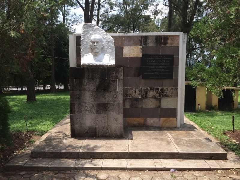
Location. 14° 39.649′ N, 90° 30.5′ W. Marker is in Guatemala City, Guatemala (Guatemala Department). Marker can be reached from Avenida Simeon Cañas. The marker and bust are to the northeast of the Relief Map of Guatemala at the end of Avenida Simeon Cañas. Touch for map. Marker is in this post office area: Guatemala City, Guatemala 01002, Guatemala. Touch for directions.
Other nearby markers. At least 8 other markers are within walking distance of this marker. Engineer Claudio Urrutia M. (within shouting distance of this marker); Engineer Francisco Vela (within shouting distance of this marker); General Francisco Morazán (approx. 1.1 kilometers away); First Autonomous University in Guatemala (approx. 1.2 kilometers away); Jocotenango Park (approx. 1.3 kilometers away); Yurrita House (approx. 1.5 kilometers away); The Mexican Fountain at El Cerrito del Carmen (approx. 1.5 kilometers away); First Council of the City of Guatemala (approx. 1.5 kilometers away). Touch for a list and map of all markers in Guatemala City.
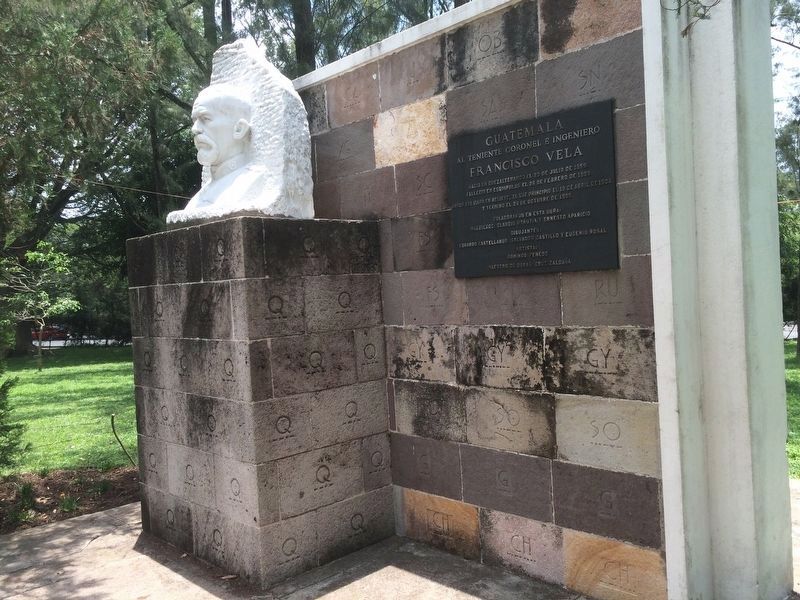
Regarding Lieutenant Colonel and Engineer Francisco Vela. The monument is interesting in that the stone blocks that make it up are engraved with letters and morse code of those letters. The pillar that supports
the bust are only engraved with "Q". At this time the meaning of the engravings is not known.
Photographed By J. Makali Bruton, June 17, 2016
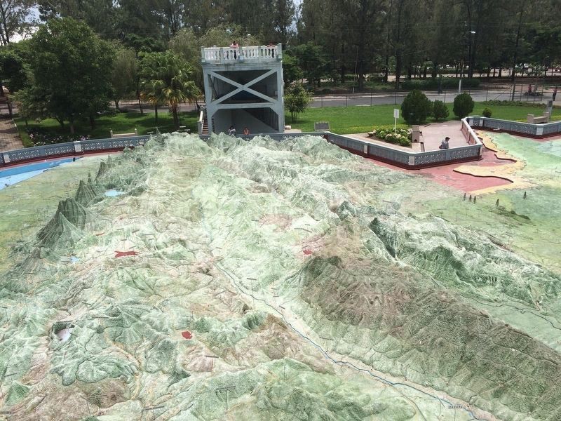
5. Vela's master work, the Relief Map seen from the east towards the west.
This view looks over the major portion of the highlands of Guatemala. The vertical scale of the map was purposely exaggerated in order to show the drastic elevation changes in Guatemala. The observation tower seen in the distance is original from 1905.
Credits. This page was last revised on May 17, 2021. It was originally submitted on July 14, 2016, by J. Makali Bruton of Accra, Ghana. This page has been viewed 412 times since then and 22 times this year. Photos: 1, 2, 3, 4, 5. submitted on July 14, 2016, by J. Makali Bruton of Accra, Ghana.
