San Bartolomé Milpas Altas, Sacatepéquez, Guatemala — Central America (Central Highlands)
Reconstruction After Guatemala's 1976 Earthquake
Inscription.
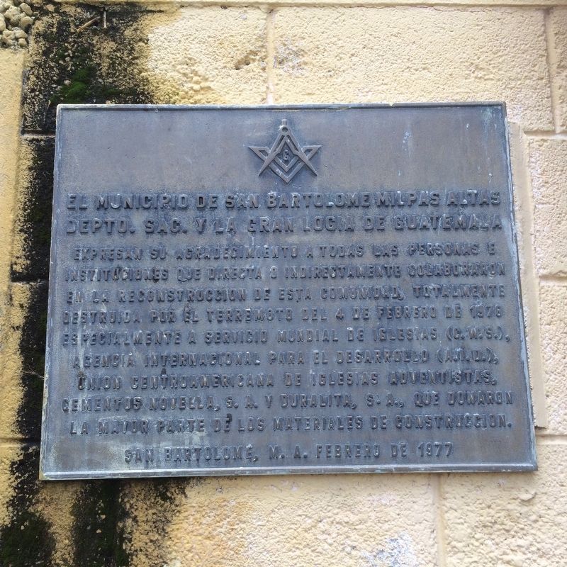
El municipio de San Bartolome Milpas Altas
Depto. Sac. y la Gran Logia de Guatemala
Expresan su agradecimiento a todas las personas e instituciones que directa o indirectamente colaboraron en la reconstrucción de esta comunidad, totalmente destruido por el terremoto del 4 de febrero de 1976 especialmente a Servicio Mundial de Iglesias (C.W.S.),
Agencia Internacional para el Desarrollo (A.I.D.),
Union Centroamericana de Iglesias Adventistas,
Cementos Novella, S.A. y Duralita, S.A., que donaron la mayor parte de los materiales de construcción.
San Bartolome, M.A. febrero de 1977
The municipality of San Bartolomé Milpas Altas
In the department of Sacatepéquez and the Grand Lodge of Guatemala
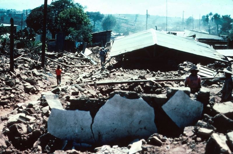
Express their thanks to all people and institutions that directly or indirectly collaborated in the reconstruction of this community, totally destroyed by the earthquake of February 4, 1976
especially to Church World Service (CWS),
The United States Agency for International Development (USAID),
The Central American Union of Adventist Churches and
Novella Cement and Duralita, that donated the majority of the construction materials.
San Bartolomé Milpas Altas, February 1977
Erected 1977 by Municipalidad de San Bartolomé Milpas Altas y la Gran Logia de Guatemala.
Topics. This historical marker is listed in these topic lists: Charity & Public Work • Disasters. A significant historical date for this entry is February 4, 1976.
Location. 14° 36.398′ N, 90° 40.736′ W. Marker is in San Bartolomé Milpas Altas, Sacatepéquez. Marker is on 2a Avenida close to 4a Calle, on the left when traveling south. Touch for map. Marker is in this post office area: San Bartolomé Milpas Altas, Sacatepéquez 03007, Guatemala. Touch for directions.
Other nearby markers. At least 8 other markers are within 8 kilometers of this marker, measured as the crow flies. The Road Workers Monument (approx. 1.6 kilometers away); Battle of San Lucas Monument (approx. 2.4 kilometers away); Santo Tomás Milpas Altas (approx. 5.4 kilometers away); Candelaria Pilgrimage of 1963 to Antigua (approx. 7.2 kilometers away); Las Delicias Fountain (approx. 7.6 kilometers away); Manuel Gálvez y Corral (approx. 7.6 kilometers away); Volcanos Fuego and Acatenango (approx. 7.7 kilometers away); Volcano Agua (approx. 7.7 kilometers away).
Credits. This page was last revised on March 14, 2023. It was originally submitted on July 15, 2016, by J. Makali Bruton of Accra, Ghana. This page has been viewed 334 times since then and 19 times this year. Photos: 1, 2, 3, 4. submitted on July 15, 2016, by J. Makali Bruton of Accra, Ghana.


