Hodges in Greenwood County, South Carolina — The American South (South Atlantic)
Good Hope Baptist Church
[Marker Front]:
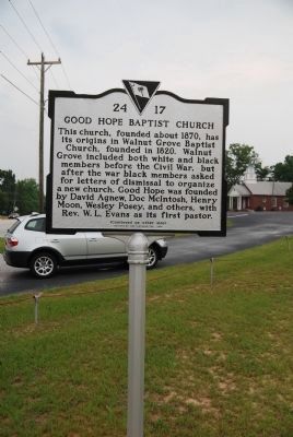
This church, founded about 1870, has its origins in Walnut Grove Baptist Church, founded in 1820. Walnut Grove included both white and black members before the Civil War, but after the war black members asked for letters of dismissal to organize a new church. Good Hope was founded by David Agnew, Doc McIntosh, Henry Moon, Wesley Posey, and others, with Rev. W.L. Evans as its first pastor.
[Marker Reverse]:
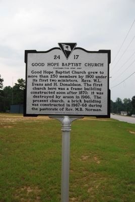
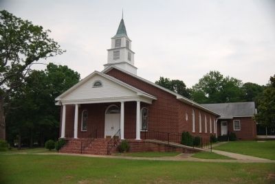
Good Hope Baptist Church grew to more than 250 members by 1900 under its first two ministers, Rev. W.L. Evans and H. Donaldson. The first church here was a frame building constructed soon after 1870; it was destroyed by arson in 1966. The present church, a brick building was constructed in 1967-68 during the pastorate of Rev. M.B. Norman.
Erected 2006 by Good Hope Baptist Church Congregation. (Marker Number 24-17.)
Topics. This historical marker is listed in these topic lists: African Americans • Churches & Religion. A significant historical year for this entry is 1870.
Location. 34° 20.717′ N, 82° 13.232′ W. Marker is in Hodges, South Carolina, in Greenwood County. Marker is on U.S. 25, on the left when traveling south. Touch for map. Marker is at or near this postal address: 6516 Highway 25 North, Hodges SC 29653, United States of America. Touch for directions.
Other nearby markers. At least 10 other markers are within 5 miles of this marker, measured as the crow flies. The William T. Jones, III Bridge (approx. 3.3 miles away); Ware Shoals High School Veterans Memorial (approx. 3˝ miles away); Ware Shoals School / Ware Shoals High School (approx. 3˝ miles away); Western Laurens Volunteer Fire Department (approx. 3.6 miles away); Ware Shoals Veterans Memorial (approx. 4 miles away); Benjamin DeWitt Riegel (approx. 4 miles away); Martin's Store (approx. 4 miles away); Old Cokesbury and Masonic Female College and Conference School (approx. 4.1 miles away); Marion P. Carnell Bridge (approx. 4.1 miles away); Irvin Pitts Park / Ware Shoals (approx. 4.2 miles away).
Credits. This page was last revised on June 16, 2016. It was originally submitted on July 29, 2008, by Brian Scott of Anderson, South Carolina. This page has been viewed 1,691 times since then and 65 times this year. Last updated on July 29, 2008, by Brian Scott of Anderson, South Carolina. Photos: 1, 2, 3. submitted on July 29, 2008, by Brian Scott of Anderson, South Carolina. • Kevin W. was the editor who published this page.


