State Historical Markers Numbering Plans
1. North Carolina
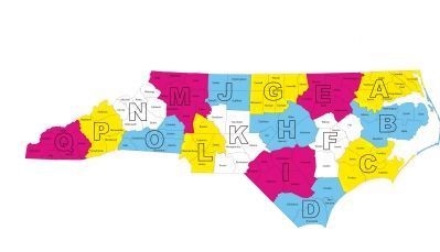
The first official highway historical marker in North Carolina was erected in 1936 in Granville County (No. G-1, titled John Penn). North Carolina historical markers with single-letter prefixes (the majority) contain text much shorter than found on markers in other states so they can be read by passing motorists. The Divison of Archives and History wherever possible places markers at turn-offs or intersections where traffic slows.
For marker numbering purposes the state’s 100 counties are divided into 17 districts, A through Q. District A is in the upper right corner of the state while district Q is the westernmost. Marker numbers consist of the district letter, a dash, and the a sequential number from 1 unique to the district. Odd-sized markers (larger or smaller) use double or triple prefixes, for example, large marker HH-1 (Battle of Bentonville) and small marker HHH-1 (Sherman), both at the Bentonville Battlefield in Johnson County (District H). Nearby is standard marker H-1 (Battle of Bentonville).
— Submitted November 20, 2010, by J. J. Prats of Powell, Ohio.
2. South Carolina Highway Historical Marker Numbers
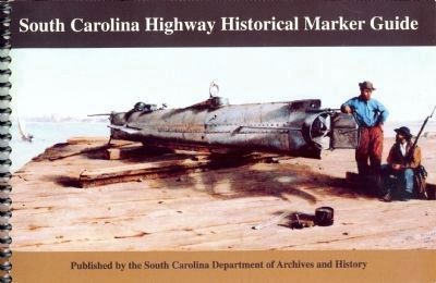
The state’s historical marker program dates from the 1930s, first under the auspices of the Historical Commission of South Carolina and from 1954 the Department of Archives and History. A marker number has appeared on markers erected after August 1990. It consists of a prefix number designating the county in which the marker has been erected, a dash, and a sequential number beginning with 1 unique to the county.
The prefix number designating the county is the same one used on secondary road numbers by the South Carolina Department of Transportation, for example S-40-100 (road 100 in county 40, Richland County). This “county” number is the position of the county’s name in an alphabetical list. For example, Abbeville county, the first county on the list is number “1” while York County, the 46th entry on the list, is number “46”.
The numbering plan has been applied retroactively to earlier markers. The South Carolina Highway Historical Marker Guide published by the Department of Archives and History is ordered by marker number, which means that counties are presented in the book in alphabetical order.
— Submitted November 20, 2010, by J. J. Prats of Powell, Ohio.
3. Tennessee Historical Markers Serial Numbers
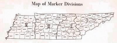
The 1972 edition of Tennessee Historical Markers published by the Tennessee Historical Commission explains the numbering scheme in the following paragraph, quoted from page 17, and accompanying map. The 1996 edition retained the paragraph but omitted the map.
“The serial numbers which appear on the markers are for administrative purposes and may be explained. The first numeral of the serial number denotes the highway division in which the marker is located. The divisions are indicated on the map on the following page. The letter which follows indicated the district within the division, a district being composed of from three to five adjoining counties. The one or two digit number following this letter indicated the order in which the marker was erected within the designated district.”
— Submitted December 5, 2010, by J. J. Prats of Powell, Ohio.
4. Virginia’s Historical Highway Marker Program
Click here for the article on the early history of the Virginia Historical Marker System by Arthur Striker in the Encyclopedia Virginia.
— Submitted July 30, 2013.
5. Virginia Marker Numbers
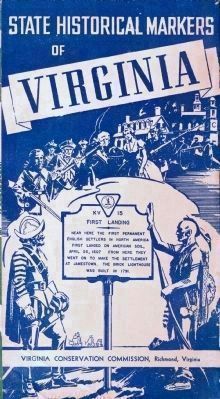
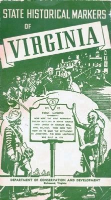
Virginia’s historical marker program is the oldest state-sponsored marker system in the country. The original intent for the program was to create nationwide interest in Virginia history and to encourage automobile-based tourism. The program began with
the creation of the Conservation and Economic Development Commission in 1926. The first markers were erected between Richmond and Fredericksburg in 1927.
Virginia marker numbers consist of one or two letters followed by a one, two, or three digit number. Some early markers reverse the position of the letters and numbers. In this database (and in all official guidebooks) marker numbers are shown letter first regardless of how they are shown on the face of the marker.
Originally the letters referred to the route along which the markers are erected. Single letters are main routes, while double letters are branch routes with the first letter indicating the main route. Within each main or branch route, markers were generally numbered from 1 in the order they were designed. Today new markers are being erected closer to the location they describe rather than on the main roads, and use letter prefixes matching older nearby markers.
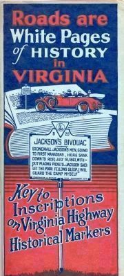
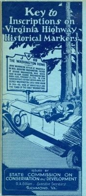
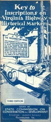
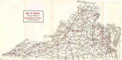
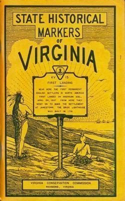
The rest of this article is copied from the introductory pages of the 167 page booklet Key to Inscriptions on Virginia Highway Historical Markers (third edition) published by the Commission in 1932, describes the numbering scheme for the markers and lists some of the towns along each route. (Editor's clarifications are in brackets.) The maps included in the 1929 and 1932 booklet are reproduced on this page.
I. INTRODUCTION: HISTORY WRITTEN ON IRON
The opening of hundreds of miles of state highways [in the 1920s] made practicable what was not possible before, the marking of Virginia for historical purposes. That this has long been needed has been generally recognized, and the State Conservation and Development Commission took up the question about the beginning of 1927.
The commission determined to try what had never before been attempted on a large scale: the marking of roads for the convenience of automobile travelers. For this reason the two-faced metal marker with large lettering was adopted so as to get the maximum of visibility. However, it is difficult to read anything when going at speed, and so the commission decided to supplement the inscriptions on the markers with a book giving the inscriptions and keyed to the road markers by means of their numbers. Thus the traveler supplied with this booklet has only to catch the number of a marker (or the title) and to turn to that number (or title) in the booklet to find the inscription, which can be read without checking the speed of the car.
It will be observed that the Conservation and Development Commission, in its system of historical marking, has used the novel plan of presenting a connected story of historical happenings. Thus, the movements of armies, such as Lee’s and Grant’s armies from Spotsylvania to the vicinity of Richmond in 1864, can be easily followed by reading the markers. Likewise, the tide of settlement can be followed along the James River and from the Rappahannock to the Potomac. In fact, what the commission has done is to write history on iron instead of on paper; by viewing the markers in conjunction with this skeleton booklet, it is possible to get a good idea of the topography of Virginia history with an absolute minimum of reading. And in a busy age this is deemed to be a much desired convenience. The approximate location of the marker is given in italics just under the inscription. Not all markers are located at or even near the exact sites of the events or places they commemorate. In many cases the markers are miles from these spots, and in such instances an approximate distance and direction is given in the body of the inscription.
Where motorists who are not familiar with roads in the community wish to visit a place off the main highway, it is expedient to inquire about the route, condition of road, etc., to the place in question.
II. KEY TO DISTRIBUTION OF MARKER ROUTE LETTERS
The roads have code letters. A single letter indicates a main route. Example: The Valley Pike, which extends from the West Virginia line northeast of Winchester, Va., and runs in a southwardly direction through Roanoke, Va., and thence to the North Carolina line via Martinsville, Va., has the code letter “A”.
Branch roads have two code letters. Example: The state road No. 822 [today’s U.S. 522], which leaves Winchester, Va., in a northwestwardly direction and runs to the West Virginia line, has the code letters “AA”.
The main roads with one letter do not follow each other alphabetically with respect to their geographical position. The branch roads do, however, and a brief explanation of this system will be of value to the tourist who intends making an extensive tour and, at the same time, giving consideration to our historical markers.
Example: Road No. 822 [today’s U.S. 522] is “AA” because it branches from the Valley Pike “A” and is the most northerly branch road of historical importance from this main road. Further south on “A” the branch roads run down the alphabet : “AB”. “AC”, “AD”, etc. On this main road, which is a north-south road, the branch roads leading from it all begin with “A” and their second code letters start with “A” in the north. On a west-east main road, the second code letter starts with “A” in the west and runs down the alphabet as the branch roads leave the main road on its eastward course.
There are four exceptions in the
code letter system as follows: “I”, state institutions; “P”, battlefield parks; “Q” towns and cities; “Z”, county-line markers. Wherever these letters occur they indicate markers dealing with the special subjects and should not be confused with the regular one or two-letter code.
. . .
Historical Outline
If the traveler enters Virginia by the northern end of the Shenandoah Valley (A), he comes into a region replete with colonial and 1861-1865 [Civil War] history. Winchester was Washington’s headquarters in the French and Indian War and the scene of three [Civil War] battles, 1862-1864. The section witnessed Jackson’s famous Valley Campaign, 1862, and Sheridan’s campaign of 1864.
The traveler who comes into Virginia from Washington and takes the Lee Highway (C) [U.S. route 29] passes directly through the battlefields of the First and Second Manassas (Bull Run). Markers point out the principal points in these noted engagements.
The Jefferson Davis Highway (E) [U.S 1] between Washington and Richmond is interesting in many phases of history. The road between Washington and Fredericksburg follows the ancient trail and passes many places connected with the early settlement. On or near this road, moreover, are Pohick Church, intimately connected with Washington, and Gunston Hall, home of the Revolutionary leader, George Mason. At Falmouth the traveler comes into stirring scenes, for this village was the camping ground of the Army of the Potomac in 1862 and 1863. The highway passes directly through the battlefield of Fredericksburg and from this point to Ashland is intimately connected with the campaign of 1864. In a general way it follows the line of the old Telegraph Road, along which Lee withdrew southward as Grant attempted to flank him.
The Jefferson Davis Highway south of Richmond (S) [U.S. 1] is also very historic. It passes many points connected with Benedict Arnold’s operations in 1781 and events of 1862-1864, including the battle of Drewry’s Bluff. Between Petersburg and Dinwiddie Courthouse many markers tell the story of the great siege of 1864-1865 and the breaking of Lee’s lines at Five Forks.
The traveler entering Virginia from West Virginia and moving eastward on State Route No. 37 (J) [today, U.S. 340 to VA 7 west to U.S. 522 south to VA 3] goes through the old and historical towns of Berryville, Winchester, Front Royal, Sperryville and Culpeper, situated in a fertile and beautiful farming region. Culpeper is intimately associated with the Revolution and events of 1862-1864. It was Grant’s headquarters early in 1864 and there he planned the Wilderness Campaign. State Route No. 37 [today, VA 3]
passes through Fredericksburg and penetrates the Northern Neck of Virginia, particularly rich in colonial associations. The road goes near the birthplaces of James Madison, James Monroe, George Washington and Robert E. Lee. On it, also is Christ Church, Lancaster, possibly the most interesting colonial church in the United States.
U. S. Route No. 17 (George Washington Highway in part) (N), running from Fredericksburg to Yorktown, is also marked by great antiquarian interest It follows in general the colonial postal route south On this highway are such points of interest as Stonewall Jackson’s headquarters, 1862-1863; the ancient towns of Port Royal and Tappahannock; Gloucester Courthouse; colonial Ware and Abingdon Churches. Near it are the celebrated colonial estates of Warner Hall and Rosewell.
From Richmond many roads radiate to regions of great interest. State Route No. 13 (O) [today, U.S. 60 west of Richmond] passes through the scenes of the Seven Days Battles, 1862, and the battlefield of Cold Harbor, 1864, as well as points of colonial history, to cross the Rappahannock River at Tappahannock. This highway west from Richmond is particularly important historically, as it was, in part, the route followed by Lee in his retreat from Petersburg to Appomattox. It was at Jetersville, on this route, that Sheridan blocked the way south and forced Lee to diverge westward to Appomattox.
State Route No. 41 (V) [today, VA 5], running east from Richmond along the James River, has historical associations unsurpassed elsewhere in the state. The road passes directly under Malvern Hill, where McClellan made his stand in 1862, and near it are such notable houses as Shirley, Berkeley, Westover and Greenway.
State Route No. 39 (W), running east from Staunton to Newport News, [today, U.S. 250 to VA 22 to US 33 to VA 54, then U.S. 60 east of Richmond] affords the traveler an admirable historical route. The road passes near Shadwell, where Thomas Jefferson was born, and Monticello, where he lived; the battlefield of Trevilians, 1864; Scotchtown, Patrick Henry’s home; the battlefield of Seven Pines, just east of Richmond; Bottom’s Bridge, associated with many events; points of colonial and Revolutionary interest; Williamsburg; east of Williamsburg, Carter’s Grove and many other places noted in colonial history; Fort Eustis and Newport News; Hampton, oldest English-settled town in the United States.
The great highway across Virginia from west to east, from Cumberland Gap to Virginia Beach (K) [U.S. 58 to U.S. 11 north to Roanoke, then U.S. 460] takes the traveler through every sort of historical scene. It passes beautiful New River, Saltville, and scenes of pioneer history; Bristol; Christiansburg; Salem; Lynchburg, with the scenes of Hunter’s raid in 1864; Poplar Forest, Jefferson’s summer home; Appomattox; Nottoway Courthouse; the battlefield of Five Forks; the route of Lee’s retreat; Petersburg, with its very rich associations; City Point, ancient settlement and Grant’s headquarters in 1864–1865; Prince George Courthouse; Jordan’s point; Flowerdew Hundred; Brandon; Cabin Point; Claremont; Bacon’s Castle; Smithfield; St. Luke’s Church; Suffolk; Dismal Swamp; Portsmouth; and on to Virginia Beach. These associations are unsurpassed in the United States, as the south side of the James River was settled at a very early period and has a romantic history.
The Eastern Shore highway (WY) [U.S. 13] also passes through ancient scenes. Here are Arlington, early home of the Custis family; Hungars Church; Pungoteague; Occahannock; Onancock; and the home of the founder of Presbyterianism in America.
The taking over of the county roads by the state will gradually bring to the attention of travelers many other historic and scenic routes. Skyland Trail [today, Skyline Drive], constructed by the United States government along the crest of the Blue Ridge Mountains, is one of the most beautiful highways in the United States.
III. MARKER SERIES IN RELATION TO ROUTE NUMBERS ON HIGHWAYS
This [list] gives the marker series in relation to United States and State highway route numbers [and has been updated with 2010 route numbers].
A — U. S. Route 11, from West Virginia line to Roanoke; U. S. Route [220], from Roanoke to North Carolina line.
B — U. S. Route 50 (Lee-Jackson Memorial Highway), from West Virginia line to [Fairfax City, and VA 236 to] Alexandria.
BX State Route 55, in Fauquier County.
C — U. S. Route 211 (Lee Highway), from New Market to [Warrenton, then U.S. 29 to] Washington [DC].
D — [U.S. 33] (Spotswood Trail), from Gordonsville to [Harrisonburg, and VA 42 to] Clifton Forge and [U.S. 220] Troutville.
E — U. S. Route 1 (Jefferson Davis Highway), from Washington to Richmond.
S — U. S. Route 1 (Jefferson Davis Highway), from Richmond to North Carolina line.
F — U. S. Route 15 (James Madison Highway), from Maryland line near Leesburg to North Carolina line near Clarksville.
FA — State Route 55, Fauquier County, east of The Plains.
FB — State Route 55, Fauquier County, west of The Plains.
FR — State Route [40] (Patrick Henry Highway), Campbell and Charlotte counties.
G — State Route 28 and U. S. Route 29 from Centreville to the intersection of State Route [6], south of Charlottesville.
I — State institutions.
J — [U.S. 340 from] West Virginia line [to Berryville; VA 7 to Winchester; U.S. 522 to Culpeper; and] State Route [3] to Kilmarnock (the Northern Neck route).
JD — [U.S. 340 south from Berryville, in] Warren, Page, and Augusta counties.
JE — State Route [231], Madison and Page counties; [and Cumberland County Route 690].
JJ — State Route [20] from Orange to ... Wilderness Run.
[ JP — State Route 205 in Westmoreland County.]
[ JQ — County route 610 in Prince William County.]
JT — State Route [202], Westmoreland and Northumberland counties.
K — U. S. Route 58, from Cumberland Gap to Bristol; U. S. Route 11 (Lee Highway), from Bristol to Roanoke; [U.S. 460/221] (Colonial Trail), from Roanoke to Lynchburg; U. S. Route [460], from Lynchburg to Burkeville; [U.S. 460], from Burkeville to Suffolk; U. S. Route 58, from Suffolk to Virginia Beach.
KA — [U.S. 23], from Kentucky line near Appalachia via Natural Tunnel on U. S. Route 23, to Tennessee line near Kingsport.
KB — [U.S> 19], from West Virginia line near Tazewell to Tennessee line near Damascus.
KC — U. S. Route [52], from Bluefield to Independence and to North Carolina line on U. S. Route 221.
KD — U. S. Route 121, from Fort Chiswell to North Carolina line.
KG — State Route [8], from North Carolina line near Stuart to [U.S. 460 to] West Virginia line near Narrows.
KV — U. S. Route 60, [Virginia Beach].
L — U. S. Route 60, from West Virginia line near White Sulphur Springs to Lynchburg; U. S. Route 29 (Seminole Trail), from Lynchburg to North Carolina line near Danville.
LB — State Route [39], Bath County.
M — U. S. Route 60, from Lynchburg to Richmond.
MG — State Route [24], Appomattox County.
MJ — State Route [45], Cumberland County.
N — [U.S. 17], from intersection of U. S. Route 15 near Bealton to Fredericksburg, thence to Bayside, Mathews County, on U. S. Route 17.
[ ND — U.S. 301, Caroline and Hanover counties.]
NW — U. S. Route 17, from Gloucester Courthouse to Gloucester Point.
O — [U.S. 360], from Callao, Northumberland County, to Amherst County.
OB — State Route [14], King and Queen County.
OC — State Route 30, King William and Middlesex counties.
OH — [County] Route [711], Powhatan County.
P — Battlefield Park Markers.
PA — Richmond Battlefield Park Markers.
Q — Town and City Markers.
QA — Petersburg City Markers.
R — State Route [6], from Afton [to U.S. 29 south to Lynchburg to U.S. 501] to North Carolina line near South Boston.
S — [U.S. 1 south of Richmond].
SA — State Route [6], from Columbia to Richmond.
SN — State Route [46], Lunenburg County.
T — [VA 7, U.S. 340 and VA 277], from Falls Church to Stephens City.
U — State Route 12 and U. S. Route 58 (J. E. B. Stuart Highway), Abingdon to Suffolk.
UE — State Route [94], Grayson County.
UL— U. S. Route 58, Mecklenburg County.
UM — U. S. Route [301], Greensville, Sussex and Dinwiddie counties.
US — U. S. Route [258], Southampton County.
V — State Route [5], Henrico and Charles City counties.
W — [U.S. 250, VA 22, U.S. 33, VA 54] and U. S. Route 60, West Virginia line to [Fort] Monroe [in Hampton].
WO — State Route [249], New Kent County.
WY — U. S. Route 13, Phoebus to Eastern Shore to Maryland line.
X — State Route [71] and U. S. Route 19, from Woodway to Bluefield.
XB — U. S. Route 23 and State Route [83], Wise and Dickenson counties.
Z — County Line Markers.
[You can list and map the markers on these routes using the Marker Number Search Prefix Match on the More Search Options page of this database. Be sure to filter for VA in the State filter.]
— Submitted October 23, 2010, by J. J. Prats of Powell, Ohio.
6. Patent for the Virginia Historical Marker Signs
Click for the two-page PDF of the patent granted to the Commonwealth of Virginia in 1927.
— Submitted December 26, 2016.
7. Indiana
The Indiana Historical Bureau administers the Historical State Marker Program and uses a simple three-number numbering system (xx.xxxx.x) to identify State historical markers.
- The first number is the county based on an alphabetical coding system used by the State for vehicle registration and taxation purposes. Adams County, the first county alphabetically in Indiana, is numbered 01 and Whitley County, the last county alphabetically, is numbered 92. (This Wikipedia entry lists the county code numbers for the counties in Indiana.)
- The second number is the year in which the sign was installed.
- The third number lists the order of the marker in regards to its installation in the county in that year.
- 92 indicates the county code for Whitley County
- 1966 indicates the year of its installation
- 2 indicates it was the second marker installed in 1966 in Whitley County
— Submitted October 2, 2013, by Duane Hall of Abilene, Texas.
8. Michigan
The Michigan Historical Commission administers the Michigan Historical Marker Program. The program was started in 1955, and there are now over 1,700 state historical markers in Michigan. The marker program uses a three-part numbering system to identify state historical markers. The numbering system consists of a letter, then a number, and lastly another letter.
The first part of the numbering system indicates the level of significance of the site and uses three letters: HB, S, and L.
- HB is for a Historic Building (This designation was used only in the early years of the program)
- S is for a site of State significance
- L is for a site of Local significance
The last part of the numbering system identifies the classification type of the registered site. This classification started in 1978 and identified whether the site was a historic building or a site registered only for the purpose of the marker program.
- A is for a historic building(s), 50 years of age or older, which retains its historic integrity and reflects the period of its construction.
- B is for a historic building, 50 years of age or older, which lost its historic integrity (These sites are no longer registered and marked)
- C is for informational and commemorative sites and designations.
- L indicates a site of local significance
- 1368 indicates the site was the 1,368th site listed in the Michigan Register of Historic Sites
- A indicates the registered site is a historic building(s) which was 50 years or older and retained its historic integrity when it was designated
Source: Ashlee, Laura Rose. Traveling Through Time: A Guide to Michigan's Historical Markers. Revised Edition. Ann Arbor: The University of Michigan Press, 2005, pp. 6-7.
— Submitted February 6, 2014, by Duane Hall of Abilene, Texas.
9. Ohio
The Ohio Historical Markers identify, commemorate and honor the important people, places and events that have contributed to the state's rich history. The placement of historic markers began in 1953 with the sesquicentennial celebration. The Ohio Historical Markers Program is administered by the Ohio Historical Society, now known as the Ohio History Connection.
A simple two-number numbering system (x-y) is used to identify State historical markers. The first number, x, lists the order of the marker in regards to its installation in the county. The second number, y, is the county based on an alphabetical coding system used by the State for vehicle registration. Adams County, the first county alphabetically in Ohio, is numbered 1 and Wyandot County, the last county alphabetically, is numbered 88. (This Wikipedia entry lists the county code numbers for the counties in Ohio.)
For example, the marker number for "Sheriden Cave" is 4-88, the fourth marker installed in Wyandot County.
— Submitted October 2, 2013, by Duane Hall of Abilene, Texas.
