Marker Logo HMdb.org THE HISTORICAL
MARKER DATABASE
“Bite-Size Bits of Local, National, and Global History”
Washington Township near Highfield-Cascade in Franklin County, Pennsylvania — The American Northeast (Mid-Atlantic)
 

Old Trolley Line


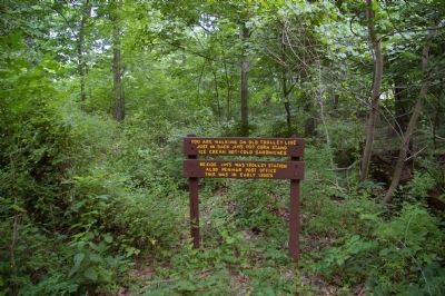
Old Trolley Line Marker image. Click for full size.
Photographed By Christopher Busta-Peck, July 20, 2008
1. Old Trolley Line Marker
Inscription.
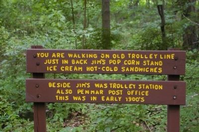
You are walking on old trolley line. Just in back Jim's pop corn stand. Ice cream, hot-cold sandwiches.

Beside Jim's was trolley station; also Pen Mar post office.
This was in early 1900's.
 
Topics. This historical marker is listed in these topic lists: CommunicationsIndustry & CommerceRailroads & StreetcarsSettlements & Settlers.
 
Location. 39° 43.201′ N, 77° 30.461′ W. Marker is near Highfield-Cascade, Pennsylvania, in Franklin County. It is in Washington Township. Marker can be reached from Pen Mar Road (Pennsylvania Route 550) near Imperial Avenue. Marker is on the Appalachain Trail. Parking may be available at the trailhead or in nearby Pen Mar Park. Touch for map. Marker is at or near this postal address: 24799 Pen Mar Rd, Waynesboro PA 17268, United States of America. Touch for directions.
 
Other nearby markers. At least 8 other markers are within 2 miles of this marker, measured as the crow flies. War Returns to South Mountain (approx. 0.2 miles away in Maryland); The Ice Lakes (approx. one mile away in Maryland); Dr. Henry Harbaugh (approx. 1.1 miles away); WW II Veterans Memorial (approx. 1.2 miles away in Maryland); D-Day Anniversary (approx. 1.2 miles away in Maryland); Military Intelligence Training Center

Paid Advertisement
Click on the ad for more information.
Please report objectionable advertising to the Editor.
Click or scan to see
this page online
(approx. 1.2 miles away in Maryland); Robert F. Barrick Memorial Library (approx. 1.2 miles away in Maryland); 9-11 Tribute (approx. 1.4 miles away).
 
Old Trolley Line Marker image. Click for full size.
Photographed By Christopher Busta-Peck, July 20, 2008
2. Old Trolley Line Marker
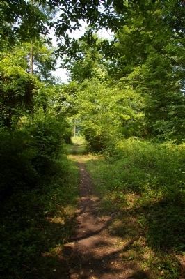
The Old Trolley Line, looking north image. Click for full size.
Photographed By Christopher Busta-Peck, July 20, 2008
3. The Old Trolley Line, looking north
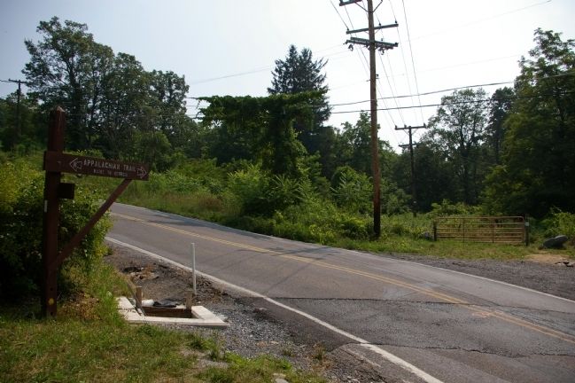
The Old Trolley Line, bisected by Pen Mar Road image. Click for full size.
Photographed By Christopher Busta-Peck, July 20, 2008
4. The Old Trolley Line, bisected by Pen Mar Road
A sign to the left indicates the directions to Maine and Georgia. The Appalachain Trail follows this route for a short distance.
 
 
Credits. This page was last revised on February 7, 2023. It was originally submitted on August 6, 2008, by Christopher Busta-Peck of Shaker Heights, Ohio. This page has been viewed 1,555 times since then and 15 times this year. Photos:   1, 2, 3, 4. submitted on August 6, 2008, by Christopher Busta-Peck of Shaker Heights, Ohio.
Share this page.  
Share on Tumblr
m=10009

CeraNet Cloud Computing sponsors the Historical Marker Database.
This website earns income from purchases you make after using our links to Amazon.com. We appreciate your support.
Paid Advertisements
Mar. 19, 2024