Pine Grove in Amador County, California — The American West (Pacific Coastal)
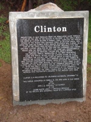
Clinton
The Spagnoli family, proprietors of the main mercantile store and ranch, helped secure Clintons future by also developing the ditches that supplied water to placer claims, around the Clinton area. Once Amador County was formed in 1854, Clinton entrepreneur Thomas Loehr petitioned the county to declare the road from Jackson to Clinton a public road. In 1877 Clinton was still alive enough for the Garbarini brothers to build St. Peter and Paulís Catholic Church which remained, when the town disappeared. In 2003, descendants of the Garbariniís, returned to restore the small church and it was moved to the Kennedy Mine Foundationís grounds in the Jackson gate area.
Clinton is registered as California Historical Landmark #37.
Erected 2011 by The James W. Marshall #49 Outpost of the Ancient and Honorable Order of E Clampus Vitus. (Marker Number 37.)
Topics and series. This historical marker is listed in these topic lists: Industry & Commerce • Settlements & Settlers. In addition, it is included in the California Historical Landmarks, and the E Clampus Vitus series lists. A significant historical month for this entry is March 1884.
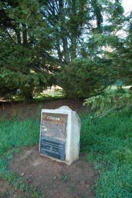
Location. 38° 22.559′ N, 120° 40.022′ W. Marker is in Pine Grove, California, in Amador County. Marker is at the intersection of Clinton Road and Ponderosa Road / East Clinton Road, on the left when traveling south on Clinton Road. Touch for map. Marker is in this post office area: Pine Grove CA 95665, United States of America. Touch for directions.
Other nearby markers. At least 8 other markers are within 5 miles of this marker, measured as the crow flies. Pine Grove (approx. 2.6 miles away); Hun'ge (approx. 3.6 miles away); Chaw'se (approx. 3.6 miles away); Petroglyphs (Rock Carvings) (approx. 3.6 miles away); Chaw Sť Roundhouse (approx. 3.7 miles away); Volcano Masonic Cave (approx. 4.9 miles away); Moose Milk (approx. 5 miles away); St. George Hotel (approx. 5 miles away). Touch for a list and map of all markers in Pine Grove.
Credits. This page was last revised on January 22, 2024. It was originally submitted on March 28, 2011, by Matt "Benjamin Franklin" Havens of Pine Grove, California. This page has been viewed 1,027 times since then and 46 times this year. Last updated on December 21, 2016, by Michael Kindig of Elk Grove, California. Photos: 1. submitted on March 28, 2011, by Matt "Benjamin Franklin" Havens of Pine Grove, California. 2. submitted on May 14, 2011, by Barry Swackhamer of Brentwood, California. • Syd Whittle was the editor who published this page.

