Southeast Orlando in Orange County, Florida — The American South (South Atlantic)
Atlantic Coastline Station
Photographed by Tim Fillmon, December 22, 2016
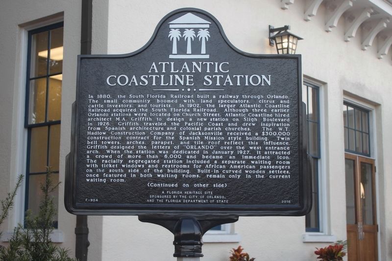
1. Atlantic Coastline Station Marker (side 1)
In 1880, the South Florida Railroad built a railway through Orlando. The small community boomed with land speculators, citrus and cattle investors, and tourists. In 1902, the larger Atlantic Coastline Railroad acquired the South Florida Railroad. Although three earlier Orlando stations were located on Church Street, Atlantic Coastline hired architect M.A. Griffith to design a new station on Sligh Boulevard in 1926. Griffith traveled the Pacific Coast and drew inspiration from Spanish architecture and colonial parish churches. The W.T. Hadlow Construction Company of Jacksonville received a $300,000 construction contract for the Spanish Mission style building. Twin bell towers, arches, parapet, and tile roof reflect this influence. Griffith designed the letters of "ORLANDO" over the west entrance arch. When the station was dedicated in January 1927, it attracted a crowd of more than 6,000 and became an immediate icon. The racially segregated station included a separate waiting room with ticket windows and restrooms for African American passengers on the south side of the building. Built-in curved wooden settees,
this page online
Photographed by Tim Fillmon, December 22, 2016
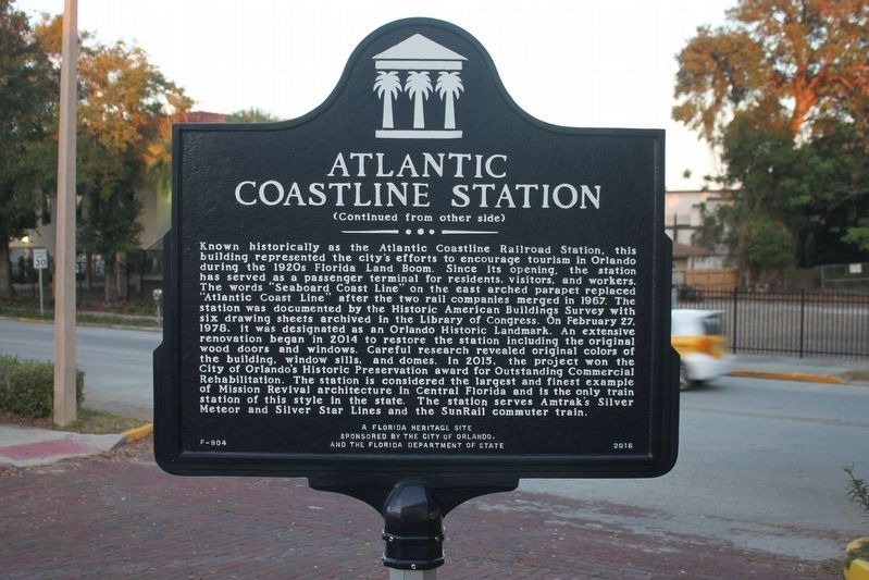
2. Atlantic Coastline Station Marker (side 2)
Erected 2016 by The City of Orlando and the Florida Department of State. (Marker Number F-904.)
Topics and series. This historical marker is listed in these topic lists: Architecture • Railroads & Streetcars. In addition, it is included in the Historic American Buildings Survey series list. A significant historical year for this entry is 1926.
Location. 28° 31.572′ N, 81° 22.895′ W. Marker is in Orlando, Florida, in Orange County. It is in Southeast Orlando. It is at the intersection of Sligh Boulevard and West Copeland Drive, on the right when traveling south on Sligh Boulevard. Touch for map. Marker is at or near this postal address: 1400 Sligh Avenue, Orlando FL 32806, United States of America. Touch for directions.

Regionally, this marker is in Central Florida. It is also in the American South. Globally, it is in the North Atlantic Region, North America, a Gulf of Mexico state, the Western Hemisphere, the Western World, and the
Photographed by Tim Fillmon, December 22, 2016
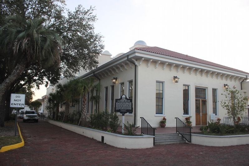
3. Atlantic Coastline Station Marker and station
Other nearby markers. At least 8 other markers are within walking distance of this marker: Pulse Interim Memorial (approx. 0.6 miles away); Dr. Phillips House (approx. ¾ mile away); Carver Court Public Housing Complex (approx. ¾ mile away); a different marker also named Carver Court Public Housing Complex (approx. 0.8 miles away); Wells' Built Hotel (approx. 0.9 miles away); The Lynching of Arthur Henry / Racial Violence in America (approx. 0.9 miles away); Hankins Building (approx. one mile away); Mount Pleasant Baptist Church (approx. one mile away). Touch for a list and map of all markers in Orlando.
Another marker is no longer nearby. Holden-Parramore Historic District (was approx. 0.9 miles away but has been confirmed missing).
Photographed by Tim Fillmon, December 22, 2016
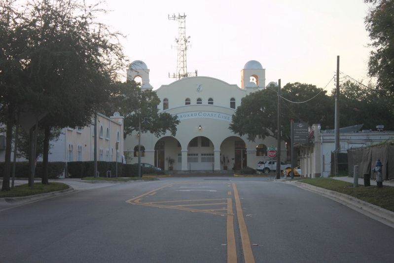
4. Atlantic Coastline Station
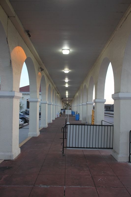
Photographed by Tim Fillmon, December 22, 2016
5. Atlantic Coastline Station platform
Credits. This page was last revised on July 28, 2024. It was originally submitted on January 16, 2017, by Tim Fillmon of Webster, Florida. This page has been viewed 2,252 times since then and 121 times this year. Photos: 1, 2, 3, 4, 5. submitted on January 16, 2017, by Tim Fillmon of Webster, Florida. • Bernard Fisher was the editor who published this page.
