Myrtle Beach in Horry County, South Carolina — The American South (South Atlantic)
Archaeological and Historical Data
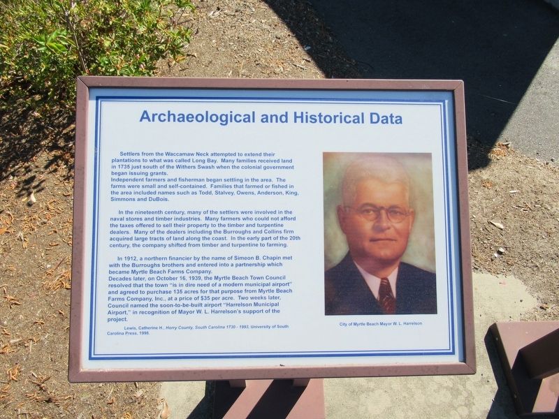
Settlers from the Waccamaw Neck attempted to extend thei plantations to what was called Long Bay. Many families received land in 1735 just south of the Withers Swash when the colonial government began issuing grants. Independent farmers and fisherman began settling in the area. The farms were small and self-contained. Families that farmed or fished in the area included names such as Todd, Stalvey, Owens, Anderson, King, Simmons and DuBois.
In the nineteenth century, many of the settlers were involved in the naval stores and timber industries. Many farmers who could not afford the taxes offered to sell their property to the timber and turpentine dealers. Many of the dealers including the Burroughs and Collins firm acquired large tracts of land along the coast. In the early part of the 20th century, the company shifted from timber and turpentine to farming.
In 1912, a northern financier by the name of Simeon B. Chapin met with the Burroughs brothers and entered into a partnership which became Myrtle Beach Farms Company. Decades later, on October 16, 1939, the Myrtle Beach Town Council resolved that the town “is in dire need of a modern municipal airport” and agreed to purchase 135 acres for that purpose from Myrtle Beach Farms Company, Inc., at a price of $35 per acre. Two weeks later Council named the soon-to-be-built airport "Harrelson Municipal Airport in recognition of Mayor W. L. Harrelson's support of the project.
Lewis, Catherine H., Horry County, South Carolina 1730 – 1993, University of South Carolina Press, 1998
City of Myrtle Beach Mayor W. L. Harrelson
( adjacent marker )
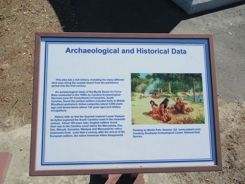
An archaeological study of the Myrtle Beach Air Force Base conducted in the 1980s by Carolina Archaeological Services (now AF Consultants) of Columbia, South Carolina, found the earliest settlers included Early to Middle Woodland prehistoric Indian campsites (about 3,000 years ago) and tenant farms (about 130 years ago) and military occupations.
History tells us that the Spanish explorer Lucas Vasquez de Ayllon explored the South Carolina coast in the sixteenth century. About 150 years later, English settlers found their way to the Carolina coast where the Waccamaw, Pee Dee, Winyah, Socastee, Wampee and Waccawache native Americans lived. Less than a century after the arrival of the European settlers, the native American tribes disappeared.
Painting by Martin Pate, Newnan, GA (www.pateart.com)
Courtesy Southeast Archeological Center, National Park Service
Topics. This historical marker is listed in this topic list: Settlements & Settlers.
Location. 33° 39.663′ N, 78° 55.72′ W. Marker is in Myrtle Beach, South Carolina, in Horry County. Marker is at the intersection of Farrow Parkway and South Kings Highway, on the right when traveling north on Farrow Parkway. Located in the Warbird Park next to Myrtle Beach International Airport. Touch for map. Marker is in this post office area: Myrtle Beach SC 29577, United States of America. Touch for directions.
Other nearby markers. At least 8 other markers are within walking distance of this marker. Wall of Service (here, next to this marker); Combat Wounded Veterans (a few steps from this marker); Grand Strand Chapter and Unit 354 (a few steps from this marker); Colonel Joseph S. Barton (a few steps from this marker); Myrtle Beach Air Force Base Historical Origin (a few steps from this marker); 354th Wing Inactivation (a few steps from this marker); World War II Missions Performed at Myrtle Beach Army Air Field (within shouting distance of this marker); Fairchild A-10 Thunderbolt II (within shouting distance of this marker). Touch for a list and map of all markers in Myrtle Beach.
Credits. This page was last revised on March 21, 2017. It was originally submitted on March 21, 2017, by Michael Herrick of Southbury, Connecticut. This page has been viewed 262 times since then and 12 times this year. Photos: 1, 2, 3. submitted on March 21, 2017, by Michael Herrick of Southbury, Connecticut.


