Oude Stad in Haarlem, North Holland, Netherlands — Northwestern Europe
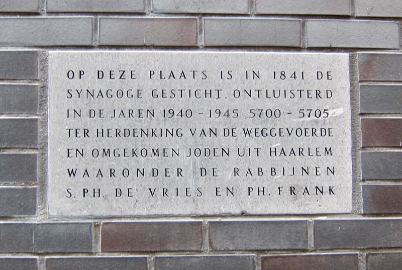
Site of Former Synagogue
Ter herdenking van de weggevoerde en omgekomen joden uit Haarlem waaronder de rabbijnen S.Ph. de Vries en Ph. Frank
At this location in 1841 a synagogue was built. Fell into disrepair in the years 1940-45 (5700-5705 Hebrew Calendar). In commemoration of the Jews from Haarlem that were deported and killed, including the Rabbis Simon Philip de Vries and Philip Frank.
Topics and series. This memorial is listed in these topic lists: Churches & Religion • War, World II. In addition, it is included in the The Holocaust series list. A significant historical year for this entry is 1841.
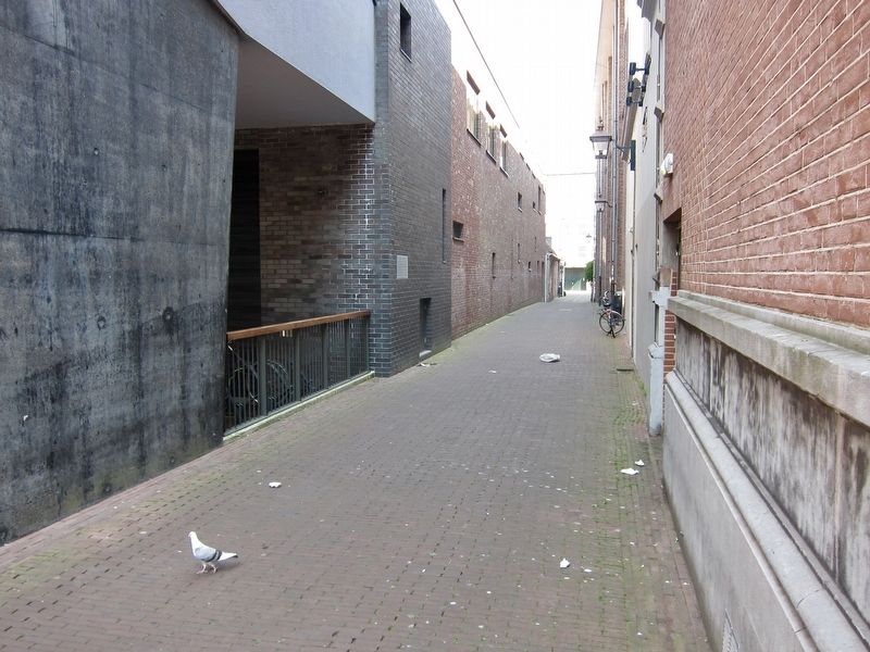
Location. 52° 22.901′ N, 4° 38.343′ E. Marker is in Oude Stad, Noord-Holland (North Holland), in Haarlem. Memorial is at the intersection of Wijde Apelaarsteeg and Klokhuisplein, on the left when traveling east on Wijde Apelaarsteeg. Touch for map. Marker is in this post office area: Oude Stad, Noord-Holland 2011 HB, Netherlands. Touch for directions.
Other nearby markers. At least 8 other markers are within walking distance of this marker. Simon Philip de Vries (about 90 meters away, measured in a direct line); Teylers Fundatiehuis / The Teyler Foundation House (about 150 meters away); Hoofdwacht / Civic Guard Headquarters (about 180 meters away); De Waag / The Weigh House (about 180 meters away); Vishal / "Fish Hall" (about 180 meters away); Hofje 'In den Groenen Tuin' / Hofje "In the Green Garden" (approx. 0.2 kilometers away); May 8 1945 / 8 Mei 1945 (approx. 0.3 kilometers away); Hofje van Oorschot (approx. 0.3 kilometers away). Touch for a list and map of all markers in Oude Stad.
Also see . . . Haarlem (Jewish Cultural Quarter). "At the outset of the German occupation of the Netherlands during the Second World War, Jewish refugees from Germany were expelled from all coastal regions of the of the country, including from Haarlem. A branch of the Jewish Coordination Commission was soon established in Haarlem, followed by a branch of the German-controlled Jewish Council. Both were chaired by Chief Rabbi Philip Frank. Following the participation of Haarlem in the general strike of February 1941, the Germans installed a member of the Dutch collaborationist NSB party as mayor of Haarlem. Thereafter, anti-Jewish measures were implemented at an accelerated tempo. Jewish children were barred from public education and a Jewish kindergarten, elementary,
and high school established. Deportations of Jews from Haarlem commenced in Augustus, 1942. A number of leading members of the community, including Chief Rabbi Frank, were shot. It is estimated that a total of more than 1,000 Jews were deported from Haarlem, of these only a dozen returned alive from the concentration camps. During the German occupation, the Jewish cemetery on the Amsterdamse Vaart was vandalized and the synagogue was plundered, its Torah scrolls, however, were eventually recovered....After the War, the synagogue was sold and later razed." (Submitted on July 11, 2017.)
Additional keywords. Holocaust
Credits. This page was last revised on February 12, 2022. It was originally submitted on July 11, 2017, by Andrew Ruppenstein of Lamorinda, California. This page has been viewed 153 times since then and 12 times this year. Photos: 1, 2. submitted on July 11, 2017, by Andrew Ruppenstein of Lamorinda, California.

