Waterfront in Buffalo in Erie County, New York — The American Northeast (Mid-Atlantic)
The Connecting Terminal and General Mills Elevators
The Industrial Heritage Trail
Inscription.
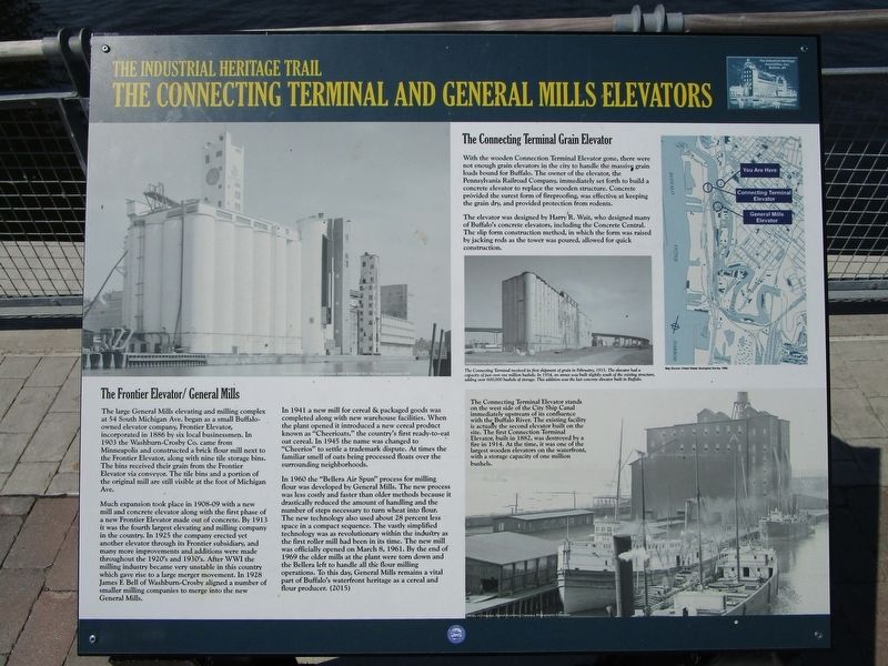
The Frontier Elevator/General Mills. The large General Mills elevating and milling complex at 54 Michigan Ave. began as a small Buffalo-owned elevator company, Frontier Elevator, incorporated in 1886 by six local businessmen. In 1903 the Washburn-Crosby Co. came from Minneapolis and constructed a brick flour mill next to the Frontier Elevator, along with nine tile storage bins. The bins received their grain from the Frontier Elevator via conveyor. The tile bins and a portion of the original mill are still visible at the foot of Michigan Avenue.
Much expansion took place in 1908-09 with a new mill and concrete elevator along with the first phase of a new Frontier Elevator made out of concrete. By 1913 it was the fourth largest elevating and milling company in the country. In 1925 the company erected yet another elevator through its Frontier subsidiary, and many more improvements and additions were made throughout the 1920's and 1930's. After WWI the milling industry became very unstable in ths country which gave rise to a large merger movement. In 1928 James F. Bell of Washburn-Crosby aligned a number of smaller milling companies to merge into the new General Mills.
In 1941 a new mill for cereal and packaged goods was completed along with new warehouse facilities. When the plant opened it introduced a new cereal product known as "Cheerioats," the country's first ready-to-eat oat cereal. In 1945 the name was changed to "Cheerios" in order to settle a trademark dispute. At times the familiar smell of oats being processed floats over the surrounding neighborhoods.
In 1960 the "Bellare Air Spun" process for milling flour was developed by General Mills. The new process was less costly and faster than older methods because it drastically reduced the amount of handling and the number of steps necessary to turn wheat into flour. The new technology also used about 28 percent less space necessary to turn wheat into flour. The vastly simplified technology was as revolutionary within the industry as the first roller mill had been in its time. The new mill was officially opened on March 8, 1961. By the end of 1969 the older mills at the plant were torn down and the Bellera left to handle all the flour milling operations. To this day, General Mills remains a vital part of Buffalo's waterfront heritage as a cereal and flour producer. (2015)
The Connecting Terminal Grain Elevator. With the wooden Connection Terminal Elevator gone, there were not enough grain elevators in the city to handle the massive grain loads bound for Buffalo. The owner of the elevator, the Pennsylvania Railroad Company, immediately set forth to build a concrete elevator to replace the wooden structure. Concrete provided the surest form of fireproofing, was effective at keeping the grain dry, and provided protection from rodents.
The elevator was designed by Harry R. Wait, who designed many of Buffalo's concrete elevators, including the Concrete Central. The slip form construction method, in which the form was raised by jacking rods as the tower was poured, allowed for quick construction.
The connecting Terminal received its first shipment of grain in February, 1915. The elevator had a capacity of just over one million bushels. In 1954, an annex was built slightly south of the existing structure, adding over 600,000 bushels of storage. This addition was the last concrete elevator built in Buffalo.
The Connecting Terminal Elevator stands on the west side of the City Ship Canal immediately upstream of its confluence with the Buffalo River. The existing facility is actually the second elevator built in the site. The first Connection Terminal Elevator, built in 1882, was destroyed by a fire in 1914. At that time, it was one of the largest wooden elevators on the waterfront, with a storage capacity of one million bushels.
Erected 2015.
Topics. This historical marker is listed in this topic list: Industry & Commerce. A significant historical year for this entry is 1886.
Location. 42° 52.484′ N, 78° 52.694′

Photographed By Anton Schwarzmueller, August 2, 2017
3. NFTA Car Barn & Marker
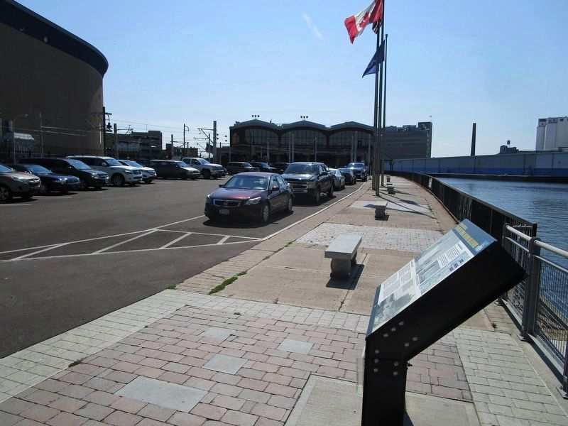
The General Mills elevator is mostly off-picture to the right. The Niagara Frontier Transportation Authority (NFTA) car barns for the light rail system are at center. Key Bank Center arena is at left. The marker area is partly under the Skyway (NY route 5). This is NFTA employee parking only.
Other nearby markers. At least 8 other markers are within walking distance of this marker. The French Connection (about 800 feet away, measured in a direct line); The Erie Canal / Two Waterfronts (approx. 0.2 miles away); Rebirth & Renewal (approx. 0.2 miles away); Harboring Hopes (approx. 0.2 miles away); The Big Picture (approx. 0.2 miles away); Buffalo - An Industrial Powerhouse (approx. 0.2 miles away); The Ruins at Canalside (approx. 0.2 miles away); Miles Gilbert "Tim" Horton (approx. 0.2 miles away). Touch for a list and map of all markers in Buffalo.
Credits. This page was last revised on February 16, 2023. It was originally submitted on August 2, 2017, by Anton Schwarzmueller of Wilson, New York. This page has been viewed 196 times since then and 13 times this year. Photos: 1, 2, 3. submitted on August 2, 2017, by Anton Schwarzmueller of Wilson, New York.

