Downtown Riverfront in Shreveport in Caddo Parish, Louisiana — The American South (West South Central)
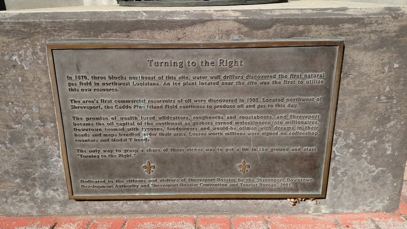
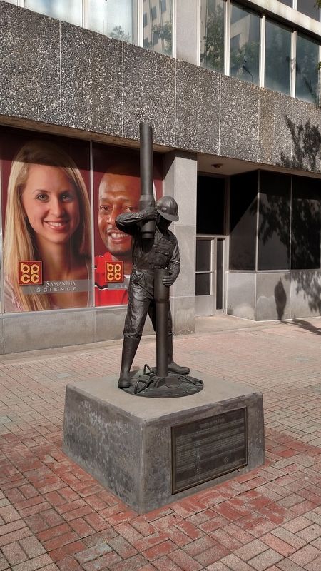
Turning to the Right
The area's first commercial reservoirs of oil were discovered in 1905. Located northwest of Shreveport, the Caddo Pine Island Field continues to produce oil and gas to this day.
The promise of wealth lured wildcatters, roughnecks and roustabouts, and Shreveport became the oil capital of the southwest as gushers turned muleskinners into millionaires. Downtown teemed with tycoons, landowners and would-be oilmen with dreams in their heads and maps bundled under their arms. Leases were signed on coffeshop counters and Model T hoods.
The only way to grasp a share of these riches was to put a bit in the ground and start "Turning to the Right."
Erected 2001 by Shreveport Downtown Development Authority and Shreveport-Bossier Convention and Visitors Bureau.
Topics. This historical marker is listed in this topic list: Industry & Commerce. A significant historical year for this entry is 1870.
Location. 32° 30.824′ N, 93° 44.917′ W. Marker is in Shreveport, Louisiana, in Caddo Parish. It is in Downtown Riverfront. Marker is at the intersection of Texas Street (Highway 79/80) and Edwards Street, on the right when traveling west on Texas Street. Touch for map. Marker is in this post office area: Shreveport LA 71101, United States of America. Touch for directions.
Other nearby markers. At least 8 other markers are within walking distance of this marker. CNB Building (a few steps from this marker); Chamber Plaza (about 300 feet away, measured in a direct line); The Pardon (about 300 feet away); a different marker also named Chamber Plaza (about 300 feet away); First City Market (about 400 feet away); Shreve Memorial Library (about 400 feet away); Old CNB Building (about 400 feet away); Hutchinson Building (about 500 feet away). Touch for a list and map of all markers in Shreveport.
Credits. This page was last revised on February 12, 2023. It was originally submitted on November 8, 2017, by Mike Wintermantel of Pittsburgh, Pennsylvania. This page has been viewed 313 times since then and 25 times this year. Photos: 1, 2. submitted on November 8, 2017, by Mike Wintermantel of Pittsburgh, Pennsylvania.

