Potomac in Montgomery County, Maryland — The American Northeast (Mid-Atlantic)
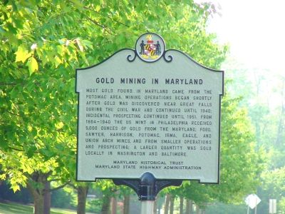
Gold Mining in Maryland
Most gold found in Maryland came from the Potomac area. Mining operations began shortly after gold was discovered near Great Falls during the Civil War and continued until 1940; incidental prospecting continued until 1951. From 1884–1940 the US Mint in Philadelphia received 5,000 ounces of gold from the Maryland, Ford, Sawyer, Harrison, Potomac, Irma, Eagle, and Union Arch mines, and from smaller operations and prospecting; a larger quantity was sold locally in Washington and Baltimore.
Erected by the Maryland Historical Trust and the Maryland State Highway Administration.
Topics. This historical marker is listed in these topic lists: Industry & Commerce • Natural Resources. A significant historical year for this entry is 1940.
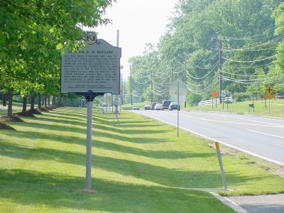
Location. 39° 1.217′ N, 77° 12.75′ W. Marker is in Potomac, Maryland, in Montgomery County. Marker is on River Road (Maryland Route 190) west of Falls Road (Maryland Route 189). Touch for map. Marker is in this post office area: Potomac MD 20854, United States of America. Touch for directions.
Other nearby markers. At least 8 other markers are within 3 miles of this marker, measured as the crow flies. The Edgar Perry House (approx. ¼ mile away); Potomac Cemetery and Church Grounds (approx. half a mile away); American Indians of the Potomac River (approx. 1.8 miles away in Virginia); River Crossing at Conn's Ferry (approx. 1.8 miles away in Virginia); Potomac Connections (approx. 1.8 miles away in Virginia); Great Falls of the Potomac (approx. 2 miles away); The Maryland Mine (approx. 2.1 miles away); Welcome to Great Falls (approx. 2.3 miles away). Touch for a list and map of all markers in Potomac.
Also see . . .
1. A Hike That’s Pure Gold. This 2001 article by Jeff Bagato originally appeared in The Washington Post. (Submitted on June 10, 2007.)
2. Gold Veins Near Great Falls, Maryland. US Government Printing Office PDF, 1969 (Submitted on July 29, 2007, by Craig Swain of Leesburg, Virginia.)
Credits. This page was last revised on April 24, 2022. It was originally submitted on June 10, 2007, by J. J. Prats of Powell, Ohio. This page has been viewed 4,291 times since then and 40 times this year. Photos: 1, 2. submitted on June 10, 2007, by J. J. Prats of Powell, Ohio.
Editor’s want-list for this marker. Photos of the Maryland Mining Co. ruins • Can you help?

