Valle de Bravo, Mexico State, Mexico — The Central Highlands (North America)
The Name of Valle de Bravo
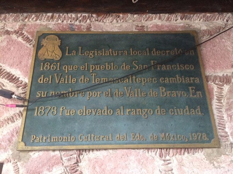
La Legislatura local decretó en 1861 que el pueblo de San Francisco del Valle de Temascaltepec cambiara su nombre por el de Valle de Bravo. En 1878 fue elevado al rango de ciudad.
Patrimonio Cultural del Edo. de México, 1978.
The local legislature decreed in 1861 that the town of San Francisco del Valle de Temascaltepec change its name to Valle de Bravo. In 1878 it was elevated to the status of city.
Cultural Heritage of the State of Mexico, 1978
Erected 1978 by Patrimonio Cultural del Estado de México.
Topics. This historical marker is listed in this topic list: Government & Politics. A significant historical year for this entry is 1861.
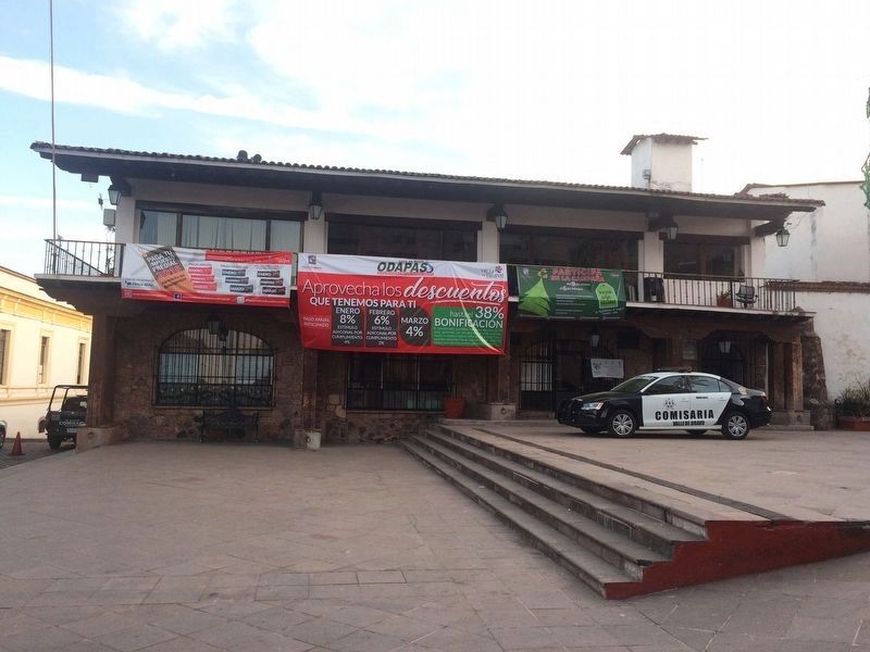
Location. 19° 11.66′ N, 100° 7.894′ W. Marker is in Valle de Bravo, Estado de Mexico (Mexico State). Marker can be reached from Calle 5 de Febrero just north of Calle Independencia, on the right when traveling north. The marker is to the right of the entry to the central police station in Valle de Bravo, on the first floor of the municipal government building. Touch for map. Marker is in this post office area: Valle de Bravo MEX 51200, Mexico. Touch for directions.
Other nearby markers. At least 8 other markers are within walking distance of this marker. The Mexican Constitution of 1857 (here, next to this marker); Valle de Bravo in the Mexican-American War (within shouting distance of this marker); Nicolás Bravo (within shouting distance of this marker); Pedro Velázquez H. (within shouting distance of this marker); Villagrán Street (about 90 meters away, measured in a direct line); José Castillo y Piña (about 90 meters away); Juan de Jesús Herrera y Piña (about 90 meters away); Coliseum Street (about 120 meters away). Touch for a list and map of all markers in Valle de Bravo.

Photographed By J. Makali Bruton, January 14, 2018
2. An additional marker on the meaning of the original name of Valle de Bravo
This marker is to the left of the police station entrance. It reads:
El nombre primitivo de Valle de Bravo fue Temascaltepec. Temazcalli, baño de vapor; tepec, cerro. Cerro de los temazcales.
Patrimonio Cultural del Edo. de México, 1978.
English translation:
The primitive name of Valle de Bravo was Temascaltepec. Temazcalli, meaning a sauna bath; tepec, meaning hill or mountain. Hill of the Sauna Baths.
Cultural Heritage of the State of Mexico, 1978
El nombre primitivo de Valle de Bravo fue Temascaltepec. Temazcalli, baño de vapor; tepec, cerro. Cerro de los temazcales.
Patrimonio Cultural del Edo. de México, 1978.
The primitive name of Valle de Bravo was Temascaltepec. Temazcalli, meaning a sauna bath; tepec, meaning hill or mountain. Hill of the Sauna Baths.
Cultural Heritage of the State of Mexico, 1978
Credits. This page was last revised on February 2, 2018. It was originally submitted on February 2, 2018, by J. Makali Bruton of Accra, Ghana. This page has been viewed 141 times since then and 5 times this year. Photos: 1, 2, 3. submitted on February 2, 2018, by J. Makali Bruton of Accra, Ghana.

