Brady in McCulloch County, Texas — The American South (West South Central)
Curtis Airfield
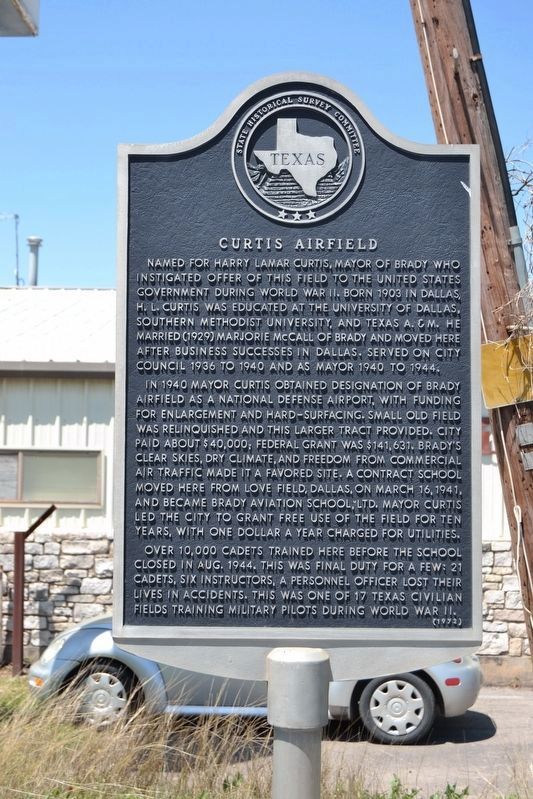
Named for Harry Lamar Curtis, mayor of Brady who instigated offer of this field to the United States government during World War II. Born in 1903 in Dallas, H.L. Curtis was educated at the University of Dallas, Southern Methodist University, and Texas A&M. He married (1929) Marjorie McCall of Brady and moved here after business successes in Dallas. Served on city council 1936 to 1940 and as mayor 1940 to 1944.
In 1940 Mayor Curtis obtained designation of Brady Airfield was a national defense airport, with funding for enlargement and hard-surfacing. Small old field was relinquished and this larger tract provided. City paid about $40,000; Federal grant was $141,631. Brady’s clear skies, dry climate, and freedom from commercial air traffic made it a favored site. A contract school moved here from Love Field, Dallas, on March 16, 1941, and became Brady Aviation School, ltd. Mayor Curtis led the city to grant free use of the field for ten years, with one dollar a year charged for utilities.
Over 10,000 cadets trained here before the school closed in Aug. 1944. This was final duty for a few: 21 cadets, six instructors, a personnel officer lost their lives in accidents. This was one of 17 Texas civilian fields training military pilots during World War II.
Erected 1972 by State Historical Survey Committee. (Marker Number 1136.)
Topics. This historical marker is listed in these topic lists: Air & Space • War, World II. A significant historical year for this entry is 1940.
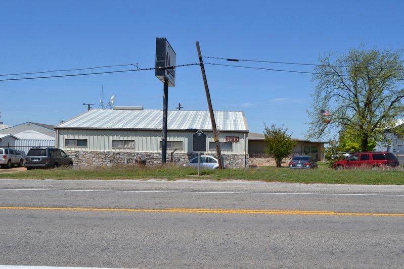
Location. 31° 10.573′ N, 99° 19.17′ W. Marker is in Brady, Texas, in McCulloch County. Marker is on U.S. 377, 0.8 miles north of County Road 405, on the left when traveling north. Touch for map. Marker is at or near this postal address: 3811 US 377, Brady TX 76825, United States of America. Touch for directions.
Other nearby markers. At least 8 other markers are within 4 miles of this marker, measured as the crow flies. Union Passenger Depot (approx. 2.7 miles away); General Ben McCulloch, C.S.A. (approx. 3 miles away); McCulloch County (approx. 3 miles away); McCulloch County Courthouse (approx. 3 miles away); McCulloch County Jail (approx. 3 miles away); East Sweden Presbyterian Church (approx. 3.8 miles away); Swedish Settlers (approx. 3.8 miles away); Onion Creek Indian Fight (approx. 3.9 miles away). Touch for a list and map of all markers in Brady.
Credits. This page was last revised on April 18, 2023. It was originally submitted on April 14, 2018, by Duane Hall of Abilene, Texas. This page has been viewed 587 times since then and 75 times this year. Photos: 1, 2. submitted on April 14, 2018, by Duane Hall of Abilene, Texas. 3. submitted on April 18, 2023, by Jeff Leichsenring of Garland, Texas.


