Corvallis in Benton County, Oregon — The American West (Northwest)
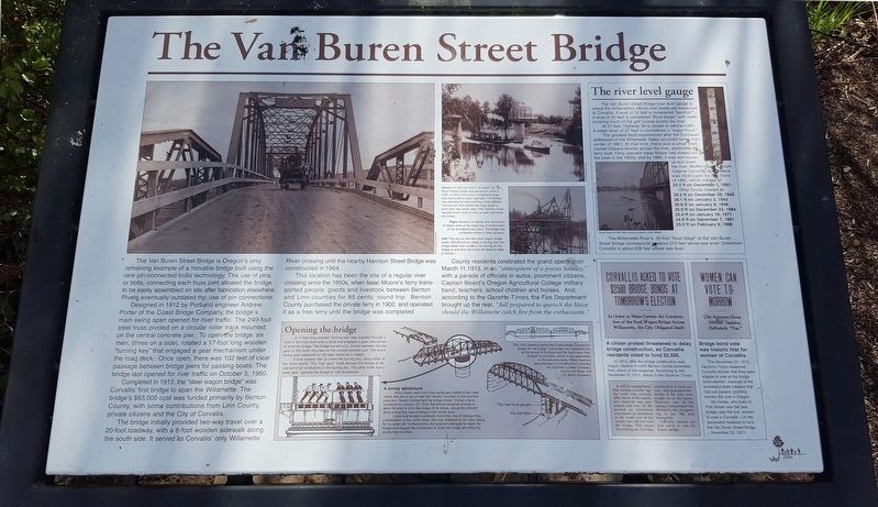
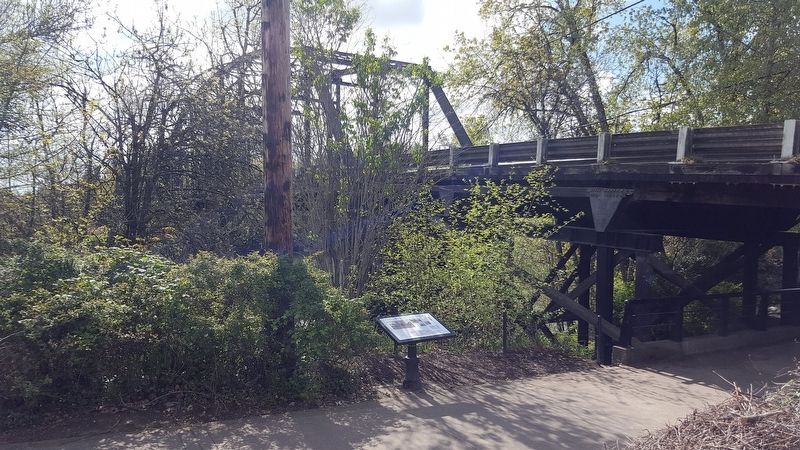
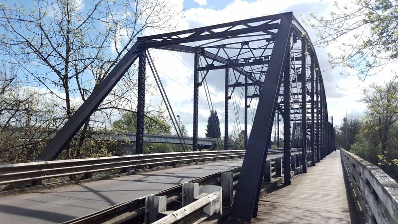
The Van Buren Street Bridge
Designed in 1912 by Portland engineer Andrew Porter of Coast Bridge Company, the bridge's main swing span opened for river traffic. The 249-foot steel truss pivoted on a circular roller track mounted on the central concrete pier. To open the bridge, six men, (three on a side), rotated a 17-foot long wooden “turning key” that engaged a gear mechanism under the road deck. Once open, there was 102 feet of clear passage between bridge piers for passing boats. The bridge last opened for river traffic on October 5, 1960.
Completed in 1913, the “steel wagon bridge” was Corvallis’ first bridge to span the Willamette. The bridge’s $63,000 cost was funded primarily by Benton County, with some contributions from Linn County, private citizens and the City of Corvallis.
The bridge initially provided two-way travel over a 20-foot roadway, with a 6-foot wooden sidewalk along the south side. It served as Corvallis’ only Willamette River crossing until the nearby Harrison Street Bridge was constructed in 1964.
This location as been the site of a regular river crossing since the 1850s, when Isaac Moore's ferry transported people, goods and livestock between Benton and Linn counties for 85 cents, round trip. Benton County purchased the private ferry in 1902, and operated it as a free ferry until the bridge was completed.
County residents celebrated the grand opening on March 11, 1913, in an “atmosphere of a joyous holiday,” with a parade of officials in autos, prominent citizens, Captain Beard’s Oregon Agricultural College military band, teachers, school children and horses. And, according to the Gazette-Times, the Fire Department brought up the rear, “full prepared to quench the blaze should the Willamette catch fire from the enthusiasm.”
(Inset):
Opening the bridge
A 17-foot long wooden “turning key” was inserted through a hole in the road deck onto a shaft that engaged a gear mechanism to pivot the bridge. The bridge turned on a 24-foot diameter circular gear of 300 teeth mounted on the central concrete pier. The entire swing span balanced on 42 steel rollers as it rotated.
key. The other shaft was a lower gear, opening the bridge in 150 revolutions.
A windy adventure
When closed, each end of the swing span rested on two steel rollers that sat on top of cast iron “shoes” mounted on the concrete end-piers. Gravity latches held the bridge closed. During a fierce windstorm on January 25, 1914, the latches loosened enough to allow the wind to blow the bridge off its shoes...at just the moment when a local boy was crossing on the center span.
Local boat tenders eventually heard the cries of George Way, a dishwasher at the Julian Hotel, who was stranded on the open span. At “no small risk” to themselves, the boatmen managed to reach the bridge and engage the mechanism to close the bridge and bring the young man to safety.
The river level gauge
The Van Buren Street Bridge river level gauge is where the Willamette’s official river levels are measured at Corvallis. A level of 16 feet is considered “bankfull.” A level of 20 feet is considered “flood stage,” with water covering much of the golf course across the river.
At 21 feet, Highway 34 is closed to vehicle traffic. A water level of 27 feet is considered a “major flood.”
The greatest flood experienced after the European settlement of the Willamette Valley occurred during the winter of 1861. At that time, there was a small town named Orleans directly across the river, accessible by the ferry boat. Ferry operator Isaac Moore had staked out the town in the 1850s, and by 1860, it was well-known up and down the river. Moore hoped it would outgrow Corvallis, but Orleans was destroyed by the flood of 1861, which crested at 34.4 ft on December 1, 1861.
Other floods crested at:
28.2 ft on December 29, 1945
28.1 ft on January 2, 1943
26,8 ft on January 8, 1948
26.0 ft on December 24, 1964
25.4 ft on January 18, 1971
24.9 ft on December 7, 1981
23.5 ft on February 9, 1996
The Willamette River’s 20-foot “flood stage” at the Van Buren Street Bridge corresponds to about 212 feet above sea level. Downtown Corvallis is about 228 above sea level.
A citizen protest threatened to delay bridge construction, so Corvallis residents voted to fund $2,500.
In 1912, after the bridge construction was begun, citizens in the north Benton County protested their share of the expense. According to the November 21, 1912, article in the Gazette-Times:
It will be remembered that several months ago the work was started. After much of the expensive material was purchased and was on the ground an injunction was issued by protesters in the north end of the county
who did not want the bridge. This meant the holding up of the bridge construction at least year, and perhaps indefinitely, if the case were fought out in the courts. However, late in the spring a compromise was effected by the city agreeing to pay the sum demanded. Corvallis citizens are now asked to vote the $2,500 pledge.
Bridge bond vote was historic first for women of Corvallis.
The November 21, 1912, Gazette-Times reassured Corvallis women that they were eligible to vote at the bridge bond election, because of the successful state initiative that had just passed, granting women the vote in Oregon.
Ida Hodes, who lived on First Street near the new bridge, was the first woman to vote in Corvallis — on the successful measure to fund the Van Buren Street Bridge — November 22, 1912.
Erected 2004 by Madison Avenue Task Force.
Topics. This historical marker is listed in this topic list: Bridges & Viaducts. A significant historical date for this entry is January 25, 1914.
Location. 44° 33.946′ N, 123° 15.44′ W. Marker is in Corvallis, Oregon, in Benton County. Marker can be reached from NE 1st Street south of NW Harrison Boulevard. Marker is located on a trail. Touch for map. Marker is in this post office area: Corvallis OR 97333, United States of America. Touch for directions.
Other nearby markers. At least 8 other markers are within walking distance of this marker. The Corvallis Ferry (a few steps from this marker); Site of the Earliest Boat Landing (within shouting distance of this marker); Early Town Development (approx. 0.2 miles away); River Transport (approx. 0.2 miles away); Benton County State Bank (approx. ¼ mile away); Benton County Courthouse (approx. ¼ mile away); L.G. Kline Building (approx. ¼ mile away); The Whiteside Theatre (approx. 0.3 miles away). Touch for a list and map of all markers in Corvallis.
Regarding The Van Buren Street Bridge. The Van Buren Street Bridge is no longer functional as a swing-span bridge.
The Oregon Department of Transportation has set aside funding for a new bridge to replace the Van Buren Street Bridge with construction beginning around 2021. The current bridge will moved to another location along the Willamette River and used for pedestrian traffic only.
Credits. This page was last revised on May 28, 2018. It was originally submitted on May 18, 2018, by Douglass Halvorsen of Klamath Falls, Oregon. This page has been viewed 333 times since then and 51 times this year. Photos: 1, 2, 3, 4. submitted on May 18, 2018, by Douglass Halvorsen of Klamath Falls, Oregon. • Syd Whittle was the editor who published this page.


