Downtown in San Antonio in Bexar County, Texas — The American South (West South Central)
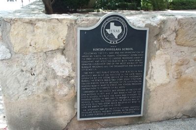
Site of Rincon/Douglass School
The first free public school for blacks in San Antonio was built on this site in the late 1860s. Operated by the local office of the Freedman's Bureau, the school was a two-story stone structure. Called Rincon School because of its location on Rincon (now St. Mary's) Street. The school provided instruction to students of all ages.
Operation of the school was assumed by the city of San Antonio in 1871, and it was made part of the city's school district. The name was changed to Riverside School in 1890, and to Frederick Douglass School in 1904. Ten years later the school was relocated to a two-story brick building at what is now 318 Martin Luther King Drive.
An important part of the city's history, Rincon/Douglass School has been integral to the education of a large portion of San Antonio's population.
Erected 1989 by Texas Historical Commission. (Marker Number 4269.)
Topics. This historical marker is listed in these topic lists: African Americans • Education • Notable Buildings. A significant historical year for this entry is 1871.
Location. This marker has been replaced by another marker nearby. It was located near 29° 25.796′ N, 98° 29.486′ W. Marker was in San Antonio, Texas, in Bexar County. It was in Downtown. Marker was at the intersection of North St Mary's Street and Convent Street, on the right when traveling south on North St Mary's Street. Northwest corner. Touch for map. Marker was in this post office area: San Antonio TX 78205, United States of America. Touch for directions.
Other nearby markers. At least 8 other markers are within walking distance of this location. Ursuline Academy/Augusta Street Bridge (about 300 feet away, measured in a direct line); a different marker also named Site of Rincon/Douglass School (about 300 feet away); Old Ursuline Academy (about 600 feet away); Navarro Street Bridge (about 600 feet away); The San Antonio River (about 600 feet away); Saint Mark's Episcopal Church (approx. 0.2 miles away); Travis Park United Methodist Church (approx. 0.2 miles away); Travis Street Crossing (approx. 0.2 miles away). Touch for a list and map of all markers in San Antonio.
More about this marker. This marker was replaced by a new one also named Site of Rincon/Douglass School (see nearby markers).
Credits. This page was last revised on February 2, 2023. It was originally submitted on September 11, 2008, by Kathy Walker of Stafford, Virginia. This page has been viewed 1,769 times since then and 45 times this year. Last updated on June 3, 2018, by Cosmos Mariner of Cape Canaveral, Florida. Photo 1. submitted on September 11, 2008, by Kathy Walker of Stafford, Virginia. • Bernard Fisher was the editor who published this page.
