Getting Water
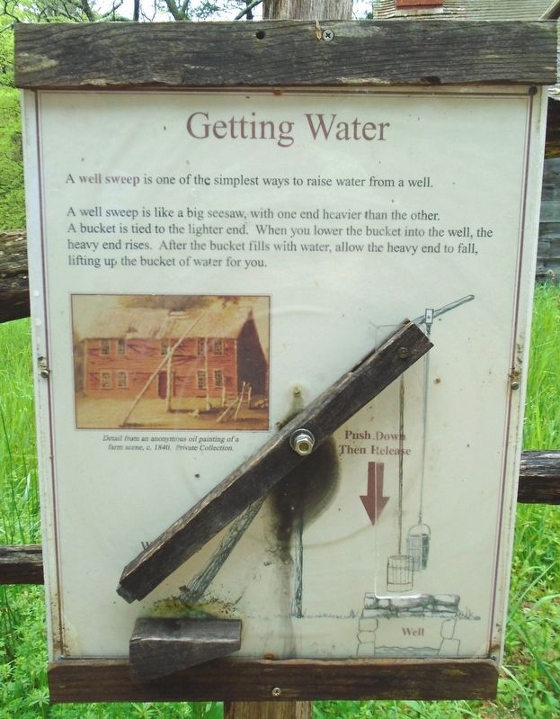
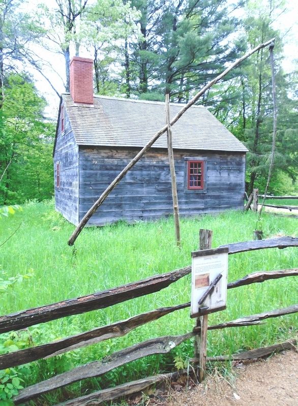
A well sweep is one of the simplest ways to raise water from a well.
A well sweep is like a big seesaw, with one end heavier than the other. A bucket is tied to the lighter end. When you lower the bucket into the well, the heavy end rises. After the bucket fills with water, allow the heavy end to fall, lifting up the bucket of water for you.
[Image caption reads]
Detail from an anonymous oil painting of a farm scene, c. 1840. Private Collection.
Erected by Old Sturbridge Village.
Topics. This historical marker is listed in these topic lists: Natural Resources • Settlements & Settlers. A significant historical year for this entry is 1840.
Location. 42° 6.455′ N, 72° 5.941′ W. Marker is in Sturbridge, Massachusetts, in Worcester County. Marker is on the Old Sturbridge Village grounds, about 150 feet SW of the Visitor Center. Touch for map. Marker is at or near this postal address: 1 Old Sturbridge Village Road, Sturbridge MA 01566, United States of America. Touch for directions.
Other nearby markers. At least 8 other markers are within walking distance of this marker. The Fire Pit (about 300 feet away, measured in a direct line); Farming as a Way of Life (about 300 feet away); Millstones (about 300 feet away); Fitch House Yard (about 400 feet away); Where is the Farm?
Also see . . .
1. Shadoof at Wikipedia. (Submitted on July 4, 2018, by William Fischer, Jr. of Scranton, Pennsylvania.)
2. Old Sturbridge Village. (Submitted on July 4, 2018, by William Fischer, Jr. of Scranton, Pennsylvania.)
Credits. This page was last revised on October 16, 2020. It was originally submitted on July 4, 2018, by William Fischer, Jr. of Scranton, Pennsylvania. This page has been viewed 131 times since then and 10 times this year. Photos: 1, 2. submitted on July 4, 2018, by William Fischer, Jr. of Scranton, Pennsylvania.

