City of Westminster in Greater London, England, United Kingdom — Northwestern Europe (the British Isles)
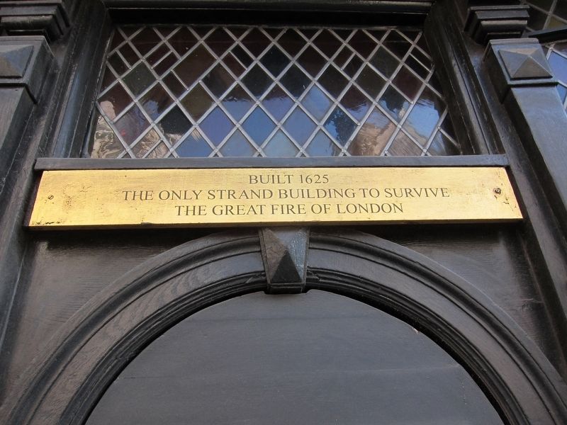
Sole Survivor
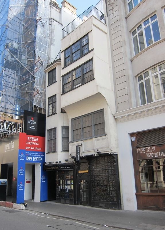
The only Strand building to survive
the Great Fire of London
Topics. This historical marker is listed in this topic list: Disasters. A significant historical date for this entry is September 2, 1666.
Location. 51° 30.809′ N, 0° 6.736′ W. Marker is in City of Westminster, England, in Greater London. Marker is on Strand just east of Essex Street, on the right when traveling east. Touch for map. Marker is at or near this postal address: 229-230 Strand, City of Westminster, England WC2R 1BF, United Kingdom. Touch for directions.
Other nearby markers. At least 8 other markers are within walking distance of this marker. Twinings (within shouting distance of this marker); The George (within shouting distance of this marker); Essex Street (about 90 meters away, measured in a direct line); The Edgar Wallace (about 90 meters away); The Automobile Association (about 90 meters away); The Imperial Society of Knights Bachelor (about 150 meters away); Air Chief Marshal Lord Dowding (about 150 meters away); The Niblett Pegasus (about 150 meters away). Touch for a list and map of all markers in City of Westminster.
Also see . . . Great Fire of London (Wikipedia). "The Great Fire of London was a major conflagration that swept through the central parts of the English city of London from Sunday, 2 September to Thursday, 6 September 1666. The fire gutted the medieval City of London inside the old Roman city wall. It threatened but did not reach the aristocratic district of Westminster, Charles II's Palace of Whitehall, and most of the suburban slums. It consumed 13,200 houses, 87 parish churches, St Paul's Cathedral, and most of the buildings of the City authorities. It is estimated to have destroyed the homes of 70,000 of the City's 80,000 inhabitants." (Submitted on September 11, 2018, by Andrew Ruppenstein of Lamorinda, California.)
Credits. This page was last revised on January 27, 2022. It was originally submitted on September 11, 2018, by Andrew Ruppenstein of Lamorinda, California. This page has been viewed 108 times since then and 8 times this year. Photos: 1, 2. submitted on September 11, 2018, by Andrew Ruppenstein of Lamorinda, California.

