Marker Logo HMdb.org THE HISTORICAL
MARKER DATABASE
“Bite-Size Bits of Local, National, and Global History”
Middelalderbyen in Copenhagen in Københavns Kommune, Capital Region, Copenhagen, Denmark — Northen Europe (a Nordic Country in Scandinavia)
 

En historie for en omvej / A Story of a Detour

Carlsberg Breweries


En historie for en omvej / A Story of a Detour Marker image. Click for full size.
Photographed By Andrew Ruppenstein, September 20, 2018
1. En historie for en omvej / A Story of a Detour Marker
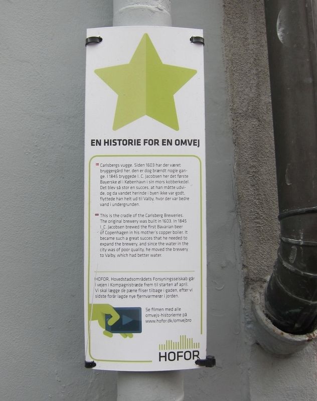
Inscription.  Carlsbergs vugge. Siden 1603 har der været bryggergård her, den er dog brændt nogle gange. I 1845 bryggede I. C. Jacobsen her det første Bayerske øl i København i sin mors kobberkedel. Det blev så stor en succes, at han måtte udvide, og da vandet herinde i byen ikke var godt, flyttede han helt ud til Valby, hvor der var bedre vand i undergrunden.

-

This is the cradle of the Carlsberg Breweries. The original brewery was built in 1603. In 1845 I. C. Jacobsen brewed the first Bavarian beer of Copenhagen in his mother's copper boiler. It became such a great success that he needed to expand the brewery, and since the water in the city was of poor quality, he moved the brewery to Valby, which had better water.
 
Erected by HOFOR, Hovedstadsområdets Forsyningsselskab.
 
Topics. This historical marker is listed in this topic list: Industry & Commerce. A significant historical year for this entry is 1603.
 
Location. 55° 40.663′ N, 12° 34.497′ E. Marker is in Copenhagen, Hovedstaden (Capital Region, Copenhagen), in Københavns Kommune.

Paid Advertisement
Click on the ad for more information.
Please report objectionable advertising to the Editor.
Click or scan to see
this page online
It is in Middelalderbyen. Marker is at the intersection of Brolæggerstræde and Knabrostræde, on the right when traveling east on Brolæggerstræde. Touch for map. Marker is at or near this postal address: Brolæggerstræde 5, Copenhagen, Hovedstaden 1211, Denmark. Touch for directions.
 
Other nearby markers. At least 8 other markers are within walking distance of this marker. Carl and J.C. Jacobsen (here, next to this marker); J.C. Jacobsen (a few steps from this marker); Samvirkende Fagforbund / Cooperative Trade Union (within shouting distance of this marker); Han Christian Lumbye (about 120 meters away, measured in a direct line); Holger Danske Gruppe War Memorial (about 180 meters away); Tomb of the Unknown Concentration Camp Prisoner (about 180 meters away); Harald Høffding (about 180 meters away); Holger Drachmann (approx. 0.2 kilometers away). Touch for a list and map of all markers in Copenhagen.
 
Also see . . .  History of Carlsberg (YouTube, 4.5 mins.). (Submitted on January 25, 2019.)
 
Additional keywords. mindeplade
 
En historie for en omvej / A Story of a Detour Marker - wide view image. Click for full size.
Photographed By Andrew Ruppenstein, September 20, 2018
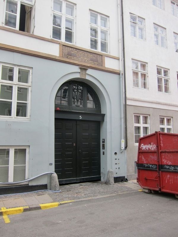
2. En historie for en omvej / A Story of a Detour Marker - wide view
The marker is visible to the right of the doorway.
 
 
Credits. This page was last revised on January 10, 2021. It was originally submitted on January 24, 2019, by Andrew Ruppenstein of Lamorinda, California. This page has been viewed 217 times since then and 12 times this year. Photos:   1. submitted on January 24, 2019, by Andrew Ruppenstein of Lamorinda, California.   2. submitted on January 25, 2019, by Andrew Ruppenstein of Lamorinda, California.
Share this page.  
Share on Tumblr
m=129101

CeraNet Cloud Computing sponsors the Historical Marker Database.
This website earns income from purchases you make after using our links to Amazon.com. We appreciate your support.
Paid Advertisement
May. 9, 2024