Near Greenough in Missoula County, Montana — The American West (Mountains)
Ghost Town Byway
Discover Stories Worth Their Weight in Gold
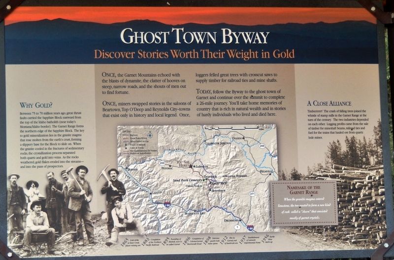
Once, miners swapped stories in the saloons of Beartown, Top O'Deep and Reynolds City — towns that exist only in history and local legend. Once, loggers felled great trees with crosscut saws to supply timber for railroad ties and mine shafts.
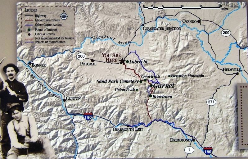
Today, follow the Byway to the ghost town of Garnet and continue over the summit to complete a 26-mile journey. You'll take home memories of country that is rich in natural wealth and in stories of hardy individuals who lived and died here.
Why Gold?
Between 75 to 70 million years ago, great thrust faults carried the Sapphire Block eastward from the top of the Idaho batholith (near today's Montana/Idaho border). The Garnet Range forms the northern edge of the Sapphire Block. The key to gold mineralization lies in the granite magma that rose molten from the earth's crust, forming a slippery base for the Block to slide on. When the granite cooled in the fractures of sedimentary rocks, the crystallization process separated both quartz and gold into veins. As the rocks weathered, gold flakes eroded into the streams — and into the pans of prospectors.
A Close Alliance
Timberrrmr! The crash of falling trees joined the whistle of stamp mills in the Garnet Range at the turn of the century. The two industries depended on each other. Logging profits came from the sale of timber for mineshaft beams, railroad ties and fuel for the trains that hauled ore from quartz lode mines.
Namesake of the Garnet Range
When the granitic magma entered limestone, the two reacted to form a new kind of rock called a “skarn” that consisted mostly of garnet crystals.
1865 • Gold strike at Bear Creek; placer mining era
1883 • Completion of the Northern Pacific Railroad
1895 • Founding of Mitchell, soon to be called Garnet
1896 • Completion of Coloma-Garnet Bearmouth Road
1898 • Fairview quartz lode mine opens
1912 • Fire in Garnet; end of hard-rock era
1937 • Establishment of Lubrecht Experimental Forest
1956 • Barite Mine starts up
Topics. This historical marker is listed in these topic lists: Industry & Commerce • Settlements & Settlers.
Location. 46° 53.208′ N, 113° 27.679′ W. Marker is near Greenough, Montana, in Missoula County. Marker is on Garnet Range Road, 0.1 miles south of State Highway 200, on the left when traveling south. Marker is located in a large pull-out and parking area on the south side of the road. Touch for map. Marker is in this post office area: Bonner MT 59823, United States of America. Touch for directions.
Other nearby markers. At least 8 other markers are within 14 miles of this marker, measured as the crow flies. Historic Logging Shaped These Woods (approx. 1.7 miles away); Sand Park Cemetery (approx. 5.2 miles away); A Vast Network of Indigenous Trails. (approx. 9.1 miles away); Big Blackfoot Milling Company (approx. 9.1 miles away); Souvenirs of the Ice Age (approx. 9.1 miles away); Big Blackfoot Railroad (approx. 9½ miles away); The Blackfoot River Corridor (approx. 11.9 miles away); Madison Limestone and the Garnet Mountains (approx. 13.6 miles away). Touch for a list and map of all markers in Greenough.
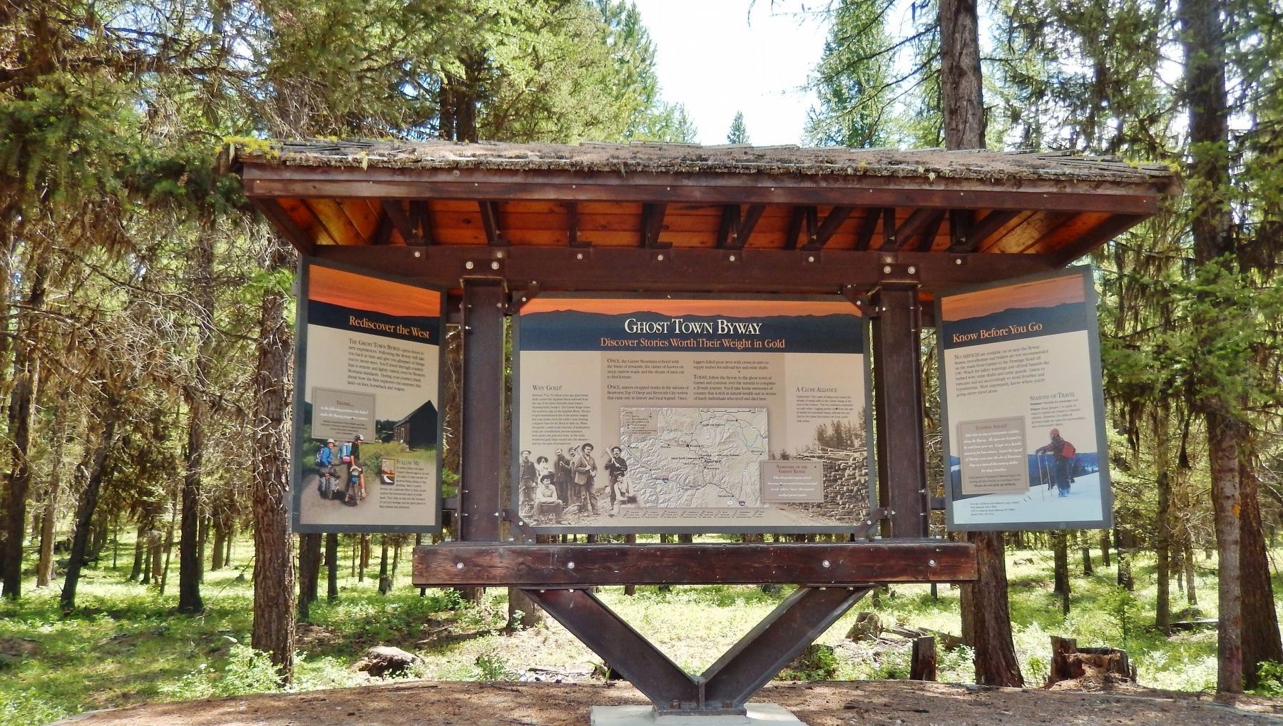
More about this marker. Marker is a large, framed, rectangular composite plaque, mounted at eye-level in a heavy-duty steel and timber kiosk frame.
Photographed By Cosmos Mariner, July 15, 2016
4. Ghost Town Byway:
Rediscover the West panel
Rediscover the West panel
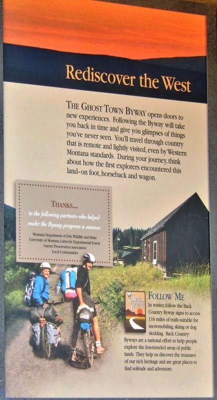
The Ghost Town Byway opens doors to new experiences. Following the Byway will take you back in time and give you glimpses of things you've never seen. You'll travel through country that is remote and lightly visited, even by Western Montana standards. During your journey think about how the first explorers encountered this land - on foot, horseback and wagon.
Thanks to the following partners who helped make the Byway program a success: Montana Department of Fish, Wildlife and Parks, University of Montana Lubrecht Experimental Forest, Garnet Preservation Association, and local communities.
In winter, follow the Back Country Byway signs to access 116 miles of trails suitable for snowmobiling, skiing or dog sledding. Back Country Byways are a national effort to help people explore the less-traveled areas of public lands. They help us discover the treasures of our rich heritage and are great places to find solitude and adventure.
Photographed By Cosmos Mariner, July 15, 2016
5. Ghost Town Byway:
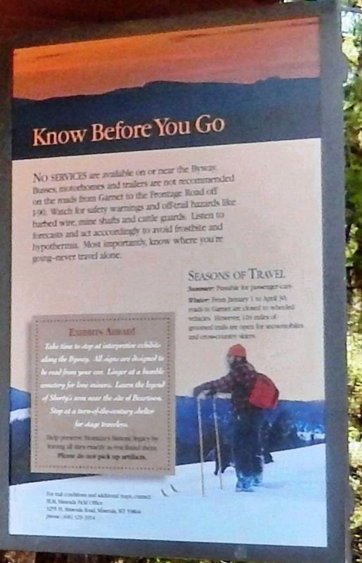
Know before You Go panel
Know before You Go panel
No services are available on or near the Byway. Buses, motorhomes and trailers are not recommended on the roads from Garnet to the Frontage Road off I-90. Watch for safety warnings and off-trail hazards like barbed wire, mine shafts and cattle guards. Listen to forecasts and act accordingly to avoid frostbite and hypothermia. Most importantly, know where you’re going – never travel alone.
Credits. This page was last revised on February 26, 2019. It was originally submitted on February 25, 2019, by Cosmos Mariner of Cape Canaveral, Florida. This page has been viewed 199 times since then and 11 times this year. Photos: 1, 2, 3, 4, 5. submitted on February 25, 2019, by Cosmos Mariner of Cape Canaveral, Florida. • Bill Pfingsten was the editor who published this page.
