Union in Union County, South Carolina — The American South (South Atlantic)
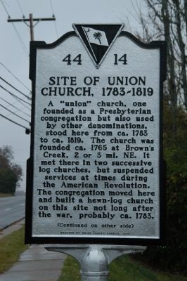
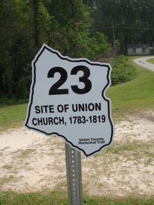
Site of Union Church, 1783-1819
A "union" church, one founded as a Presbyterian congregation but also used by other denominations, stood here from ca. 1783 to ca. 1819. The church was founded ca. 1765 at Brown's Creek, 2 or 3 mi. NE. It met there in two successive log churches, but suspended services at times during the American Revolution. The congregation moved here and built a hewn-log church on this site not long after the war, probably ca. 1783.
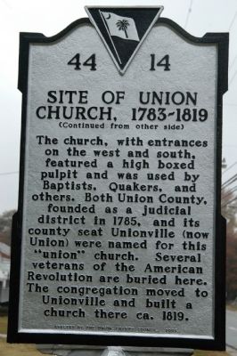
The church, with entrances on the west and south, featured a high boxed pulpit and was used by Baptists, Quakers, and others. Both Union County, founded as a judicial district in 1785, and its county seat Unionville (now Union) were named for this "union" church. Several veterans of the American Revolution are buried here. The congregation moved to Unionville and built a church there ca. 1819.
Erected 2006 by Union County Council. (Marker Number 44-14.)
Topics and series. This historical marker is listed in this topic list: Churches & Religion. In addition, it is included in the Quakerism series list. A significant historical year for this entry is 1783.
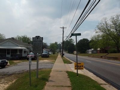
Location. 34° 43.254′ N, 81° 35.346′ W. Marker is in Union, South Carolina, in Union County. Marker is at the intersection of State Highway 49 and Paula Circle, on the left when traveling west on State Highway 49. Touch for map. Marker is in this post office area: Union SC 29379, United States of America. Touch for directions.
Other nearby markers. At least 8 other markers are within 2 miles of this marker, measured as the crow flies. Cemetery of Union Church (within shouting distance of this marker); Jefferson Davis Dined in This House (approx. 1.7 miles away); Thomas N. Dawkins House (approx. 1.8 miles away); Sims High School (approx. 1.8 miles away); Union County Veterans Memorial (approx. 1.9 miles away); Culp-Beaty Hall (approx. 1.9 miles away); Episcopal Church Of The Nativity (approx. 1.9 miles away); a different marker also named Sims High School (approx. 1.9 miles away). Touch for a list and map of all markers in Union.
Credits. This page was last revised on June 16, 2016. It was originally submitted on November 13, 2008, by Michael Sean Nix of Spartanburg, South Carolina. This page has been viewed 1,267 times since then and 44 times this year. Photos: 1, 2. submitted on November 13, 2008, by Michael Sean Nix of Spartanburg, South Carolina. 3, 4. submitted on April 16, 2012, by Anna Inbody of Columbia, South Carolina. • Bill Pfingsten was the editor who published this page.


