Bingham Canyon in Salt Lake County, Utah — The American Mountains (Southwest)
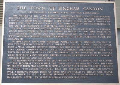
The Town of Bingham Canyon
In 1850 the Bingham brothers took samples of assayed ore to Brigham Young who advised them not to engage in mining at that time. Following the discovery of silver and gold containing ore in the fall of 1863, the west mountain mining district, embracing the entire Oquirrh range, was organized.
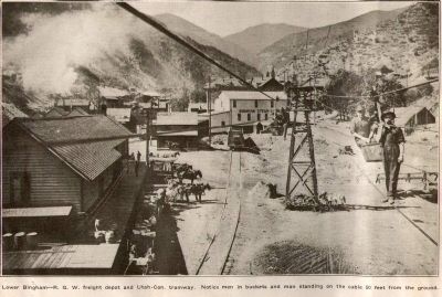
In 1868 fewer than one hundred people lived in Bingham Canyon; by 1880 the town had grown to a population of 1,022. About 1893 Col. Enos A. Wall located ground containing millions of pounds of copper. The Utah Copper Company began large scale mining operations in 1904. The town was incorporated as a city on February 29, 1904. Involved in its history were people of many nations, Greeks, Italians, Mexicans, Japanese, Chinese, British and Australians.
The prosperous Bingham Mine led the nation in the production of copper but the prosperity which built the town also hastened its death. The land where the town was located is now a part of the Kennecott Copper Open Pit Mine. The 1970 census indicated that the population of Bingham Canyon, once a roaring mining town of 15,000, had dwindled to thirty-one people on November 22, 1971, a special proposition to disincorporate the town was passed. After 123 years, Bingham Canyon was dead.
Erected by , and this site donated by Jack Tallis, Bingham businessman.
Topics. This historical marker is listed in this topic list: Settlements & Settlers. A significant historical month for this entry is February 1847.
Location. 40° 32.132′ N, 112° 8.874′ W. Marker is in Bingham Canyon, Utah, in Salt Lake County. Marker can be reached from the intersection of Kennecott Access Road and Utah Route 111. At the Bingham Canyon Visitor's Center. Touch for map. Marker is in this post office area: Bingham Canyon UT 84006, United States of America. Touch for directions.
Other nearby markers. At least 8 other markers are within 7 miles of this marker, measured as the crow flies. Stamp Mill Foundation (within shouting distance of this marker); Bingham Canyon (approx. ¼ mile away); Bingham Tunnel (approx. 2.9 miles away); Honoring with Glory (approx. 3.2 miles away); Copperton Community Methodist Church (approx. 3.3 miles away); Bingham City Cemetery Veterans Memorial (approx. 4.1 miles away); Fort Herriman (approx. 6.1 miles away); Pioneer Rock Church (approx. 6.2 miles away).
Additional commentary.
1. Movement of Marker
It is believed that this marker was originally located just to the west of a souvenir shop called the House of Copper, at the end of Utah Highway 48 on the west side of Copperton (a brown state Historical Marker sign still exists just east of that location). The House of Copper is now the Ore House, a bar at the very end of the highway and just below a huge mound of waste rock that towers above it.
Until 1992 Utah Highway 48 was the access to Bingham Canyon and the Visitor Center at the top of the canyon on the west side of the mine pit. When that access was closed in 1992, this marker was probably moved to a Visitor Center at the upper northeast corner of the pit. It then moved again in 2005 to its current location when the Visitors Center was relocated moved to its current location near the northwest corner of the pit at about the halfway vertical level of the pit. Note To Editor only visible by Contributor and editor
— Submitted August 27, 2010, by Bryan R. Bauer of Kearns, Ut 84118.
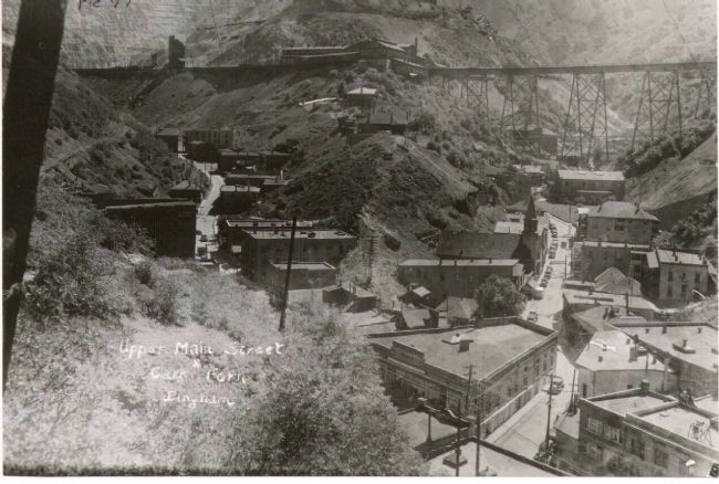
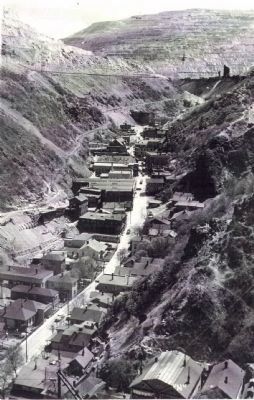
circa 1946
5. Upper Bingham Canyon & Carr Fork
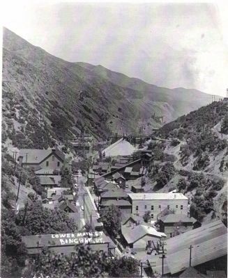
Downtown Bingham Canyon is shown with the large triangular Bingham Mercantile at the junction of the canyons. Up the canyon to the right were the towns of Carr Fork, Phoenix, and Highland Boy. Up the left branch were Upper Bingham, Copperfield, Jap Camp, Greek Camp, Upper Terraces, and Dinkyville. Due to the narrow nature of the canyons there was seldom more than a single row of buildings on either side of a single street. Some parts of Bingham Canyon and Copperfield were exceptions.
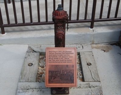
Photographed By Dawn Bowen, June 20, 2007
7. Bingham Canyon Fire Hydrant
Beginning in 1905, the Bingham Canyon Volunteer Fire Department used newly installed cast iron fire hydrants, with leaded-in brass fittings similar to this. Before that, fires were fought by bucket brigades formed by local citizens.
Credits. This page was last revised on February 16, 2023. It was originally submitted on June 27, 2007, by Dawn Bowen of Fredericksburg, Virginia. This page has been viewed 3,523 times since then and 157 times this year. Photos: 1. submitted on June 27, 2007, by Dawn Bowen of Fredericksburg, Virginia. 2, 3, 4, 5. submitted on August 25, 2010, by Bryan R. Bauer of Kearns, Ut 84118. 6, 7. submitted on June 27, 2007, by Dawn Bowen of Fredericksburg, Virginia. • J. J. Prats was the editor who published this page.
