Sydney in Cape Breton Region, Nova Scotia — The Atlantic Provinces (North America)
The Development of Whitney Pier / L'essor De Whitney Pier
Inscription.
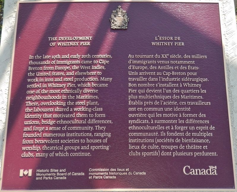
In the late 19th and early 20th centuries, thousands of immigrants came to Cape Breton from Europe, the West Indies, the United States, and elsewhere to work in iron and steel production. Many settled in Whitney Pier, which became one of the most ethnically diverse neighbourhoods in the Maritimes. There, overlooking the steel plant, the labourers shared a working-class identity that motivated them to form unions, bridge ethnocultural differences, and forge a sense of community. They founded numerous institutions, ranging from benevolent societies to houses of worship, theatrical groups and sporting clubs, many of which continue.
Au tournant du XXe siècle, des milliers d'immigrants venus notamment d'Europe, des Antilles et des États-Unis arrivent au Cap-Breton pour travailler dans l'industrie sidérurgique. Bon nombre s'installent à Whitney Pier qui devient l'un des quartiers les plus multiethniques des Maritimes. Établis près de l'aciérie, ces travailleurs ont en commun une identité ouvrière qui les motive à former des syndicats, à surmonter les différences ethnoculturelles et à forger un esprit de communauté. Ils fondent de multiples institutions (sociétés de bienfaisance, lieux de culte, troupes de théâtre et clubs sportifs) dont plusieurs perdurent.
Erected by Historic Sites and Monuments Board of Canada and Parks Canada/Commission de lieux et monuments historique du Canada et Parcs Canada.
Topics and series. This historical marker is listed in these topic lists: Industry & Commerce • Settlements & Settlers. In addition, it is included in the Canada, Historic Sites and Monuments Board series list.
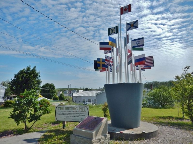
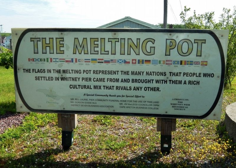
Location. 46° 9.703′ N, 60° 11.214′ W. Marker is in Sydney, Nova Scotia, in Cape Breton Region. Marker is on Victoria Road (Route 28) south of Church Street, on the right when traveling north. Marker is located a small plaza across Victoria Road from the Harbourside Elementary School, directly in front of the Whitney Pier "Melting Pot" monument. Touch for map. Marker is at or near this postal address: 1092 Victoria Road, Sydney NS B1N 1L1, Canada. Touch for directions.
Other nearby markers. At least 8 other markers are within 3 kilometers of this marker, measured as the crow flies. Cossit House (approx. 2.2 kilometers away); Sir Peter D. Macdonald (approx. 2.3 kilometers away); St. George's Church (approx. 2.3 kilometers away); "Northern Friends" (approx. 2.3 kilometers away);
Sir John George Bourinot (approx. 2.3 kilometers away); Joseph Frederick Wallet DesBarres (approx. 2.3 kilometers away); Royal Bank Lion (approx. 2.3 kilometers away); J.F.W. DesBarres (approx. 2.5 kilometers away). Touch for a list and map of all markers in Sydney.
Also see . . . The Development of Whitney Pier. Prior to the 20th century, this area was known as “Eastmount” or “South Sydney Harbour,” and had long been a fishing and farming district. In 1899, Henry Melville Whitney, a Boston businessman, created the Dominion Iron and Steel Company, which constructed a steel plant at the site. This plant would employ thousands, but the demand for labour could not be met by the local population. Instead, skilled and unskilled labourers from around the world found work at the plant. Many of these new immigrants settled in the neighbourhood that emerged beside the steel plant, which became known as Whitney Pier. The district was incorporated into the City of Sydney in 1904. (Submitted on September 10, 2019, by Cosmos Mariner of Cape Canaveral, Florida.)
Credits. This page was last revised on September 10, 2019. It was originally submitted on September 9, 2019, by Cosmos Mariner of Cape Canaveral, Florida. This page has been viewed 391 times since then and 35 times this year. Photos: 1, 2, 3. submitted on September 10, 2019, by Cosmos Mariner of Cape Canaveral, Florida.


