The Building of Oklahoma City
— The ‘89er Trail —
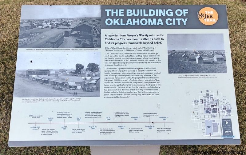
A reporter from Harpers Weekly returned to Oklahoma City two months after its birth to find its progress remarkable beyond belief.
William Willard Howard writing an article called "The Building of Oklahoma" in the June 29, 1889 issue of Harper's Weekly, said:
"That Oklahoma would, in the first two months of its existence, get much beyond its chaotic state of tents and hap-hazard existence was not thought possible even by those enthusiasts whose imaginations were as rosy as the soil of the Oklahoma uplands; that it would in that time have better buildings than many Western towns ten years old was simply not thought of at all.
"The wonderful rapidity with which Oklahoma City and Guthrie [e]merged from what at first appeared to be confused camps of holiday excursionists into matter-of-fact towns of excessively practical ways of thought, showed plainly the dominating influence of the experienced Kansas town-builder. No people other than those who had grown skillful in the work of building pioneer towns in the West could have created a town of such compactness, completeness, and future promise as Oklahoma City in the incredibly short space of time of two months. The result shows that the new citizens of Oklahoma had planned what to do weeks ahead, that they had ordered their lumber and other building supplies,
and that, with the exception of delays unavoidable in a pioneer country, they had carried out their arrangements like clock-work."
Photo captions:
Top left: Oklahoma City two weeks after the land run with a population estimated at 7,000.
Research Division of the Oklahoma Historical Society
Bottom left: Less than two months after the land run, businesses that opened in tents have upgraded to single and multi-story buildings with wooden sidewalks and awnings on the front. Western History Collections University of Oklahoma Libraries
Top right: Looking south from 2nd Street in the middle of May. Oklahoma City Land Run to Statehood (Images of America) by Terry L Griffith (Arcadia Publishing, 1999)
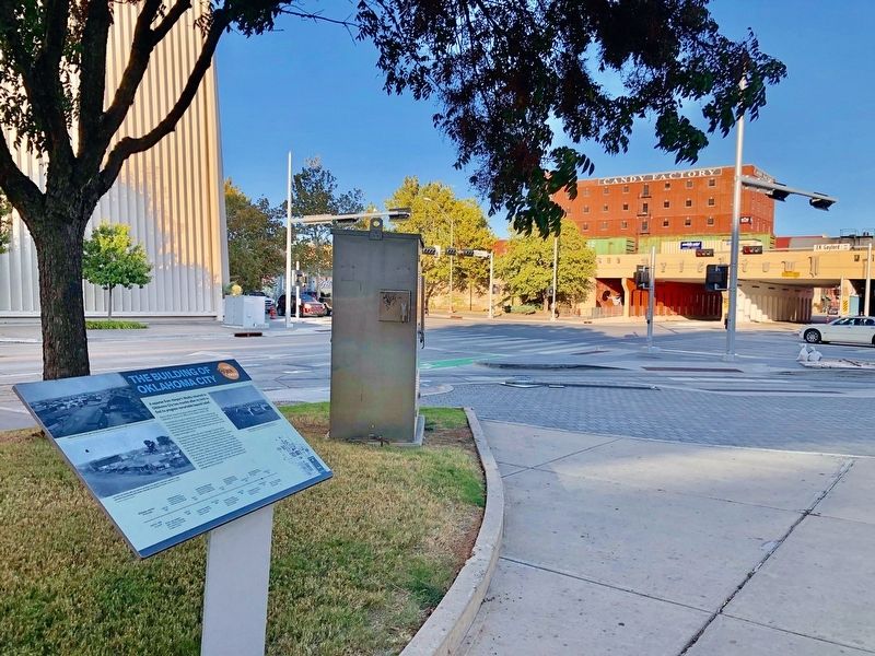
Erected 2018 by Oklahoma City Community Foundation, Wiggin Properties. (Marker Number 9.)
Topics and series. This historical marker is listed in this topic list: Settlements & Settlers. In addition, it is included in the The '89er Trail series list. A significant historical date for this entry is June 29, 1889.
Location. 35° 27.981′ N, 97° 30.804′ W. Marker is in Oklahoma City, Oklahoma, in Oklahoma County. It is in Central Oklahoma City.
Other nearby markers. At least 8 other markers are within walking distance of this marker. The Land Run (within shouting distance of this marker); City Hall by Forfeiture (about 300 feet away, measured in a direct line); A Summer of Political Unrest (about 400 feet away); Ray Ackerman Dancing Fountains (about 400 feet away); a different marker also named The Land Run (about 400 feet away); Angelo C. Scott (about 500 feet away); The Election of May 1, 1889 (about 500 feet away); Settling the Conflicting Surveys (about 600 feet away). Touch for a list and map of all markers in Oklahoma City.
Credits. This page was last revised on February 16, 2023. It was originally submitted on October 29, 2019, by Mark Hilton of Montgomery, Alabama. This page has been viewed 153 times since then and 19 times this year. Photos: 1, 2. submitted on October 29, 2019, by Mark Hilton of Montgomery, Alabama.

