Tate in Pickens County, Georgia — The American South (South Atlantic)
Georgia Marble Company and the Village of Tate
Inscription.
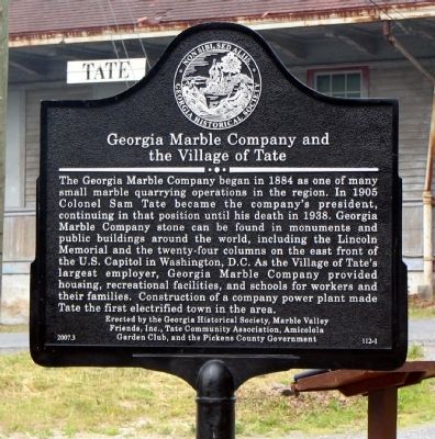
The Georgia Marble Company began in 1884 as one of many small marble quarrying operations in the region. In 1905 Colonel Sam Tate became the company's president, continuing in that position until his death in 1938. Georgia Marble Company stone can be
found in monuments and public buildings around the world, including the Lincoln Memorial and the twenty-four columns of the east front of the U.S. Capitol in
Washington, D.C. As the Village of Tate's largest employer, Georgia Marble Company provided housing, recreational facilities, and schools for workers and their families. Construction of a company power plant made Tate the first electrified town in the area.
Erected 2007 by Georgia Historical Society, Marble Valley Friends, Inc., Tate Community Association, Amicolola Garden Club, and the Pickens County Government. (Marker Number 112-1.)
Topics and series. This historical marker is listed in these topic lists: Industry & Commerce • Natural Resources • Political Subdivisions. In addition, it is included in the Georgia Historical Society series list. A significant historical year for this entry is 1884.
Location. 34° 24.841′ N, 84° 23.195′ W. Marker is in Tate, Georgia, in Pickens County. Marker is at the intersection of Georgia Route 53 and North Railroad Street, on the left when traveling east on State Route 53. Touch for map. Marker is in this post office area: Tate GA 30177, United States of America. Touch for directions.
Other nearby markers. At least 8 other markers are within 6 miles of this marker, measured as the crow flies. Old Federal Road (approx. 3.1 miles away); a different marker also named Old Federal Road (approx. 4˝ miles away); Pickens County (approx. 4.6 miles away); Old Pickens County Jail (approx. 4.6 miles away); a different marker also named The Old Pickens County Jail (approx. 4.6 miles away); The Kirby-Quinton Cabin (approx. 4.6 miles away); Oglethorpe Monument (approx. 4.6 miles away); Battle of Taliwa (approx. 5.3 miles away).
More about this marker. Marker is adjacent to the old railroad depot in Tate.
Credits. This page was last revised on June 16, 2016. It was originally submitted on January 3, 2009, by David Seibert of Sandy Springs, Georgia. This page has been viewed 2,434 times since then and 113 times this year. Photo 1. submitted on January 3, 2009, by David Seibert of Sandy Springs, Georgia. • Kevin W. was the editor who published this page.
