Hinesville in Liberty County, Georgia — The American South (South Atlantic)
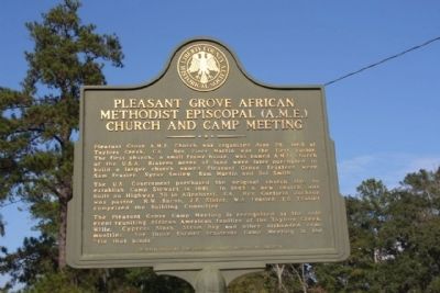
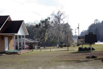
Pleasant Grove African Methodist Episcopal (AME) Church and Camp Meeting
Erected 2003 by Liberty County Historical Society.
Topics and series. This historical marker is listed in these topic lists: African Americans • Churches & Religion • Notable Places. In addition, it is included in the African Methodist Episcopal (AME) Church series list. A significant historical date for this entry is June 29, 1898.
Location. 31° 47.659′ N, 81° 36.423′ W. Marker is in Hinesville, Georgia, in Liberty County. Touch for map. Marker is at or near this postal address: 1450 W Oglethorpe Hwy (US 84,GA 38), Hinesville GA 31313, United States of America. Touch for directions.
Other nearby markers. At least 8 other markers are within 4 miles of this marker, measured as the crow flies. City of Walthourville History (approx. 2.3 miles away); Walthourville Baptist Church (approx. 2½ miles away); Walthourville Presbyterian Church (approx. 3.1 miles away); Skirmish at Hinesville (approx. 3.3 miles away); Old Liberty County Jail (approx. 3.6 miles away); Bradwell Park (approx. 3.7 miles away); Liberty County (approx. 3.8 miles away); Liberty County Confederate Monument (approx. 3.8 miles away). Touch for a list and map of all markers in Hinesville.
Regarding Pleasant Grove African Methodist Episcopal (AME) Church and Camp Meeting. "In 1869, the Pleasant Grove A.M.E. Church was founded at Taylors Creek by local preacher Rev. Piner Martin. Next to the church laid the Pleasant GroveCemetery. The cemetery included a Masonic Lodge for the African American community, and a parsonage for the pastor. A one-room school, which later became a part of the Liberty County School system,stood nearby as well. Population and economic growth continued in Taylors Creek during the first 20 years of the 20th Century. African Americans madeup slightly more than half the town’s population of 325. Crop destruction caused by the boll weevil ended Taylors Creek’s boom. The village didn’t have a railroad connection, which also contributed to the end of the boom."
("The Frontline" newspaper,Fort Stewart, October 23, 2003 )
Credits. This page was last revised on June 16, 2016. It was originally submitted on January 29, 2009, by Mike Stroud of Bluffton, South Carolina. This page has been viewed 2,098 times since then and 32 times this year. Photos: 1, 2, 3. submitted on January 29, 2009, by Mike Stroud of Bluffton, South Carolina. • Craig Swain was the editor who published this page.


